Map of El Paso, Texas
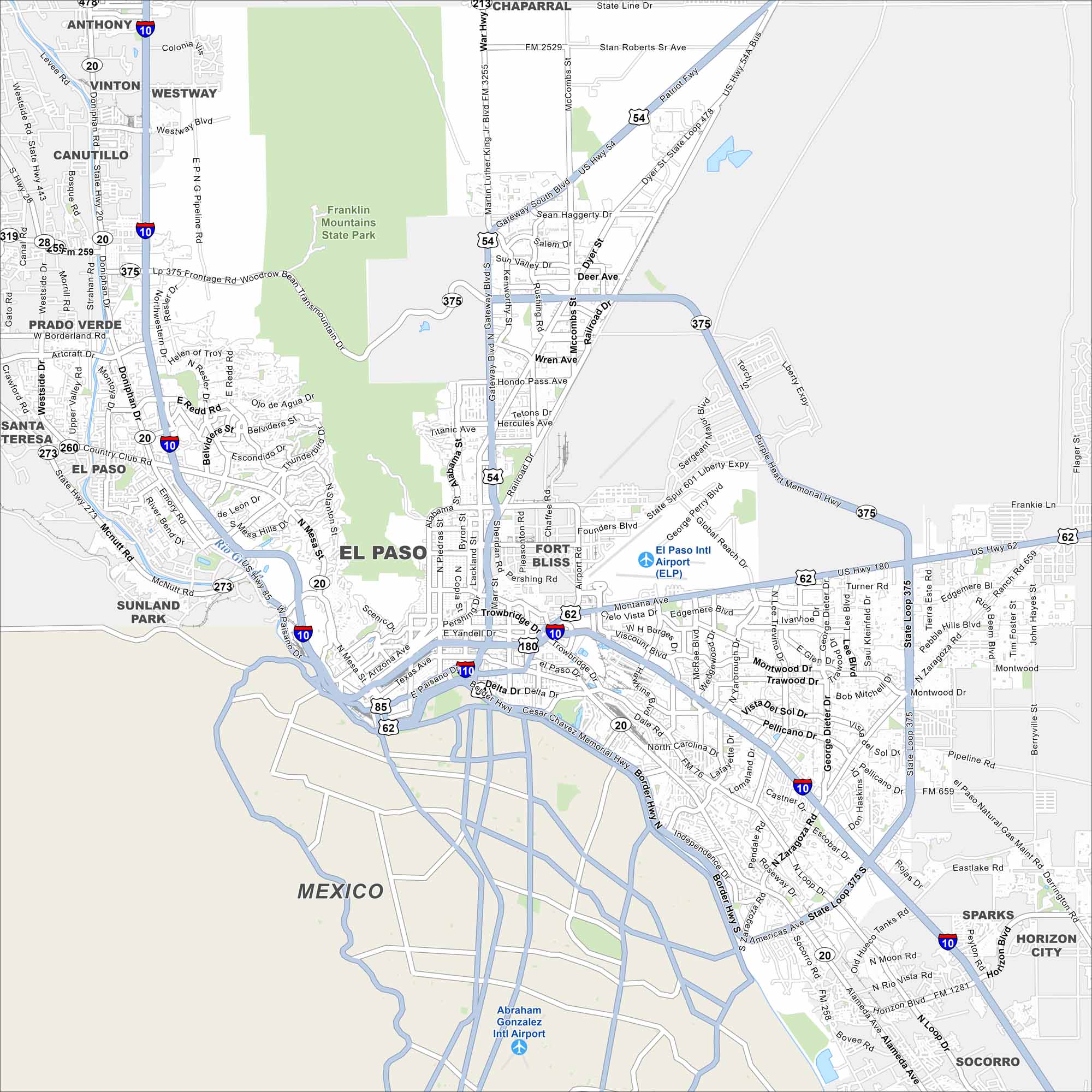
Our map of El Paso shows the Rio Grande carving a boundary with Mexico. The Franklin Mountains rise to the north. El Paso is often called “Sun City” because of its year-round bright skies.
Map Information
On the Map
Interstates/Highways: I-10, US Hwy 54, US Hwy 62, US Hwy 180, State Rte 20, State Rte 178, State Rte 375, State Rte 478 Major Roads: Montana Ave, Mesa St, Dyer St, Alameda Ave, Paisano Dr, Trowbridge Dr, McCombs St, Gateway South Blvd, Zaragoza Rd, Montwood Dr, Edgemere Blvd, Pellicano Dr, Artcraft Rd, Doniphan Dr, Resler Dr, Sunland Park Dr, Transmountain Rd, George Dieter Dr, Horizon Blvd, Americas Ave Airports: El Paso Intl Airport (ELP), Abraham Gonzalez Intl Airport Major Rivers: Rio Grande Parks and Preserves: Franklin Mountains State Park Nearby Communities: Anthony, Vinton, Westway, Canutillo, Prado Verde, Santa Teresa, Sunland Park, Fort Bliss, Chaparral, Sparks, Horizon City, Socorro, MexicoTexas State Maps
Scan our maps of the massive southern state of Texas.


City Maps of Texas
Explore our map collection of Texas cities.


