Map of Edina, Minnesota
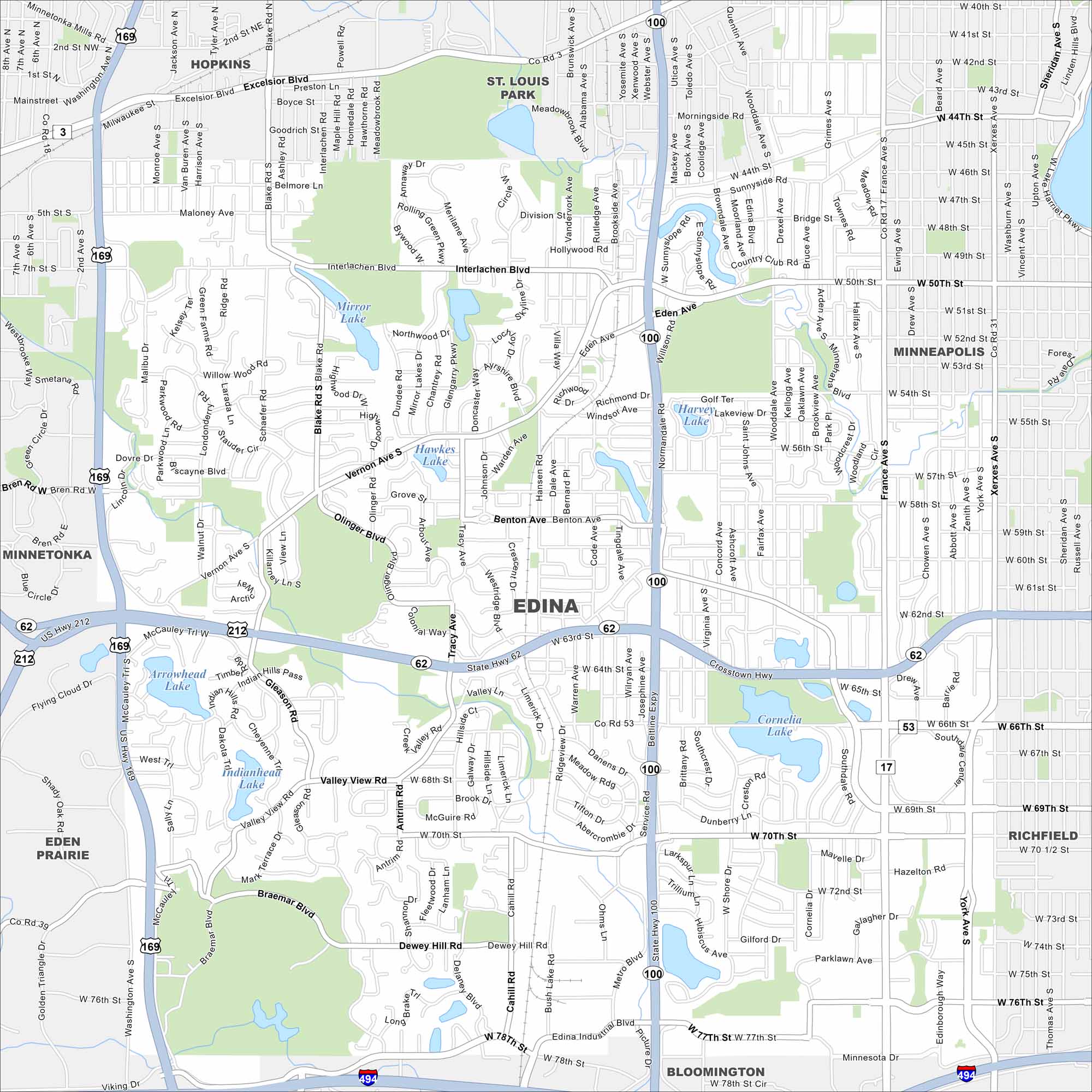
Edina is located southwest of Minneapolis. Our map highlights several lakes, including Arrowhead and Lake Cornelia. The city is well known for its tidy neighborhoods and park system.
Map Information
On the Map
Interstates/Highways: I-494, US Hwy 169, State Rte 62, State Rte 100 Major Roads: Valley View Rd, France Ave, York Ave, Xerxes Ave, Eden Ave, Vernon Ave, Interlachen Blvd, W 70th St, W 50th St, W 66th St, W 54th St, W 58th St, W 44th St, Tracy Ave, Benton Ave, Dewey Hill Rd, Cahill Rd, Braemar Blvd, Gleason Rd, Blake Rd Lakes and Reservoirs: Cornelia Lake, Mirror Lake, Hawkes Lake, Arrowhead Lake, Indianhead Lake, Harvey Lake Nearby Communities: Minneapolis, Richfield, Bloomington, Eden Prairie, Hopkins, St. Louis Park, MinnetonkaMinnesota State Maps
Explore every lake in our state maps of Minnesota


Minnesota City Maps
Browse through our city maps of Minnesota


