Map of Eagan, Minnesota
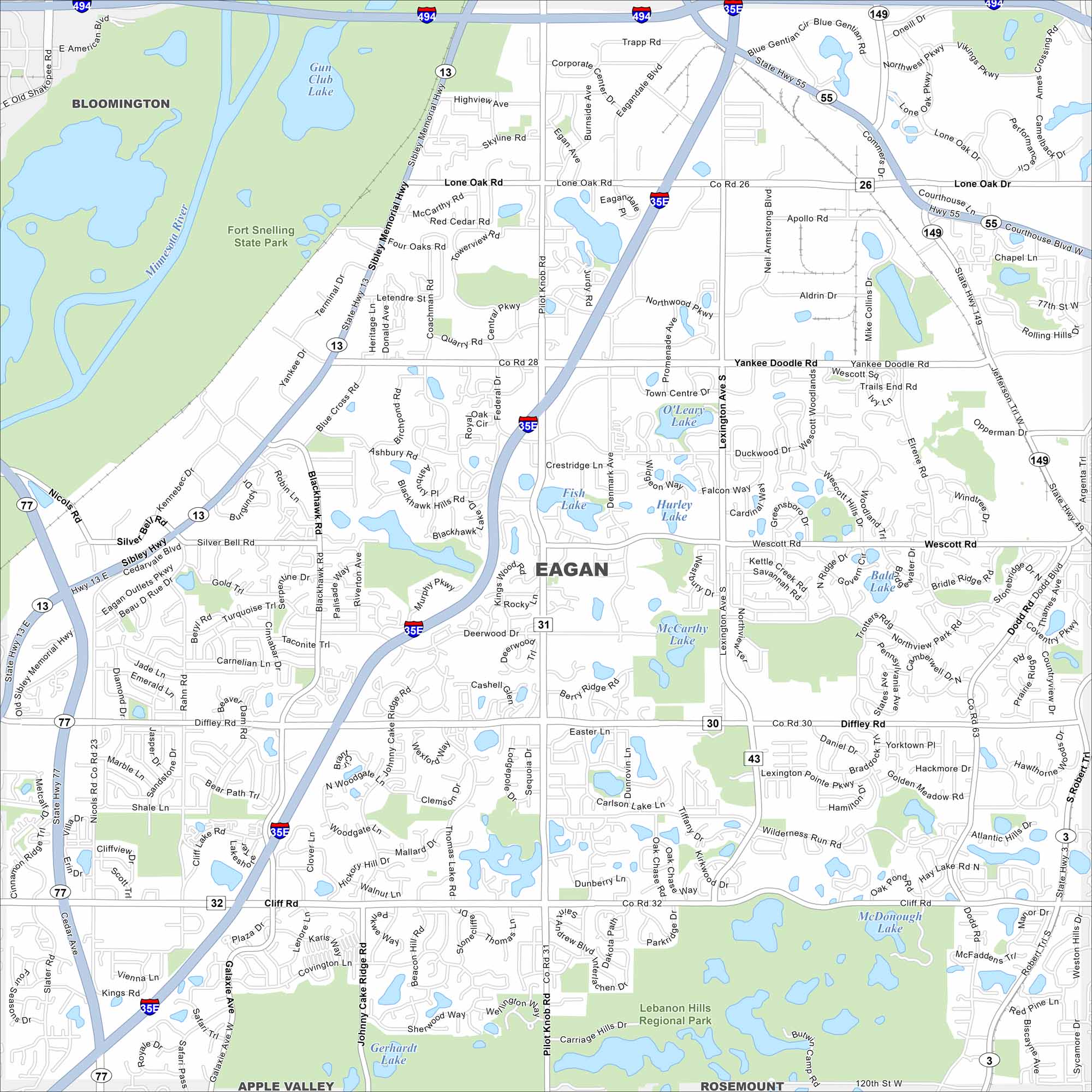
Eagan stretches along the Minnesota River, just south of St. Paul. This map shows its lakes, parks and major freeways linking the Twin Cities.
Map Information
On the Map
Interstates/Highways: I-494, I-35E, State Rte 13, State Rte 55, State Rte 77, State Rte 149 Major Roads: Yankee Doodle Rd, Pilot Knob Rd, Diffley Rd, Cliff Rd, Lone Oak Rd, Lexington Ave, Wescott Rd, Silver Bell Rd, Deerwood Dr, Blackhawk Rd, Coachman Rd, Nicols Rd, Opperman Dr, Dodd Rd, Argenta Trl, Promenade Ave, Denmark Ave, Wilderness Run Rd, Galaxie Ave Airports: Lakes and Reservoirs: Fish Lake, O’Leary Lake, McCarthy Lake, Carlson Lake, Hay Lake, Blackhawk Lake, Fitz Lake, Holz Lake, Schwanz Lake, Jensen Lake, McDonough Lake, Gerhardt Lake, Heine Lake Major Rivers: Minnesota River Parks and Preserves: Fort Snelling State Park, Lebanon Hills Regional Park Nearby Communities: Bloomington, Mendota Heights, Inver Grove Heights, Rosemount, Apple Valley, BurnsvilleMinnesota State Maps
Explore every lake in our state maps of Minnesota


Minnesota City Maps
Browse through our city maps of Minnesota


