Map of Denton, Texas
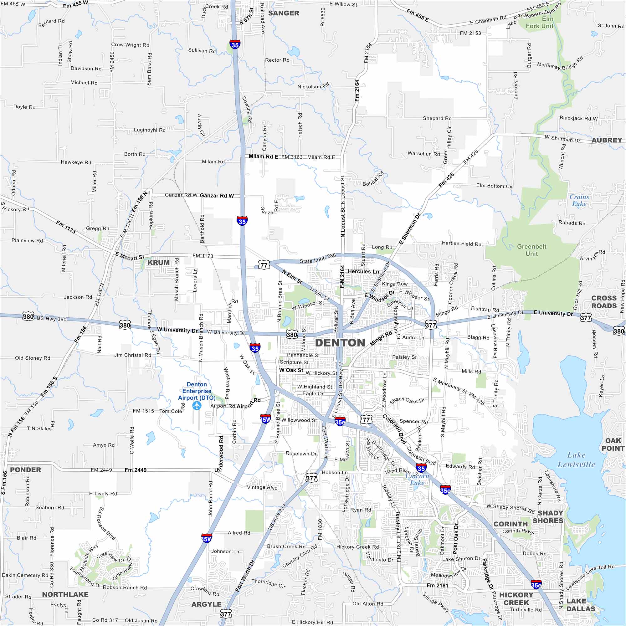
Check out our map of Denton at the north edge of the Dallas-Fort Worth metro. Roads circle its downtown square, then stretch out toward ranchland. Its blend of city and open space sets it apart.
Map Information
On the Map
Interstates/Highways: I-35, I-35E, I-35W, US Hwy 380, US Hwy 377, US Hwy 77, State Loop 288 Major Roads: University Dr, Oak St, Hickory St, Locust St, Elm St, Teasley Ln, Colorado Blvd, Mayhill Rd, Loop 288, FM 2181, FM 2164, FM 426, FM 1173, FM 156, FM 1515, Mingo Rd, Sherman Dr, Bonnie Brae St, McKinney St, Spencer Rd Airports: Denton Enterprise Airport (DTO) Lakes and Reservoirs: Lake Lewisville, Unicorn Lake, Crains Lake Parks and Preserves: Greenbelt Unit Nearby Communities: Sanger, Krum, Ponder, Northlake, Argyle, Corinth, Shady Shores, Lake Dallas, Hickory Creek, Oak Point, Cross Roads, AubreyTexas State Maps
Scan our maps of the massive southern state of Texas.


City Maps of Texas
Explore our map collection of Texas cities.


