Map of Del Rio, Texas
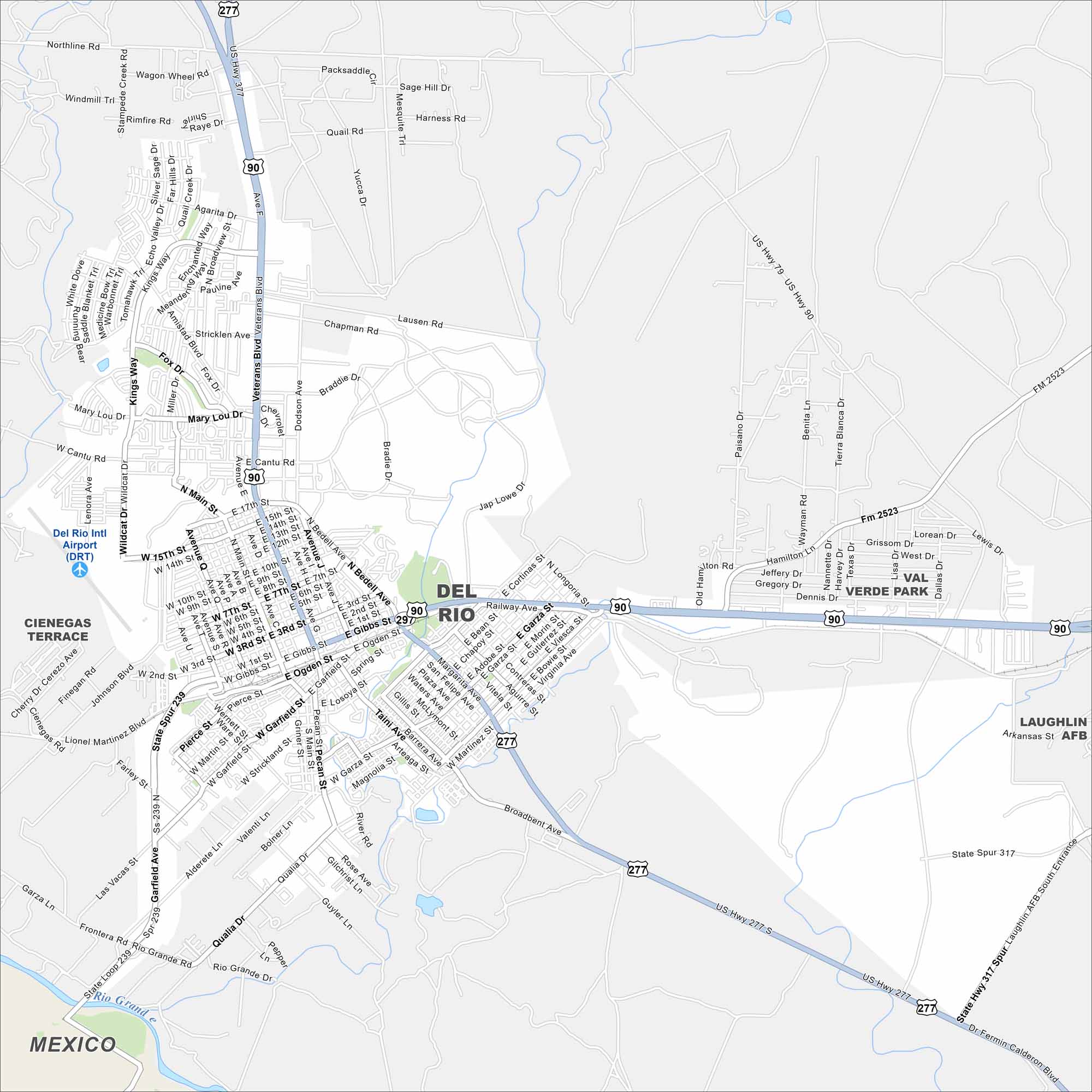
Our map of Del Rio shows the main roads, highways, and its position on the border. The city sits on the Rio Grande so it’s called the “Queen City of the Rio Grande”. Amistad Reservoir spreads just north of the city.
Map Information
On the Map
Interstates/Highways: US Hwy 90, US Hwy 277, US Hwy 377, State Loop 239 Major Roads: Veterans Blvd, Bedell Ave, Main St, Gibbs St, Garfield Ave, Las Vacas St, Qualia Dr, Broadbent Ave, Dr Fermin Calderon Blvd, Highway 90, 15th St, 4th St, 17th St, Amistad Blvd, Kings Way, Strickland Ave, Losoya St, Martinez St, San Felipe Ave, Garza St Airports: Del Rio Intl Airport (DRT) Major Rivers: Rio Grande Nearby Communities: Cienegas TerraceTexas State Maps
Scan our maps of the massive southern state of Texas.


City Maps of Texas
Explore our map collection of Texas cities.


