Map of Corpus Christi, Texas
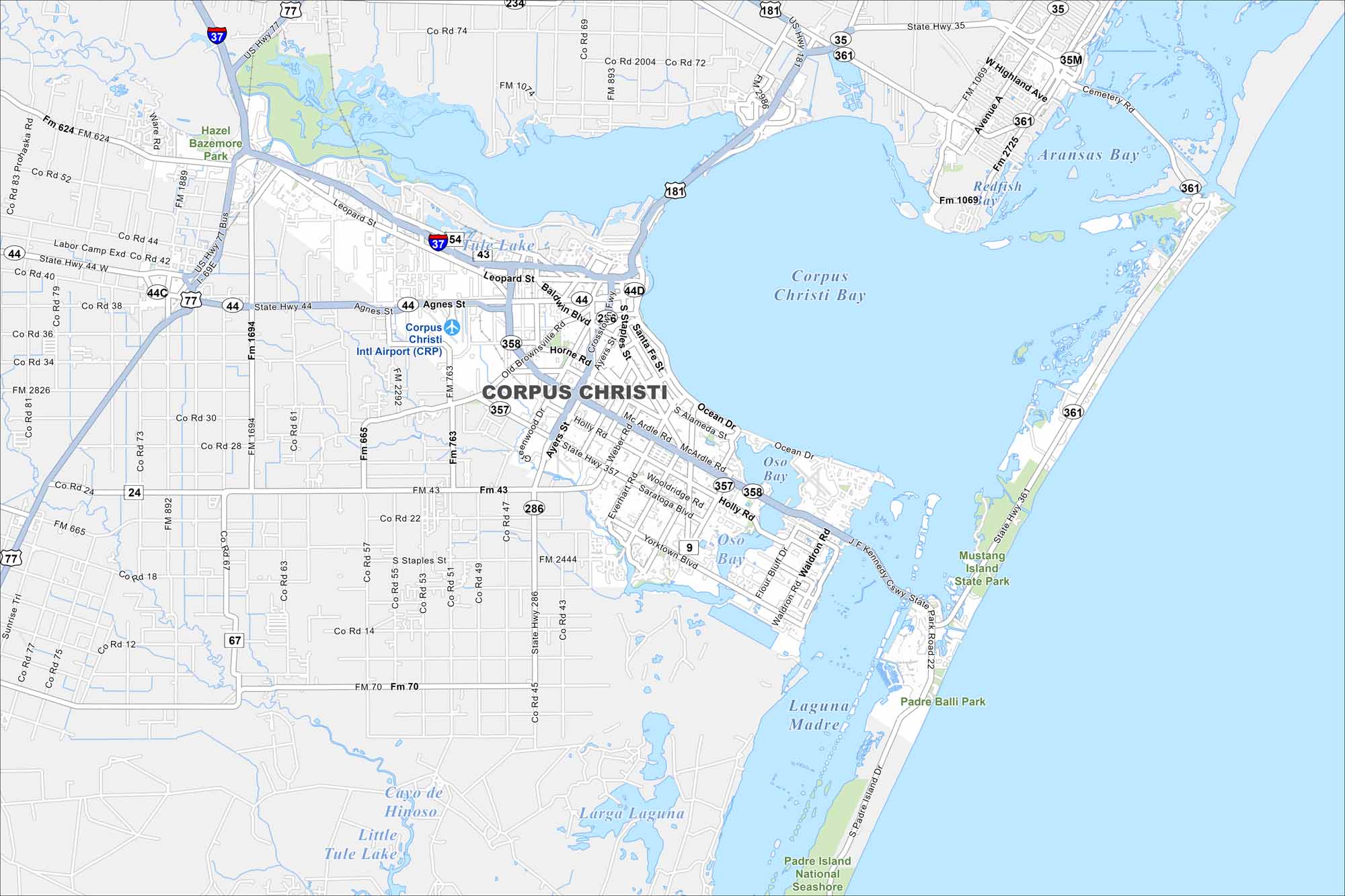
Our map of Corpus Christi highlights the city’s roads, highways, and shoreline. Sitting on the Gulf Coast, it’s known as the “Sparkling City by the Sea”. The bay and barrier islands dominate the view.
Map Information
On the Map
Interstates/Highways: I-37, US Hwy 77, US Hwy 181, State Hwy 44, State Hwy 35, State Hwy 357, State Hwy 358, State Hwy 286 Major Roads: Leopard St., Agnes St., S Staples St., Ocean Dr., S Padre Island Dr., Mc Ardle Rd., Holly Rd., Saratoga Blvd., Yorktown Blvd., Weber Rd., Everhart Rd., Rodd Field Rd., Ennis Joslin Rd., Flour Bluff Dr., Waldron Rd., Laguna Shores Rd., Paul Jones Ave., Up River Rd., Corn Prods Rd., Carbon Plant Rd. Airports: Corpus Christi Intl Airport (CRP) Lakes and Reservoirs: Corpus Christi Bay, Oso Bay, Laguna Madre, Aransas Bay, Tule Lake, Cayo de Hinoso, Little Tule Lake, Larga Laguna Parks and Preserves: Hazel Bazemore Park, Mustang Island State Park, Padre Island National Seashore, Padre Balli ParkTexas State Maps
Scan our maps of the massive southern state of Texas.


City Maps of Texas
Explore our map collection of Texas cities.


