Map of Coon Rapids, Minnesota
Coon Rapids hugs the Mississippi River and is north of Minneapolis. The area mixes neighborhoods with riverfront trails. Parks line the water’s edge.
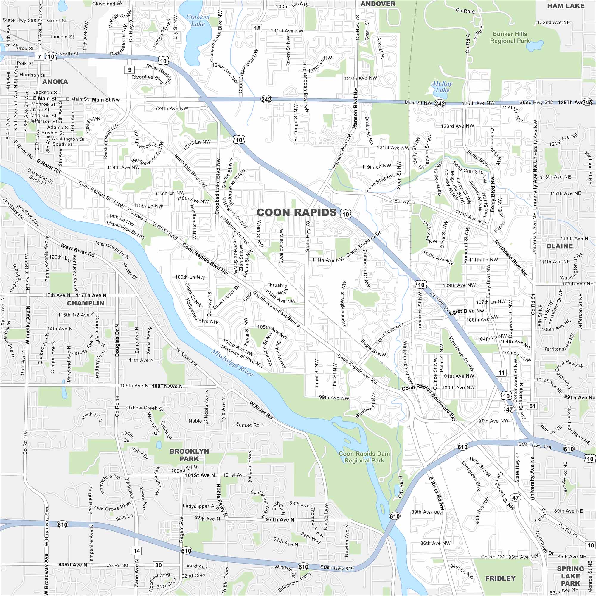
Map Information
On the Map
Interstates/Highways: US Hwy 10, State Rte 47, State Rte 242, State Rte 610 Major Roads: Coon Rapids Blvd, Hanson Blvd, Main St, University Ave, Northdale Blvd, Foley Blvd, 121st Ave, 111th Ave, 131st Ave, Mississippi St, Egret Blvd, Crooked Lake Blvd, Shenandoah Blvd, Round Lake Blvd, Zilla St, Woodcrest Dr, 97th Ave, 85th Ave, Evergreen Blvd Lakes and Reservoirs: Crooked Lake, McKay Lake Major Rivers: Mississippi River Parks and Preserves: Bunker Hills Regional Park, Coon Rapids Dam Regional Park Nearby Communities: Anoka, Andover, Ham Lake, Blaine, Spring Lake Park, Fridley, Brooklyn Park, ChamplinMinnesota State Maps
Explore every lake in our state maps of Minnesota


Minnesota City Maps
Browse through our city maps of Minnesota


