Map of Conroe, Texas
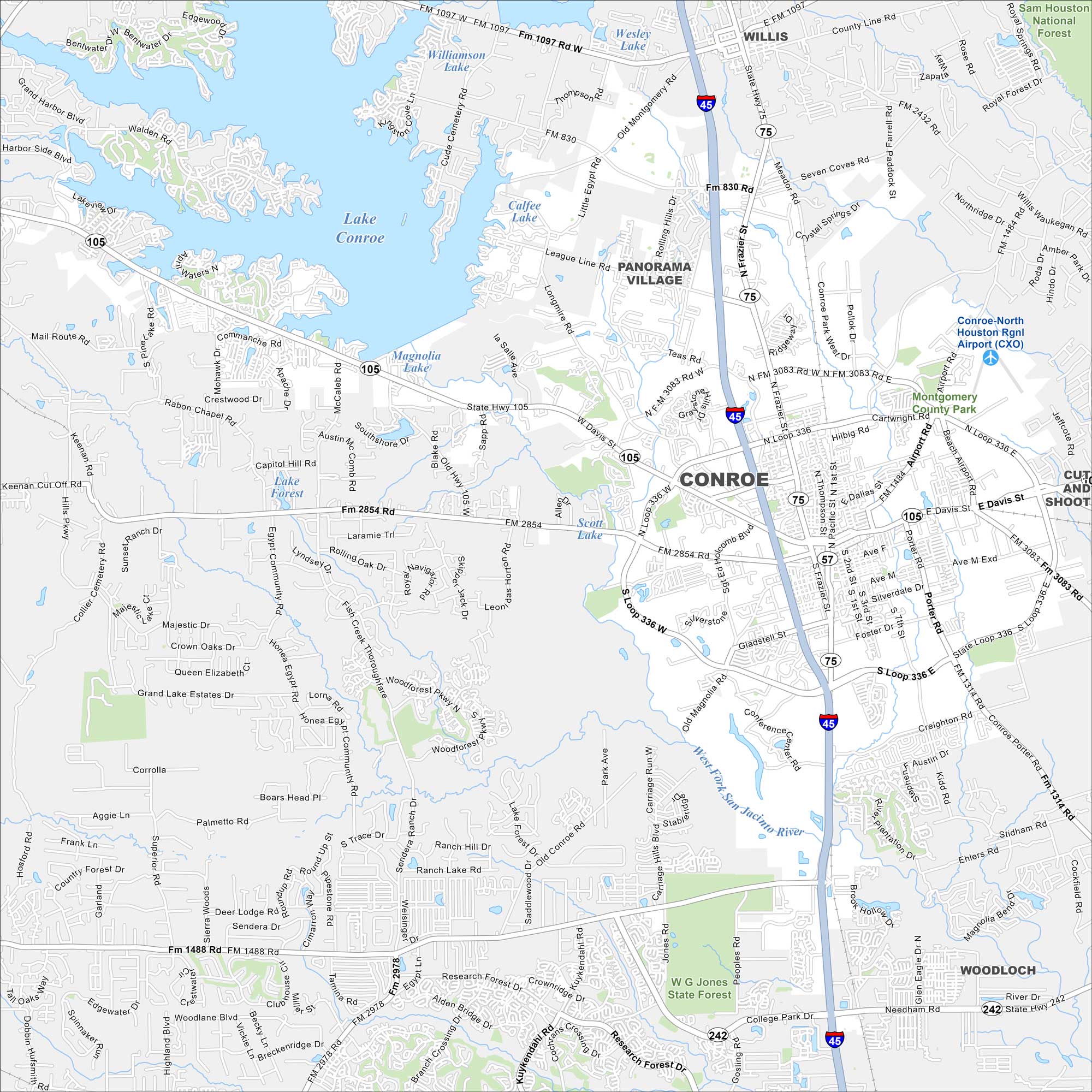
Conroe lies along Lake Conroe, north of Houston. The city mostly grew around timber and oil. We’ve mapped it with roads, highways, and nearby lakes.
Map Information
On the Map
Interstates/Highways: I-45, State Rte 105, State Rte 75, State Rte 242 Major Roads: Loop 336, Frazer St, Davis St, Conroe Park West Dr, Airport Rd, FM 2854, FM 3083, FM 1488, FM 2978, FM 1314, FM 830, Gladstell St, Crighton Rd, Research Forest Dr, Kuykendahl Rd, Alden Bridge Dr, Egypt Community Rd, Fish Creek Thoroughfare, Longmire Rd, League Line Rd Airports: Conroe-North Houston Rgnl Airport Lakes and Reservoirs: Lake Conroe, Magnolia Lake, Scott Lake, Calfee Lake, Williamson Lake, Lake Forest Major Rivers: West Fork San Jacinto River Parks and Preserves: W G Jones State Forest, Montgomery County Park, Sam Houston National Forest Nearby Communities: Willis, Panorama Village, WoodlochTexas State Maps
Scan our maps of the massive southern state of Texas.


City Maps of Texas
Explore our map collection of Texas cities.


