Map of Colleyville, Texas
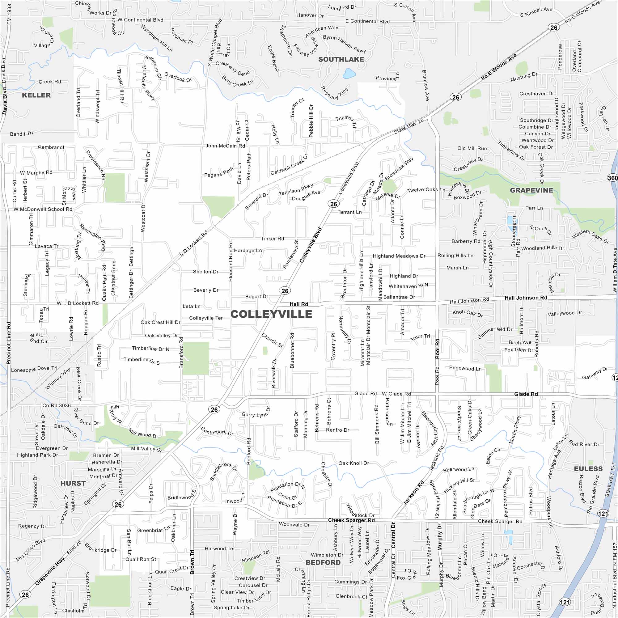
Colleyville is mapped with its streets, highways, and parks. You can find this city between Dallas and Fort Worth with lots of open space.
Map Information
On the Map
Interstates/Highways: State Rte 26, State Rte 121, State Rte 360 Major Roads: Colleyville Blvd, Glade Rd, Hall Johnson Rd, Cheek Sparger Rd, Precinct Line Rd, Bransford Rd, Pool Rd, Jackson Rd, Main St, John McCain Rd, Pleasant Run Rd, Westcoat Rd, Heritage Ave, L D Lockett Rd, McDonwell School Rd, Bluebonnet Rd, Church St, Riverwalk Dr, Bedford Rd, Mill Valley Dr Nearby Communities: Southlake, Grapevine, Euless, Bedford, Hurst, KellerTexas State Maps
Scan our maps of the massive southern state of Texas.


City Maps of Texas
Explore our map collection of Texas cities.


