Map of Cedar Rapids, Iowa
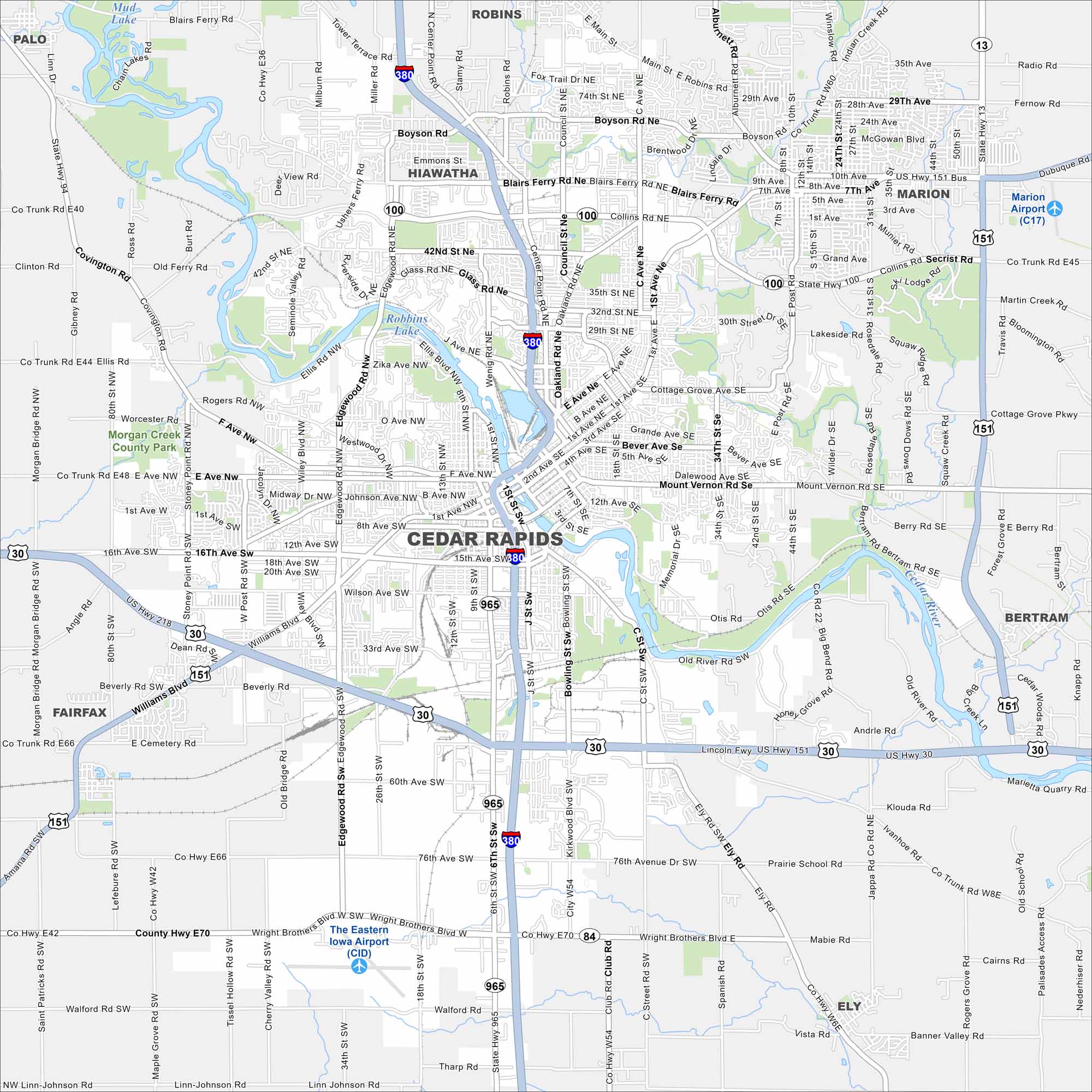
See Cedar Rapids on our map. Parks and neighborhoods stretch along the water, with Cedar River splitting the city in two. It’s the second-largest city in Iowa, but it keeps a grounded, local feel. The river really shapes its identity.


Map Information
On the Map
Interstates/Highways: I-380, US Hwy 30, US Hwy 151, US Hwy 218, State Hwy 100, State Hwy 94, State Hwy 13, State Hwy 965, State Hwy 84 Major Roads: 1st Ave, Collins Rd, Edgewood Rd, Williams Blvd, Wright Brothers Blvd, Boyson Rd, Blairs Ferry Rd, 42nd St, 32nd St, Mt Vernon Rd, 16th Ave, Glass Rd, Wilson Ave, 33rd St, 76th Ave, J St, Bowling St, Kirkwood Blvd, C St, Ely Rd Airports: The Eastern Iowa Airport (CID), Marion Airport (C17) Lakes and Reservoirs: Robbins Lake, Mud Lake, Chain Lakes Major Rivers: Cedar River Parks and Preserves: Morgan Creek County Park Nearby Communities: Hiawatha, Marion, Robins, Palo, Fairfax, Bertram, ElyIowa City Maps
Browse city maps in the state of Iowa


