Map of Cedar Park, Texas
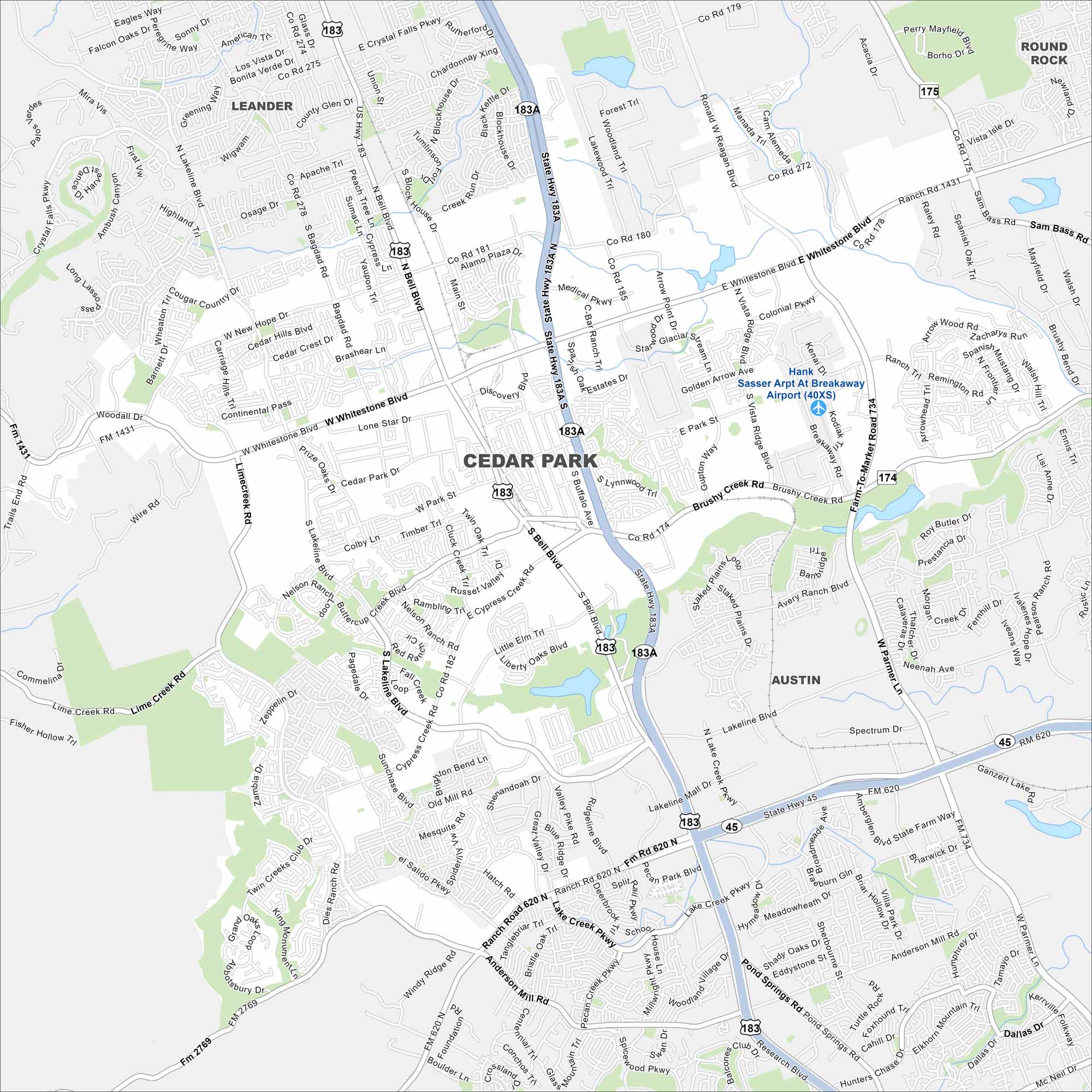
Cedar Park is a growing suburb just north of Austin. Our map highlights its neighborhoods, parks, and nearby highways. Growth has been steady because of its connection to the Austin metro.
Map Information
On the Map
Interstates/Highways: US Hwy 183, State Rte 183A, State Rte 45, US Hwy 175 Major Roads: Whitestone Blvd, Bell Blvd, Parmer Ln, Lakeline Blvd, Cypress Creek Rd, Brushy Creek Rd, Park Blvd, Anderson Mill Rd, Avery Ranch Blvd, Buttercup Creek Blvd, New Hope Rd, Bagdad Rd, Vista Ridge Blvd, Ronald Reagan Blvd, Lakeline Mall Dr, Pecan Park Blvd, Pond Springs Rd, Research Blvd, Crystal Falls Pkwy Airports: Hank Sasser Arpt At Breakaway Nearby Communities: Leander, Round Rock, AustinTexas State Maps
Scan our maps of the massive southern state of Texas.


City Maps of Texas
Explore our map collection of Texas cities.


