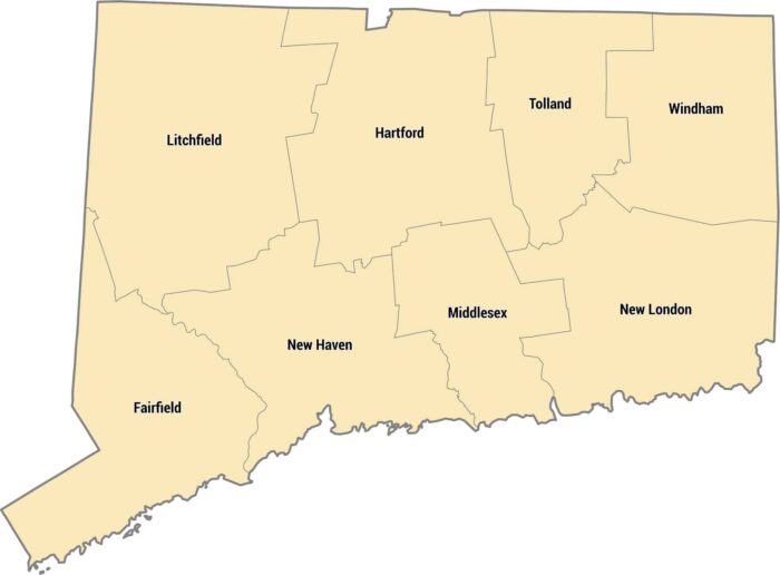
Connecticut County Map
Connecticut only has 8 counties, some dating back to the 1600s. The whole state is tiny, so you can cross multiple counties in an hour.
Connecticut only has 8 counties, some dating back to the 1600s. The whole state is tiny, so you can cross multiple counties in an hour.

The Rockies split Colorado’s 64 counties down the middle. Eastern counties are flat prairie, western counties are mountains and ski towns.
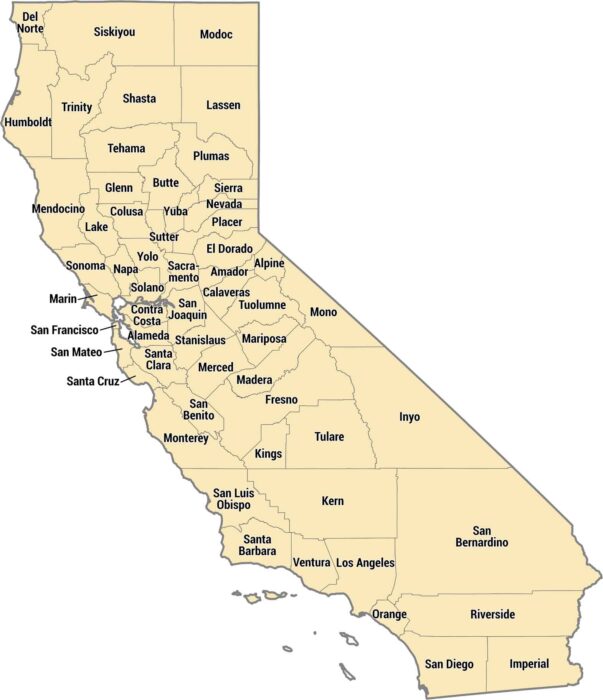
California has 58 counties ranging from tiny Alpine to massive San Bernardino. The coastal counties pack in millions of people.
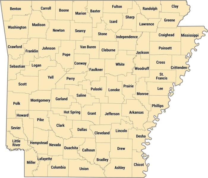
Our Arkansas county map shows all 75 counties across the state. Arkansas counties stretch from the rugged Ozarks to the flat, fertile Delta.
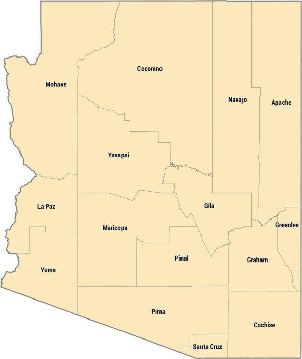
Check out Arizona’s 15 counties stretching from desert valleys to pine forests. Maricopa County dominates the center with Phoenix and more.

Alaska’s borough system is different from other states. Much of the state isn’t organized into counties at all, just massive census areas.
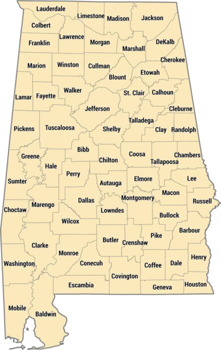
Our Alabama county map shows all 67 counties in the state. The state’s geography ranges from beaches along the Gulf Coast to mountains.
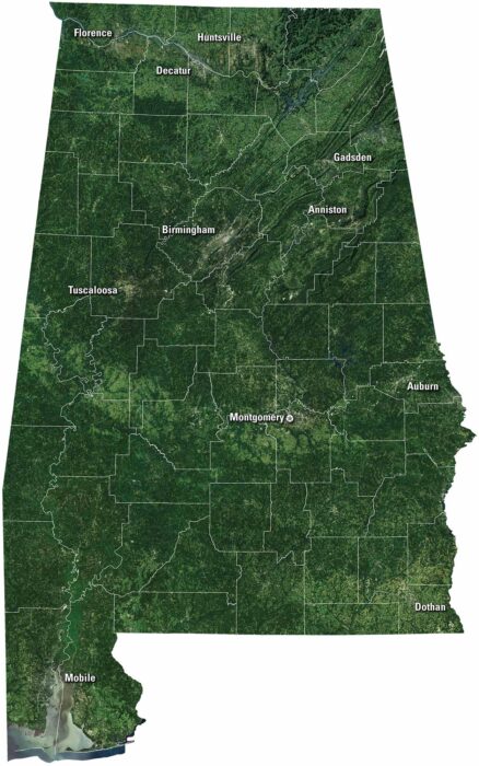
Get to know Alabama our satellite map. Forests and farmland cover the area. Down south, the Gulf Coast shines with bays, beaches and Mobile.
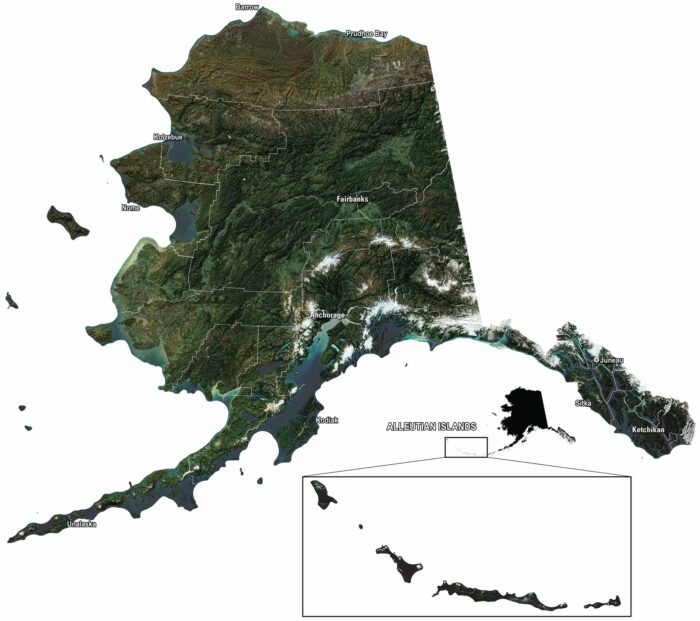
Our satellite map of Alaska shows mountains, glaciers, and endless forest. You can spot Anchorage, Juneau, and the Aleutian Islands out west.
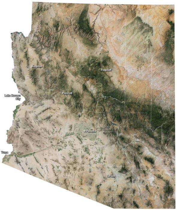
Our satellite map of Arizona shows its desert landscape. There are patches of green forests up north, but most of the land is brown and open.
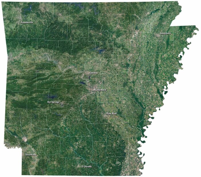
On our satellite map of Arkansas, green covers most of the state. The Ozark Mountains spread out in the north. Little Rock is near the middle.
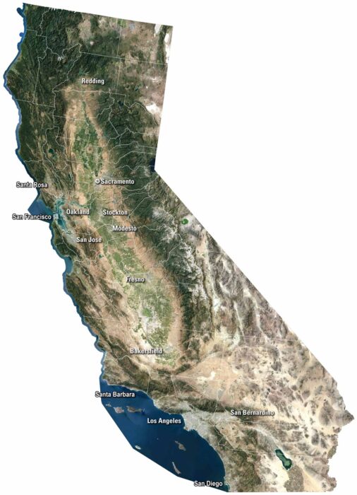
Our satellite map shows cities like San Diego and San Francisco along the coast. The Sierra Nevada rises east, while deserts cover the south.
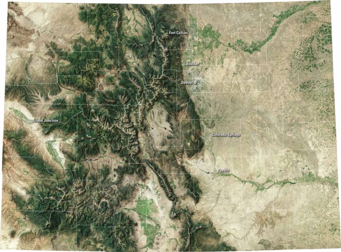
Colorado bursts with variety. Our satellite map shows the capital of Denver, the Rocky Mountains to the west, and wide plains to the east.
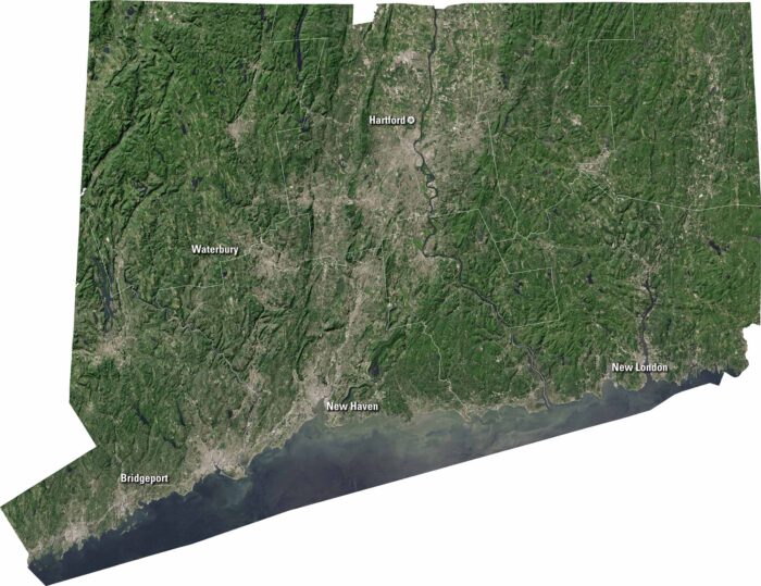
Connecticut is compact, with cities and countryside close together. Our satellite map shows Hartford, New Haven, and Long Island Sound.
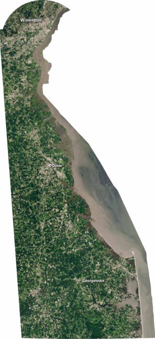
Delaware is small but full of detail. Our satellite map shows the coastline, rivers, and farmland. You’ll spot Wilmington, Dover, and beaches.