Kansas National Parks and Forests Map
Open space here isn’t protected, it’s working land. Our map shows almost nothing for federal land. Plains dominate everything here.
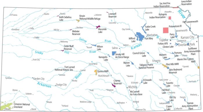
Open space here isn’t protected, it’s working land. Our map shows almost nothing for federal land. Plains dominate everything here.
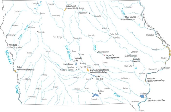
Federal land barely registers at first glance in Iowa. Our map shows only small refuges near waterways with mostly farming.
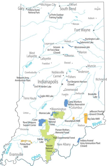
Flat farmland takes over most of Indiana. The south looks different from the north with forests bunching up in the hillier terrain.
Our map shows limited national forests and parks. Most protected land sticks close to rivers. Forests appear narrow and broken up.
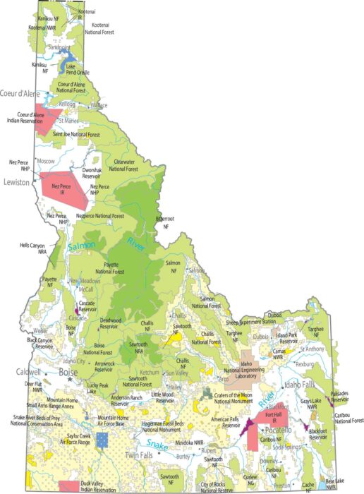
Our map shows one of the largest uninterrupted protected regions in the country. Central Idaho is almost entirely forest and wilderness.
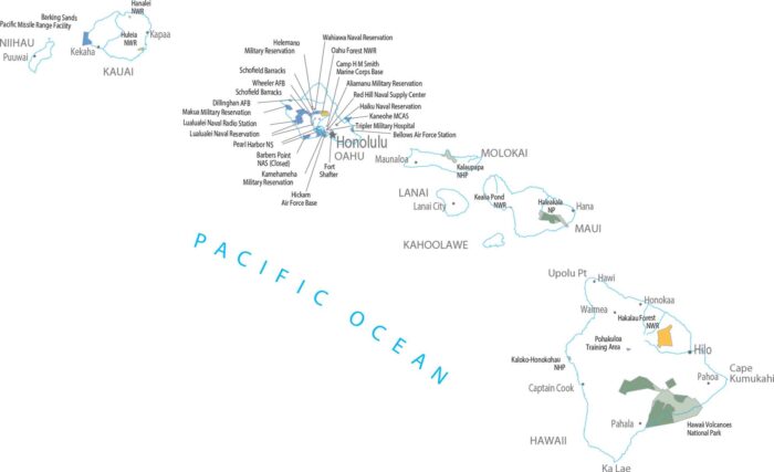
Hawaii Volcanoes National Park stands out instantly on our federal lands map. Protected land follows lava, not roads here in Hawaii.
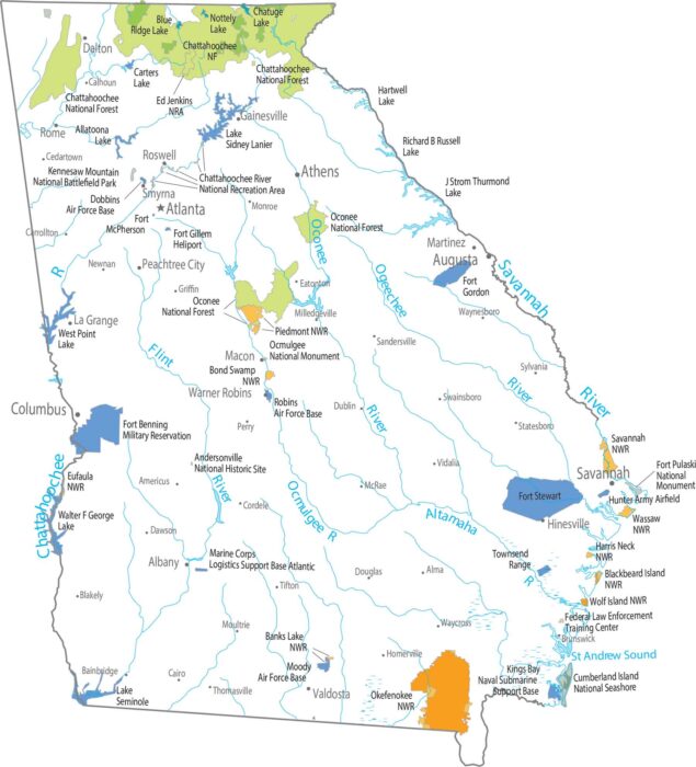
Our map shows protected areas hugging the Appalachian foothills. Chattahoochee National Forest covers a wide, uneven stretch.
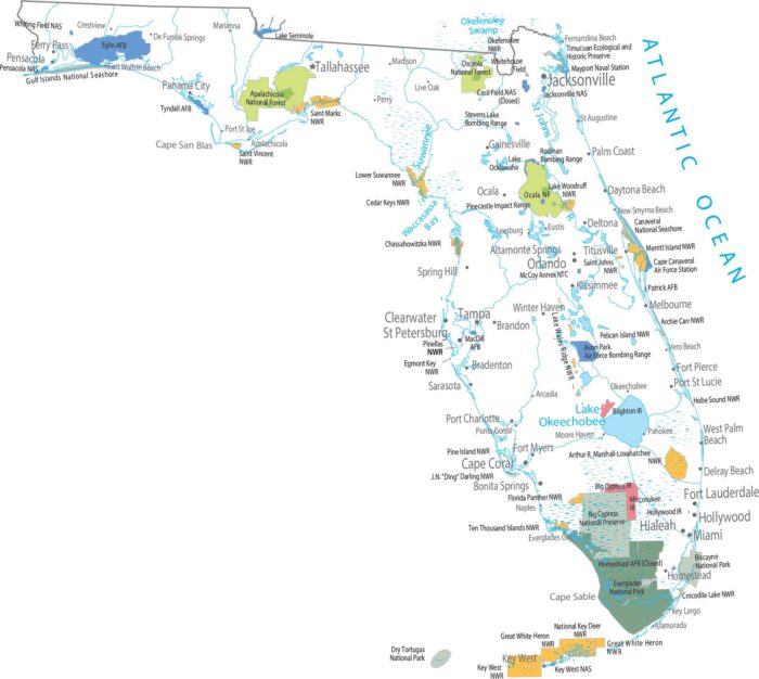
The coastal areas in Florida define where protected lands exists. Our map shows Everglades National Park covering the southern tip.
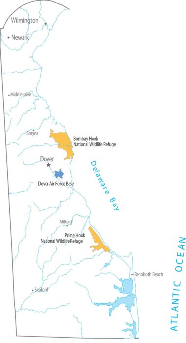
There’s very little federal land to work with in Delaware. Our map shows only small, scattered national wildlife refuges.
There’s not much here for national parks and forests. Open land appears in short breaks between development on our map.
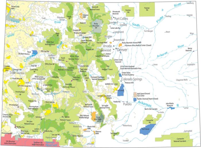
Everything clusters around height with Rocky Mountain National Park as the centerpiece. Forests stretch along the Rockies in long bands.
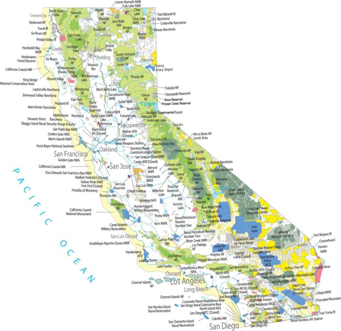
Protected land stacks up along mountain walls and coast ranges. Our map highlights forest and parks running the length of the Sierra Nevada.
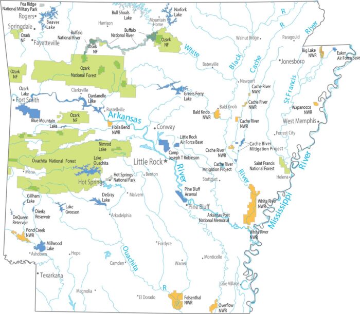
Northern and western Arkansas contain the largest forested regions. Our map shows protected land like the Ozark-St. Francis National Forest.
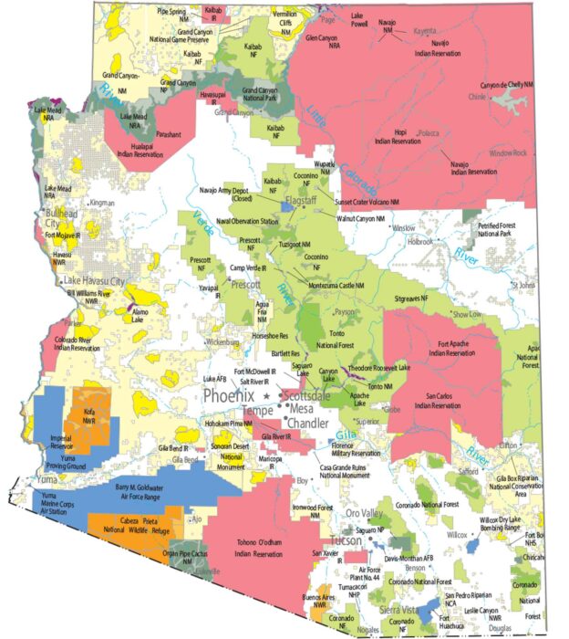
Our national parks and forests map of Arizona shows the Grand Canyon and protected forests in the entire state.
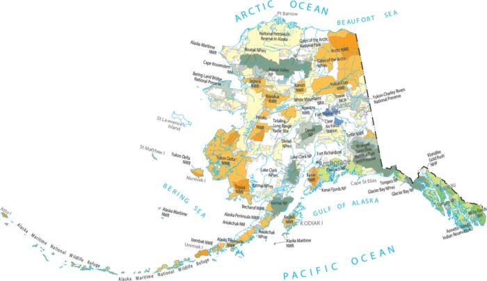
National parks and forests dominate much of Alaska. Our map shows massive protected areas broken only by rivers and coastlines.