Upper Peninsula Michigan Map
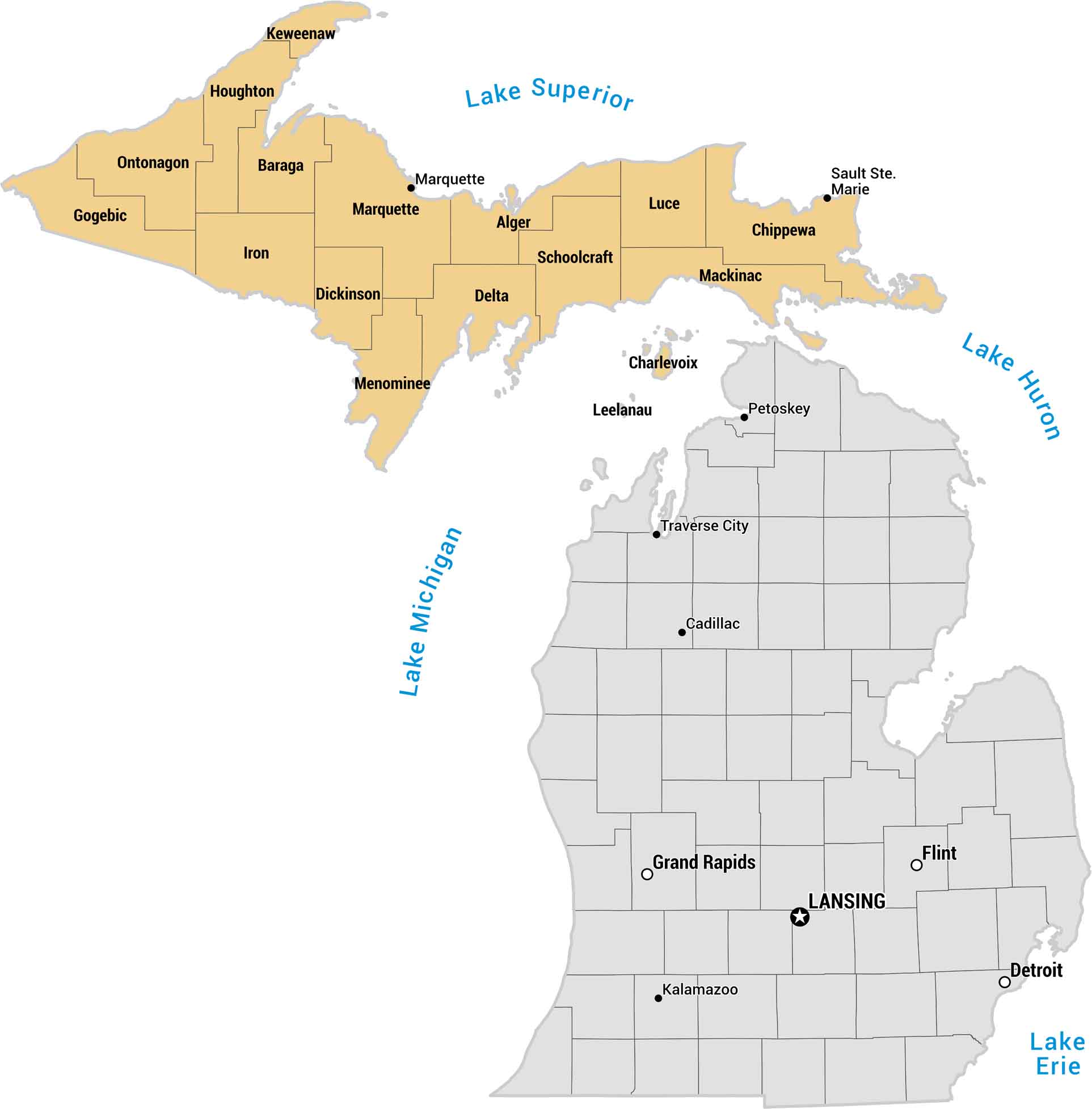
Michigan’s Upper Peninsula feels like its own world because it’s surrounded by water on three sides. Our map shows this region in yellow with its counties and islands. This region has cold air, wide-open space and is place built for long drives.
Map Information
On the Map
Upper Peninsula (Yellow Region)
Here are the counties and major cities located in the northern section of Michigan.- Counties: Alger, Baraga, Chippewa, Delta, Dickinson, Gogebic, Houghton, Iron, Keweenaw, Luce, Mackinac, Marquette, Menominee, Ontonagon, Schoolcraft
- Cities: Marquette, Sault Ste. Marie
Lower Peninsula (Gray Region)
Here are the counties and major cities located in the southern section of Michigan.- Counties: Charlevoix, Leelanau
- Cities: Cadillac, Detroit, Flint, Grand Rapids, Kalamazoo, Lansing, Petoskey, Traverse City
Geographic Features
These labels are the Great Lakes surrounding the Upper Peninsula.- Bodies of Water: Lake Erie, Lake Huron, Lake Michigan, Lake Superior
Metropolitan Regions
Developed areas, suburban zones, and metro regions.