Yellowstone National Park Map
Our map Yellowstone National Park highlights its geysers, lakes, and roads through the world’s first national park.
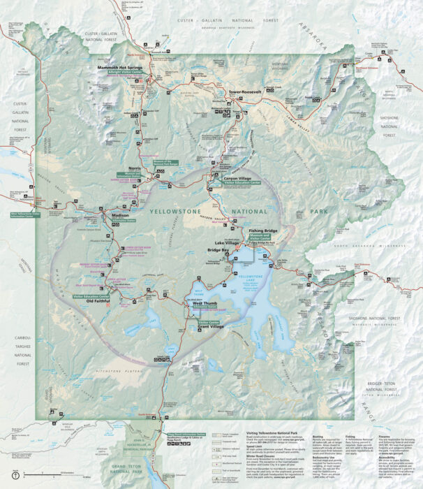
Our map Yellowstone National Park highlights its geysers, lakes, and roads through the world’s first national park.
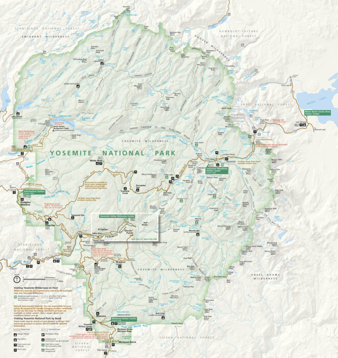
From El Capitan to Half Dome, Yosemite National Park feels larger than life. Our map follows the valleys, rivers, and forest roads.
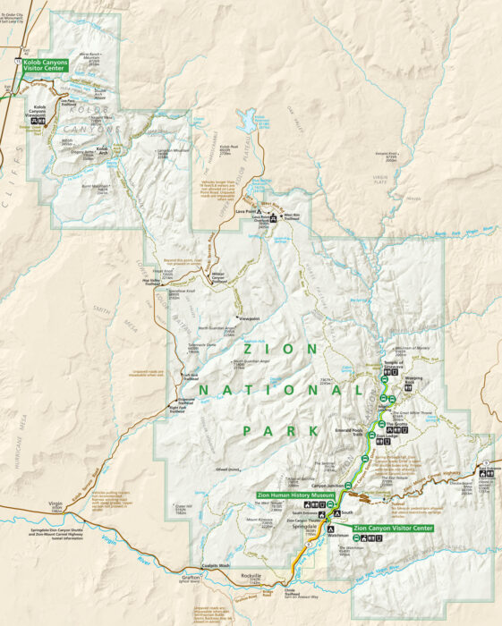
Our map of Zion National Park highlights its roads, rivers, and trails. Visitor centers are marked, along with lakes and points of interest.
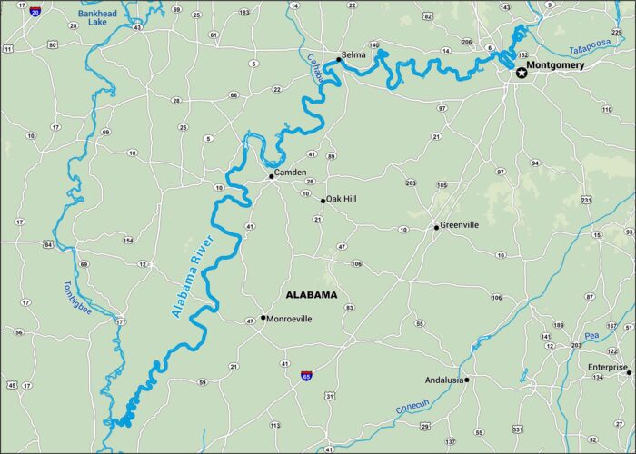
The Alabama River bends through rolling hills and towns. Our map follows its broad path south. It’s calm water with a deep sense of history.

Georgia’s Altamaha runs through thick coastal forest. Use our map to get acquainted to its quiet oxbows and long drift toward the Atlantic.
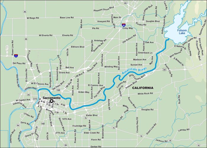
Start where gold fever began. The American River cuts through the Sierra foothills toward Sacramento. It’s lined with trails and rapids.
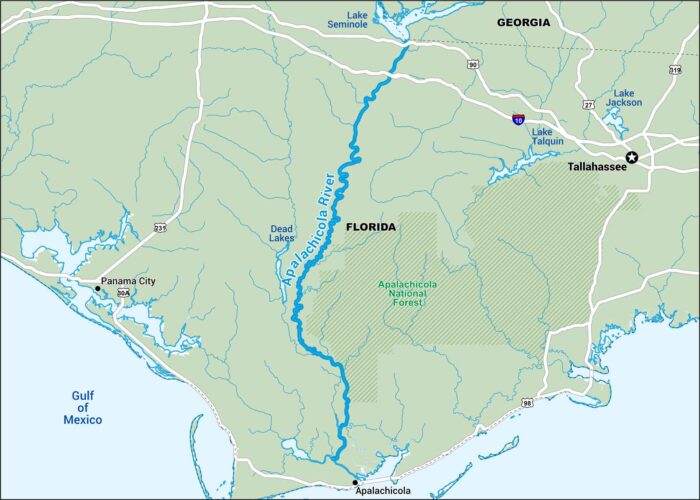
Down in Florida, the Apalachicola moves slow and wide. This map follows it through swamps and more. It ends at the City of Apalachicola.
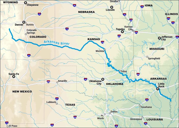
The Arkansas starts high in the Rockies and rolls all the way to the plains. Our map tracks it through canyons, farmland, and cities.

Michigan’s Au Sable drifts through pine forest and small towns. It’s steady and calm. Follow the map to find launch points, camp spots, etc.
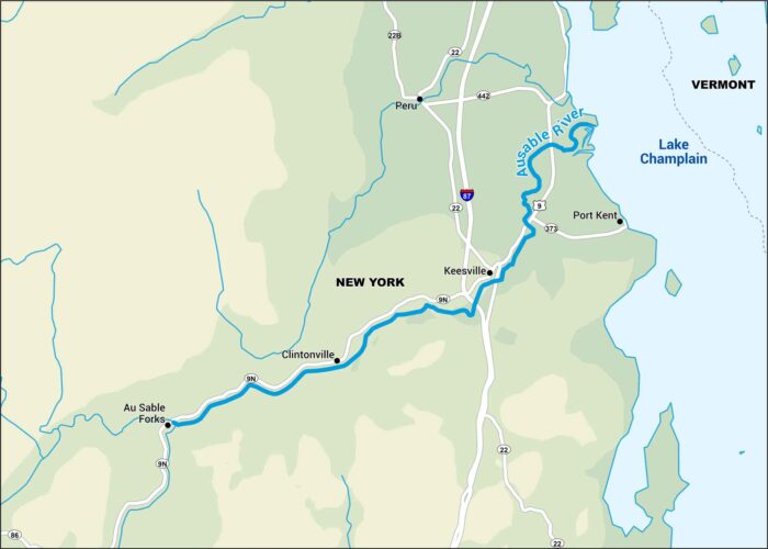
Cold water, tight turns, and the Adirondacks rising close around it. It doesn’t get any sweeter than this. See our map of the Ausable River.
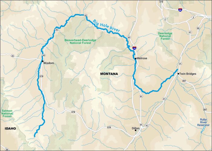
Montana’s Big Hole has broad valleys, wide water, open sky. It’s near Beaverhead-Deerlodge National Forest, perfect to set up a campsite.
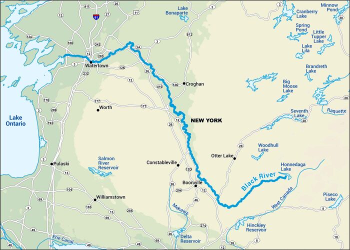
Wade in. The Black River drifts through woods and farmland, quiet and slow. You’ll find on our map highways and small towns that sit close.

The Blackfoot runs clean through western Montana. Our map shows the bends and stretches where the water runs through national forests.
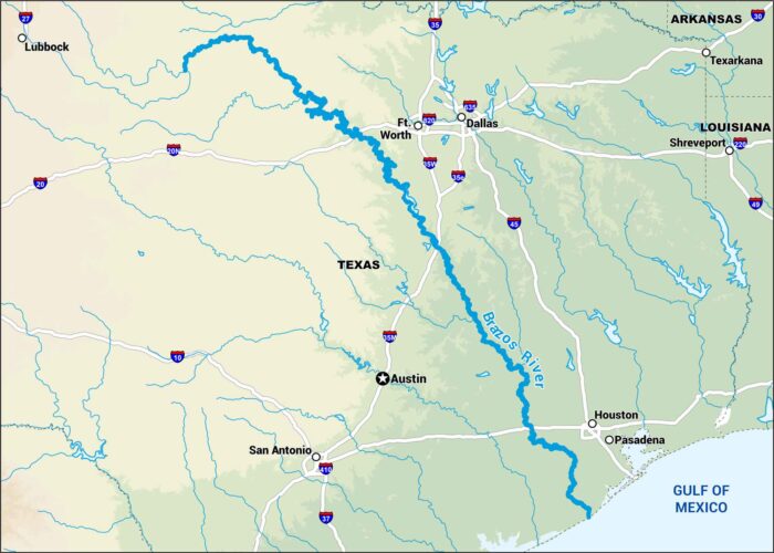
They call it the “Arms of Texas” because it stretches like one. It’s wide and wandering from the Hill Country down to the Gulf.
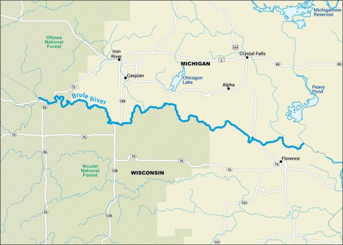
Paddle the Brule. It’s cold, fast, and covered by pine and birch. This map points out nearby highways, rivers and national forests.