US Election 1956 Map
The 1956 election map is a sea of red. Dwight D. Eisenhower cruised to a second term with support stretching across nearly the entire country.
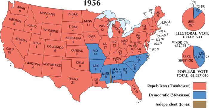
The 1956 election map is a sea of red. Dwight D. Eisenhower cruised to a second term with support stretching across nearly the entire country.
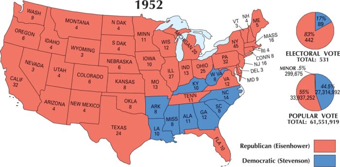
A red wave swept across the 1952 map as Dwight D. Eisenhower won in a landslide. Our US election 1952 map glows red from coast to coast.
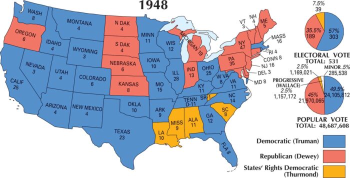
The 1948 US election map burst blue after nearly everyone predicted a Republican win. Harry S. Truman defeated Thomas E. Dewey.
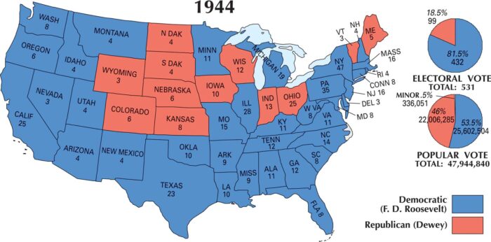
By 1944, Americans had been through depression and war. Our US election map of 1944 shows they felt steady with Franklin D. Roosevelt.
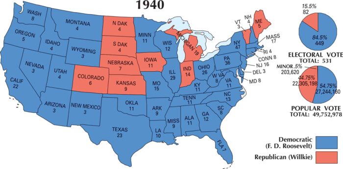
Blue covers nearly the whole map again in 1940. Franklin D. Roosevelt won a third term, defeating Republican Wendell Willkie.
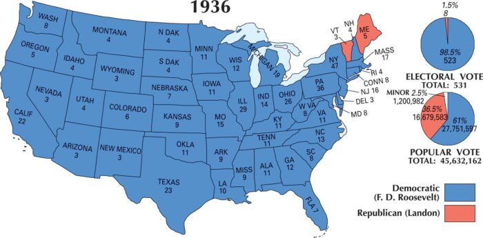
The 1936 US election map is almost entirely blue, with only Maine and Vermont voting Republican. It was for hope during the Great Depression.
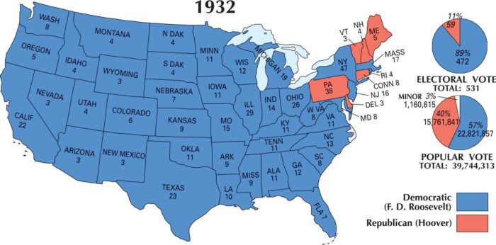
Franklin D. Roosevelt won against Herbert Hoover in 1932. The US election map of 1932 shows a desire for change amid the Great Depression.
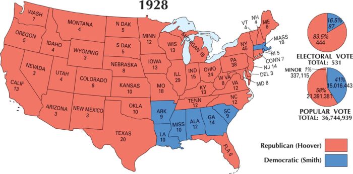
Wow, look at that red. Herbert Hoover won the 1928 election in a landslide. The US election map of 1928 is almost entirely Republican.
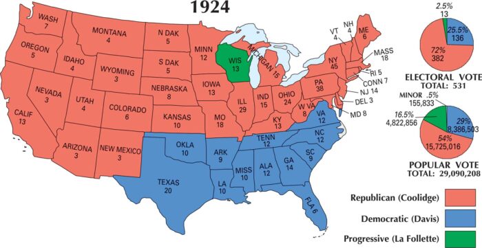
Calvin Coolidge secured a victory in the 1924 election. This map is dominated by red across the North. The South remained largely Democratic.
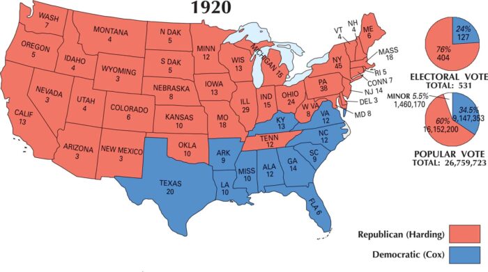
The US election map of 1920 is a sea of red. Warren G. Harding, the Republican, won in a lopsided landslide winning the northern sections.
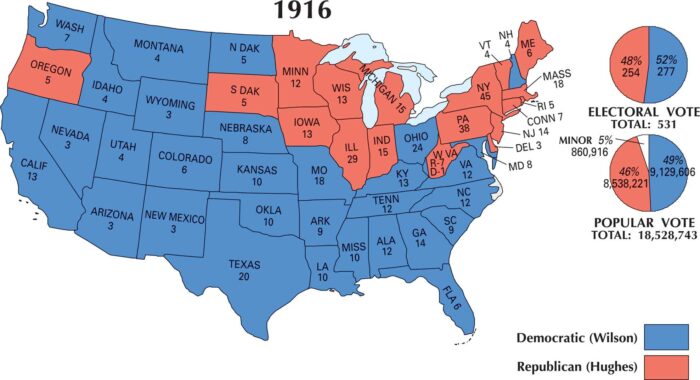
The 1916 map is mostly blue, showing Woodrow Wilson’s Democratic strength. He won re-election by winning more electoral and popular vote.
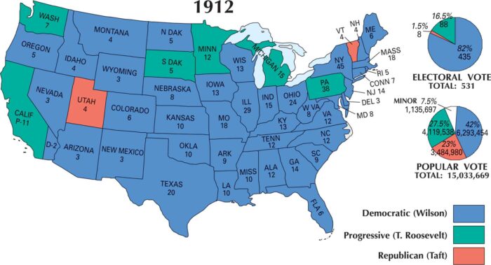
The 1912 US election map is almost entirely blue. The country leaned heavily Democratic as it handed the presidency to Woodrow Wilson.
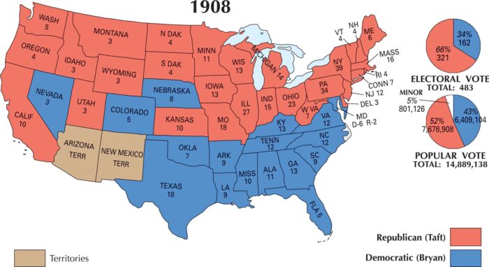
Our US election 1908 map shows the country was split between North and South. William Howard Taft won the industrial North and Midwest.
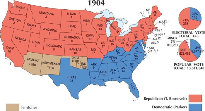
The 1904 election was a landslide for Theodore Roosevelt. Our US election 1904 map shows Roosevelt winning the northern half of states.
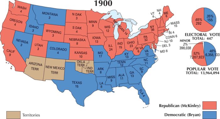
The 1900 election gave William McKinley a second term. Similar to the last election, support came from the Northeast, Midwest and West.