Map of Castle Rock, Colorado
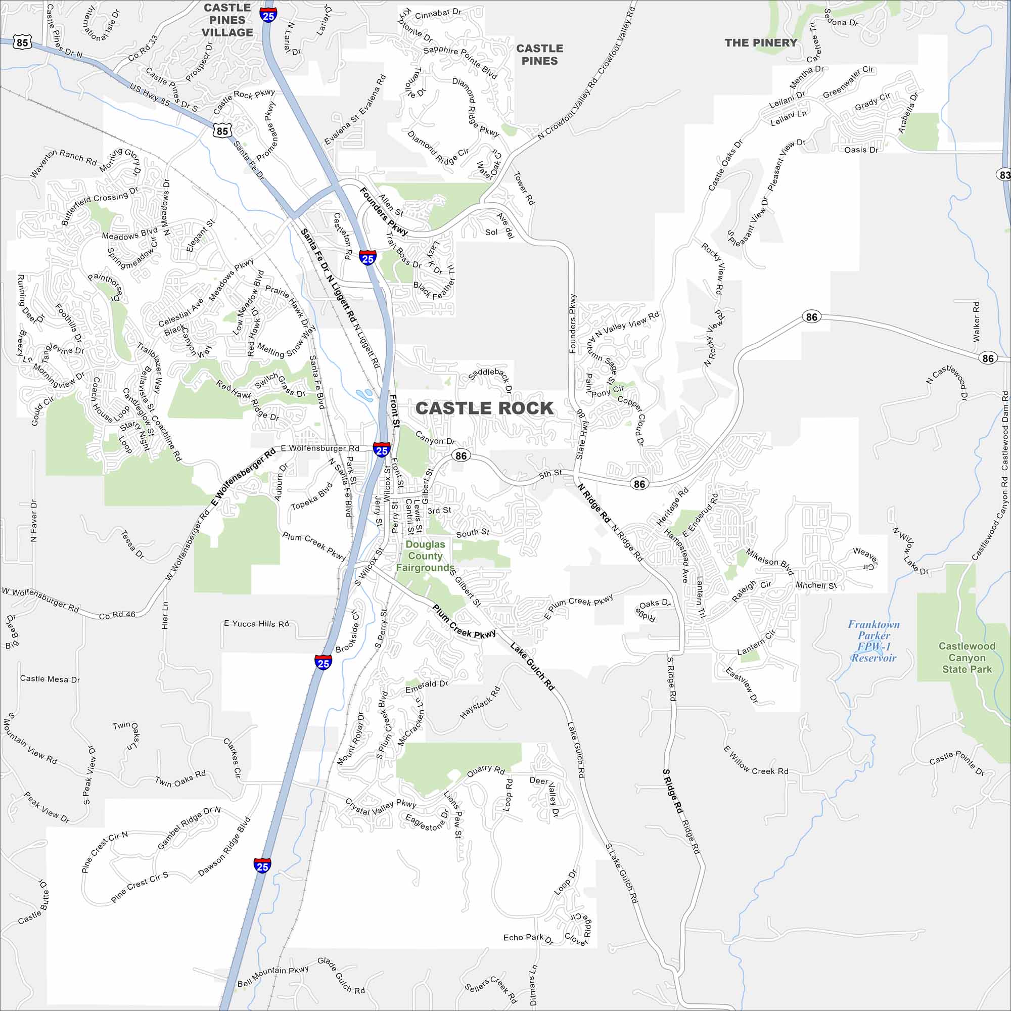
Explore Castle Rock with our map, set between Denver and Colorado Springs. The city is defined by its namesake butte and rolling hills. The scenery gives it a distinct foothills character.
Colorado State Maps
Browse Colorado with our detailed state maps


Map Information
On the Map
Interstates/Highways: I-25, State Rte 86, US Hwy 85 Major Roads: Founders Pkwy, Wolfensberger Rd, Front St, Wilcox St, Ridge Rd, Plum Creek Pkwy, Meadows Pkwy, Coachline Rd, Fifth St, Lake Gulch Rd, Mikelson Blvd, Crowfoot Valley Rd, Sapphire Pointe Blvd, Diamond Ridge Pkwy, Liggett Rd, Santa Fe Dr, Gilbert St, Perry St, Crystal Valley Pkwy, Plateau Rd Lakes and Reservoirs: Franktown Reservoir Parks and Preserves: Castlewood Canyon State Park, Douglas County Fairgrounds Nearby Communities: Castle Pines Village, Castle Pines, The PineryColorado City Maps
Here are maps of Colorado’s urban areas


