Map of Carrollton, Texas
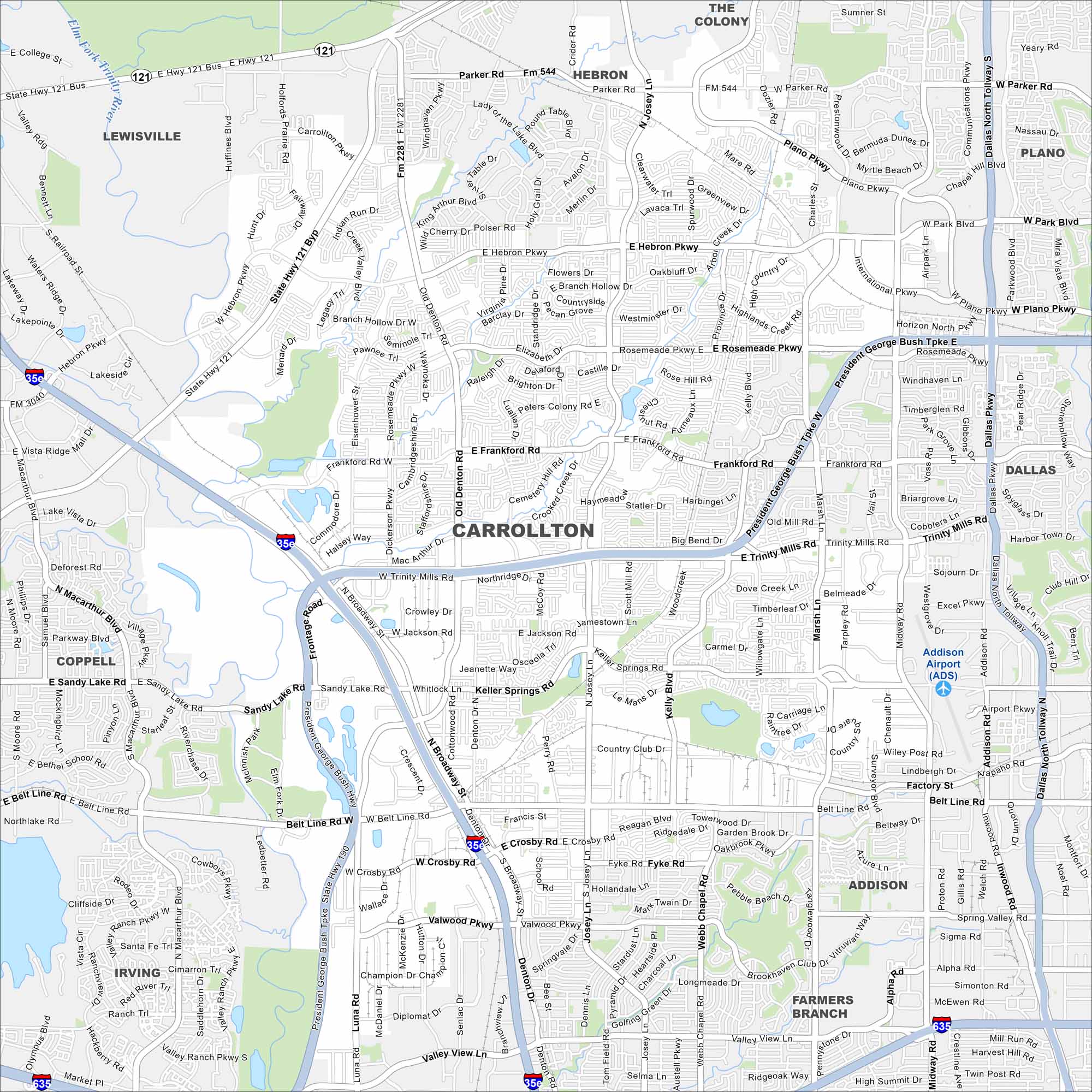
Our map of Carrollton shows this city in the Dallas-Fort Worth metro. Neighborhoods stretch across flat plains with greenbelt parks and creeks running through. It’s close to major highways, but local trails are just as prominent.
Map Information
On the Map
Interstates/Highways: I-35E, I-635, State Hwy 121, State Hwy 190 Major Roads: Belt Line Rd, Trinity Mills Rd, Frankford Rd, Hebron Pkwy, Josey Ln, Old Denton Rd, Rosemeade Pkwy, President George Bush Tpk, Marsh Ln, Midway Rd, Kelly Blvd, Keller Springs Rd, McCoy Rd, Parker Rd, Plano Pkwy, Dozier Rd, Peters Colony Rd, Whitlock Ln, Valwood Pkwy, Crosby Rd Airports: Addison Airport (ADS) Major Rivers: Elm Fork Trinity River Nearby Communities: Lewisville, The Colony, Hebron, Plano, Dallas, Addison, Farmers Branch, Irving, CoppellTexas State Maps
Scan our maps of the massive southern state of Texas.


City Maps of Texas
Explore our map collection of Texas cities.


