Map of Cambridge, Massachusetts
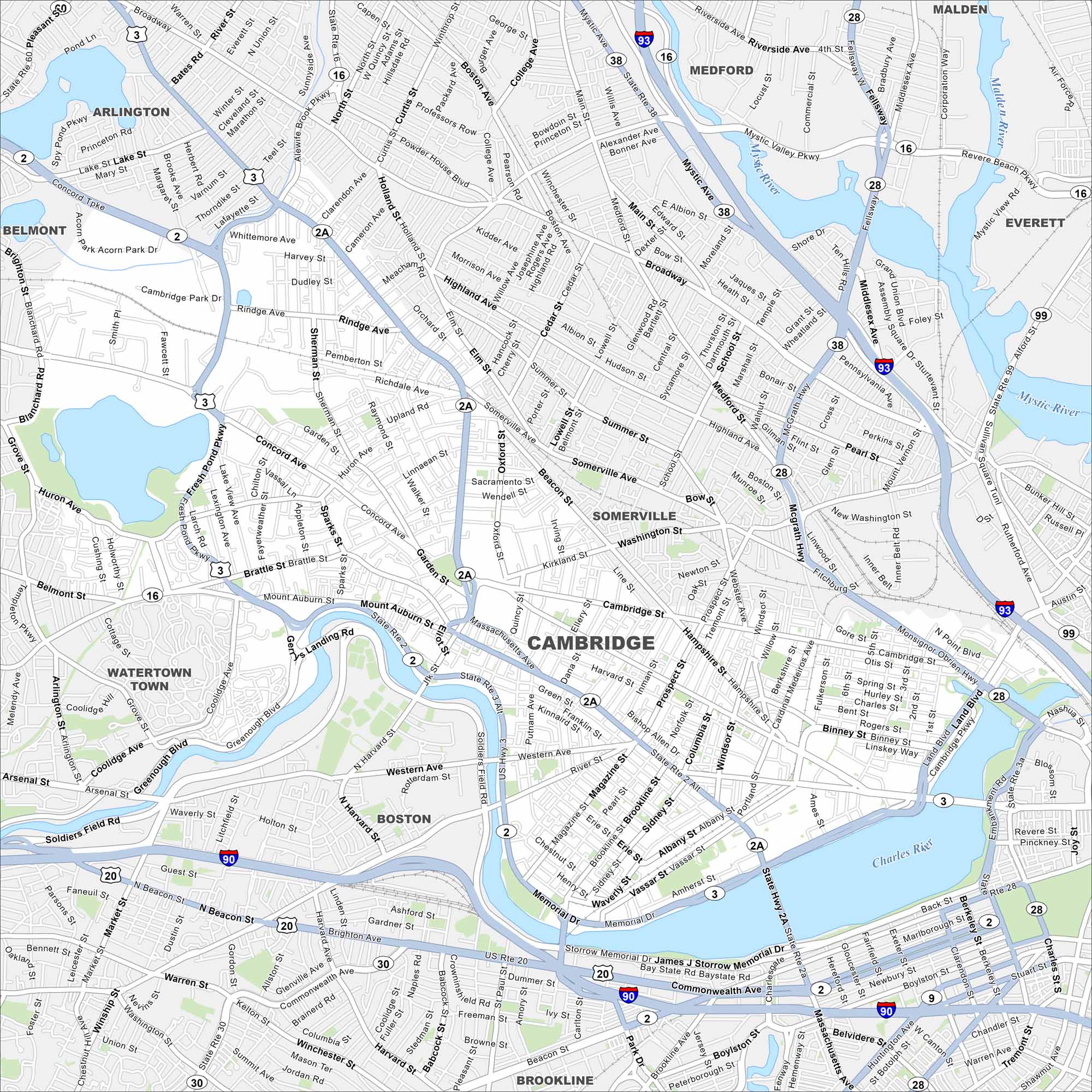
Our map of Cambridge highlights the Charles River and dense streets. It’s located near Boston with bridges across the water. Cambridge is known worldwide because of its universities.
Map Information
On the Map
Interstates/Highways: I-93, US Rte 20, State Rte 2, State Rte 2A, State Rte 3, State Rte 16, State Rte 28, State Rte 38, State Rte 99 Major Roads: Massachusetts Ave, Concord Ave, Brattle St, Mt Auburn St, Broadway, Main St, Hampshire St, Binney St, Memorial Dr, Vassar St, Brookline St, Magazine St, Western Ave, River St, Prospect St, Portland St, Garden St, Huron Ave, Rindge Ave, Fresh Pond Pkwy Major Rivers: Charles River, Mystic River Nearby Communities: Boston, Somerville, Arlington, Belmont, Watertown Town, Brookline, Medford, Everett, MaldenMassachusetts State Maps
Here’s our state maps of Massachusetts


City Maps of Massachusetts
Explore Boston and other urban areas in Massachusetts


