Map of Broken Arrow, Oklahoma
Check out Broken Arrow on our map just outside Tulsa. This city has grown into one of the state’s largest suburbs. It’s family-focused but still tied closely to the metro.
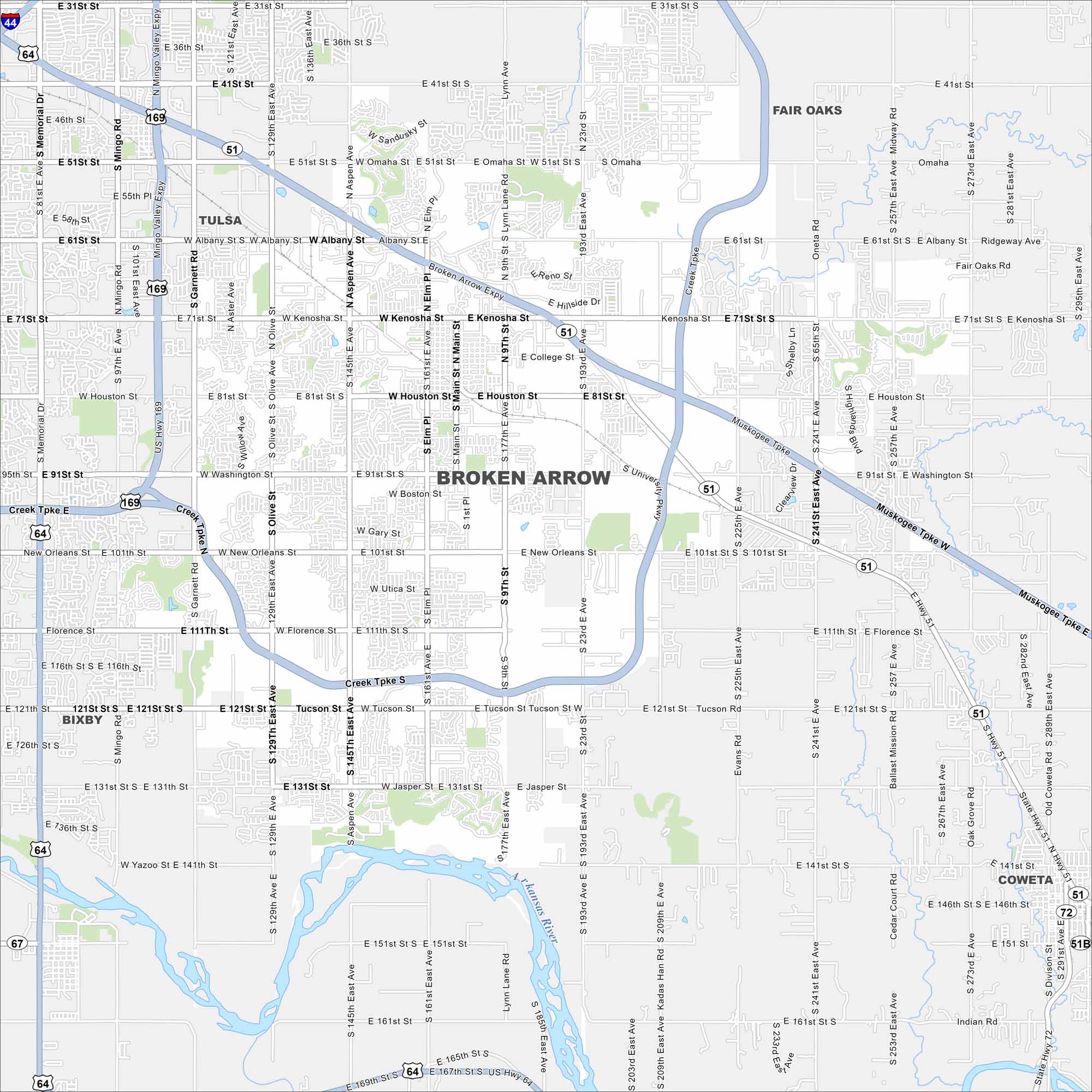
Map Information
On the Map
Interstates/Highways: US Hwy 64, US Hwy 169, State Rte 51 Major Roads: Kenosha St, Houston St, Washington St, New Orleans St, Florence St, Tucson St, Jasper St, 101st St, 111st St, 121st St, 131st St, 151st St, 71st St, 81st St, 91st St, Main St, Aspen Ave, Olive Ave, Garnett Rd, Memorial Dr Major Rivers: Arkansas River Nearby Communities: Tulsa, Bixby, Coweta, Fair OaksOklahoma State Maps
Here is our map collection of the Sooner State.


City Maps of Oklahoma
Explore Oklahoma’s cities with our maps


