Map of Brighton, Colorado
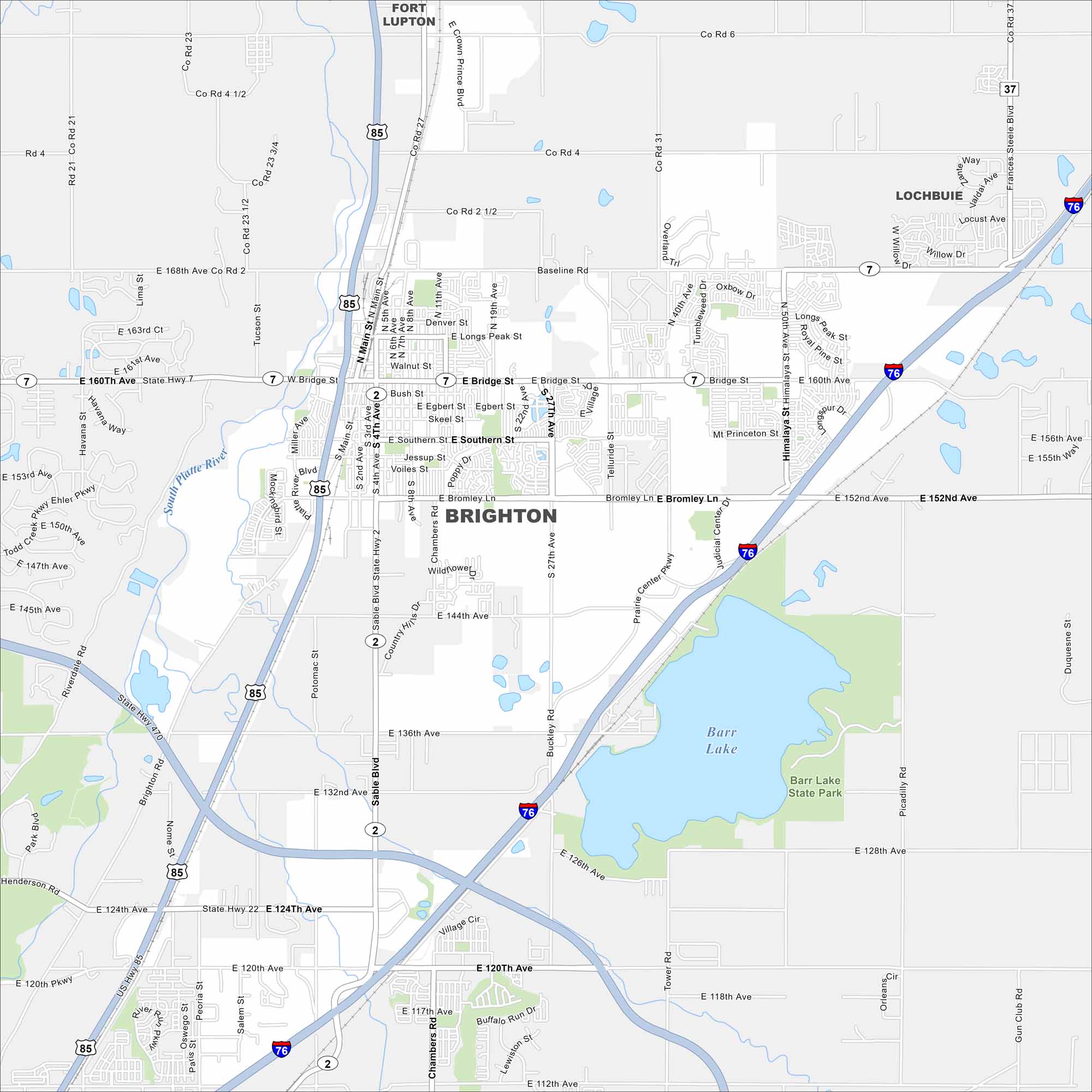
Take a look at Brighton on our map. You can find it northeast of Denver. Fields and open plains meet a growing city. Barr Lake is a major waterbody here.
Colorado State Maps
Browse Colorado with our detailed state maps


Map Information
On the Map
Interstates/Highways: I-76, State Rte 2, State Rte 7, US Hwy 85 Major Roads: Bridge St, Bromley Ln, Main St, 160th Ave, 168th Ave, 120th Ave, 144th Ave, 152nd Ave, Chambers Rd, Buckley Rd, Tower Rd, 27th Ave, 50th Ave, Himalaya St, Baseline Rd, 136th Ave, 124th Ave, 4th Ave, 5th Ave, 19th Ave Lakes and Reservoirs: Barr Lake Major Rivers: South Platte River Parks and Preserves: Barr Lake State Park Nearby Communities: Fort Lupton, Lochbuie, HendersonColorado City Maps
Here are maps of Colorado’s urban areas


