Map of Brainerd, Minnesota
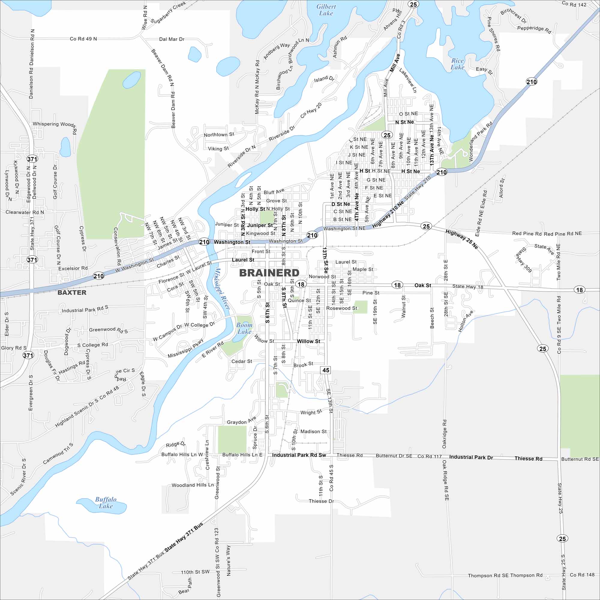
See Brainerd with our map in the heart of lake country. The Mississippi River cuts through the area. It’s a hub for fishing and summer trips but stays relatively quiet in winter.
Map Information
On the Map
Interstates/Highways: State Rte 210, State Rte 371, State Rte 18, State Rte 25 Major Roads: Washington St, Paul Bunyan Dr, Laurel St, Oak St, Willow St, Wright St, Madison St, Thiesse Dr, Industrial Park Rd, 13th St, 6th St, 4th Ave, Riverside Dr, Mill Ave, 28th St, Pine St, Bluff Ave, College Dr, Business Hwy 371, Excelsior Rd Lakes and Reservoirs: Rice Lake, Boom Lake, Buffalo Lake, Gilbert Lake, Island Lake Major Rivers: Mississippi River Nearby Communities: BaxterMinnesota State Maps
Explore every lake in our state maps of Minnesota


Minnesota City Maps
Browse through our city maps of Minnesota


