Map of Bay St. Louis, Mississippi
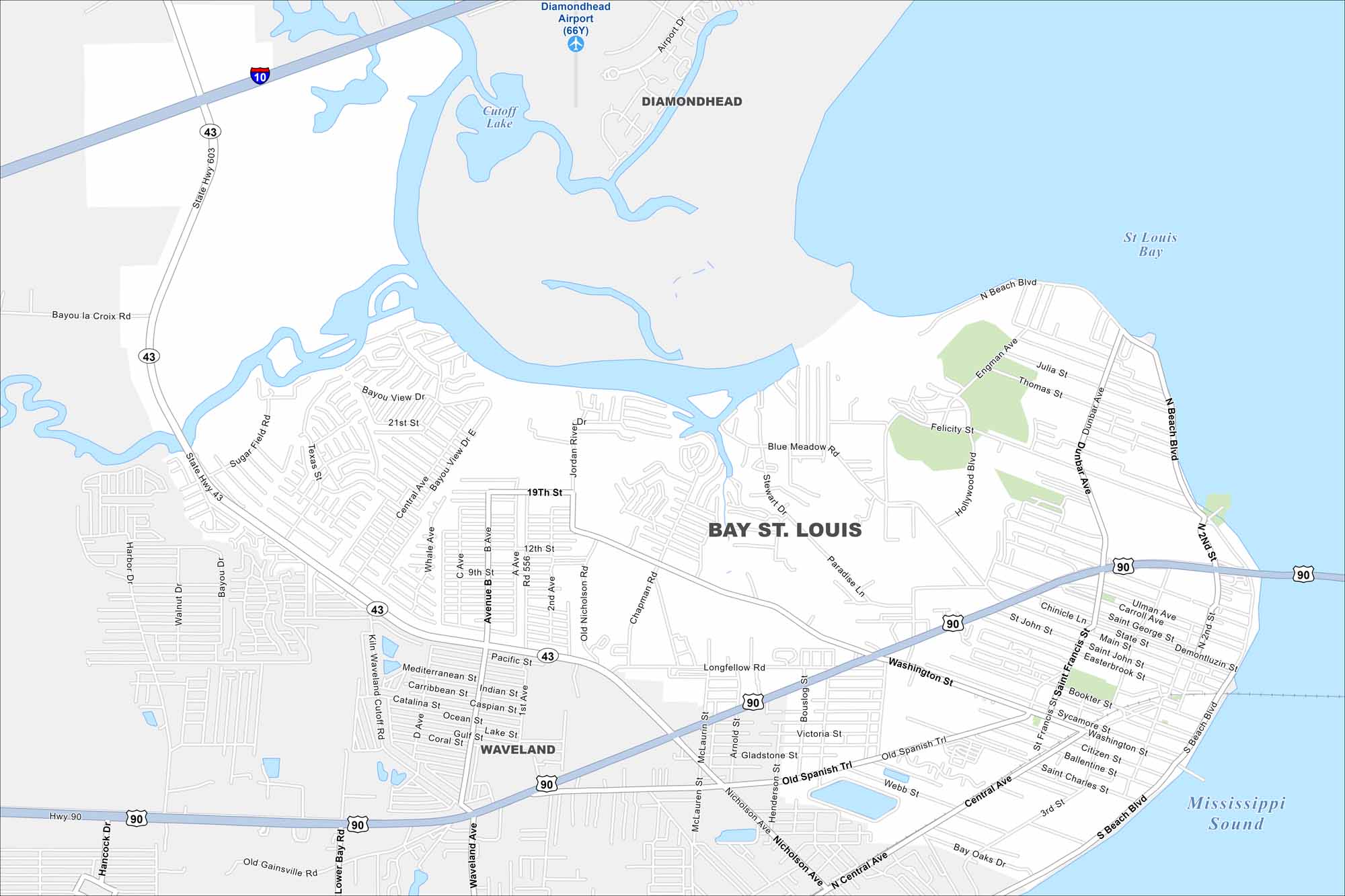
Step into Bay St. Louis on the Gulf Coast. Find sandy beaches along the coast. Our map of Bay St. Louis highlights the shoreline, bay bridges, and coastal neighborhoods.
Map Information
On the Map
Interstates/Highways: I-10, US Hwy 90, State Hwy 603, State Hwy 43 Major Roads: Washington St, Central Ave, Hwy 90, Old Spanish Trl, Nicholson Ave, 19th St, 12th St, River Dr, Blue Meadow Rd, Felicity St, Dunbar Ave, Beach Blvd, Kiln Waveland Cutoff Rd, Sugar Field Rd, Texas St, Whale Ave, Main St, Ulman Ave, Carroll Ave Airports: Diamondhead Airport (66Y) Lakes and Reservoirs: Cutoff Lake, St Louis Bay, Mississippi Sound Parks and Preserves: Commagere Park, Citizen Park, Carol Vegas Park, McDonald ParkMississippi State Maps
Explore maps of Mississippi’s towns, rivers, and roads.


Mississippi City Maps
Discover Mississippi with our city maps