Map of Barnstable, Massachusetts
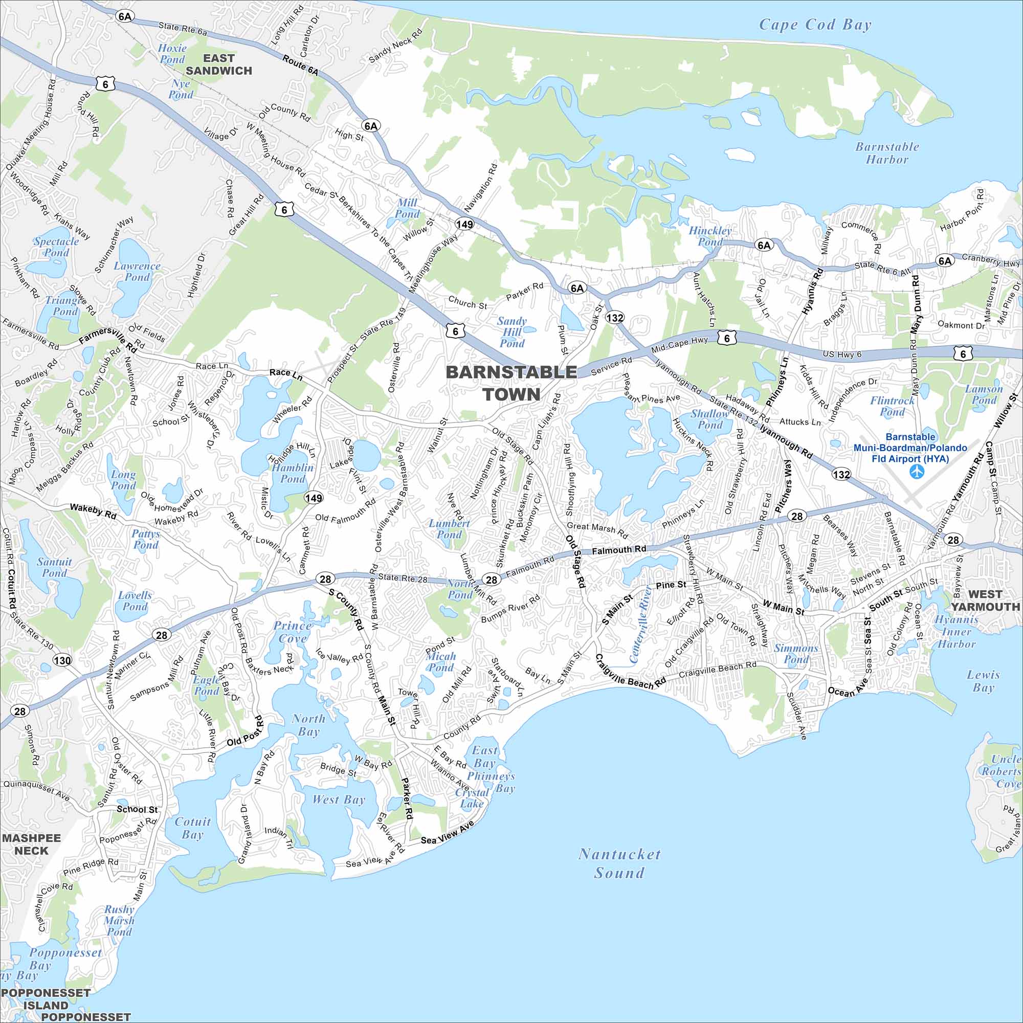
Our map of Barnstable shows the streets, highways, and coastal edges. Our map shows the whole Barnstable area, covered much by Cape Cod. It is the largest community on the Cape.
Map Information
On the Map
Interstates/Highways: US Hwy 6, State Rte 28, State Rte 132, State Rte 149, State Rte 6A, State Rte 130 Major Roads: Phinneys Ln, Mary Dunn Rd, Osterville-West Barnstable Rd, Old Stage Rd, Race Ln, Main St, West Main St, South St, Ocean St, Craigville Beach Rd, Shootflying Hill Rd, Service Rd, Iyannough Rd, Pitchers Way, Bearses Way, Scudder Ave, Gosnold St, High St, Cedar St, Willow St Airports: Barnstable Muni-Boardman/Polando Fld Airport (HYA) Lakes and Reservoirs: Cape Cod Bay, Nantucket Sound, Barnstable Harbor, Lewis Bay, Hyannis Inner Harbor, West Bay, North Bay, Cotuit Bay, Prince Cove, Mystic Lake, Middle Pond, Hamblin Pond, Lovells Pond, Shallow Pond, Hinckley Pond, Mill Pond, Sandy Hill Pond, Lumbert Pond, Micah Pond, Crystal Lake Nearby Communities: East Sandwich, West Yarmouth, Mashpee Neck, Popponesset Island, PopponessetMassachusetts State Maps
Here’s our state maps of Massachusetts


City Maps of Massachusetts
Explore Boston and other urban areas in Massachusetts


