Map of Aurora, Colorado
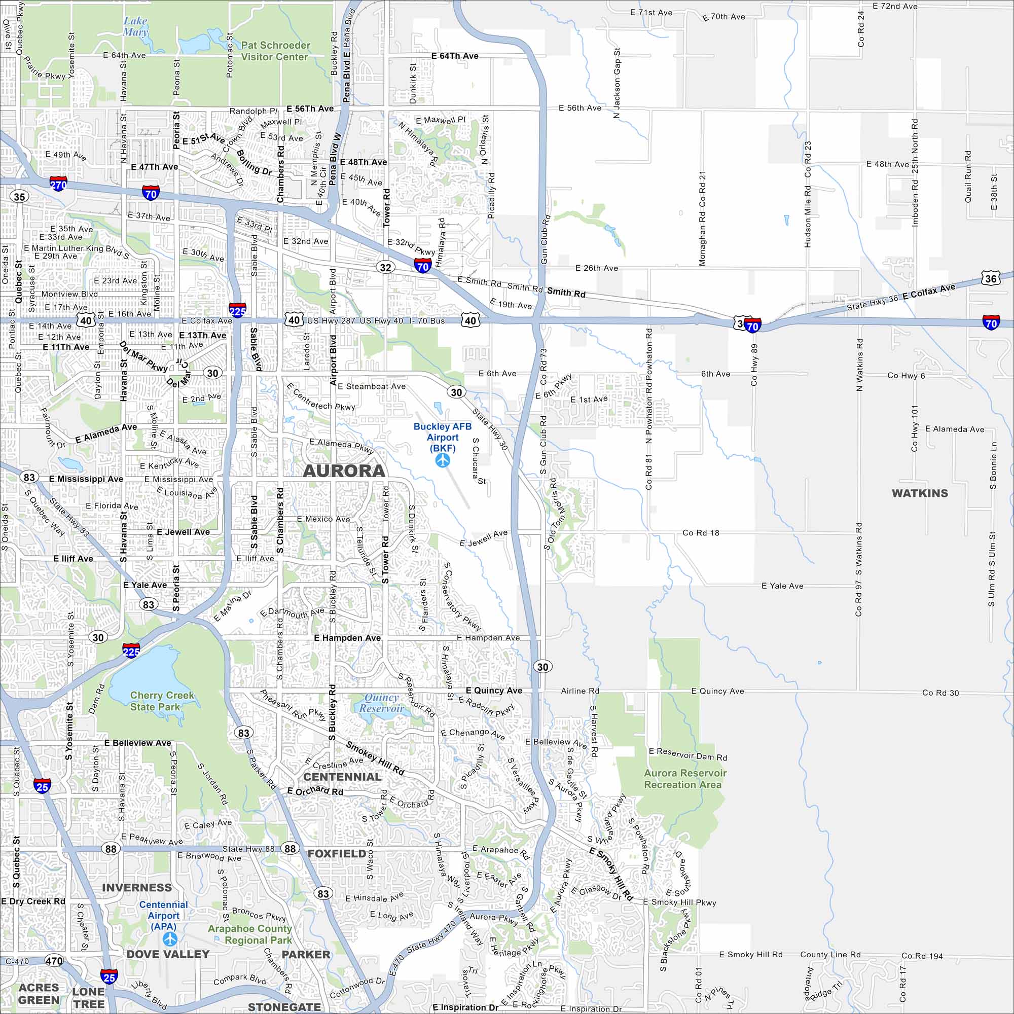
Our map of Aurora highlights the highways, streets, and parkland. It connects to Denver but still covers a wide area. Aurora is especially known for its mountain views.
Colorado State Maps
Browse Colorado with our detailed state maps


Map Information
On the Map
Interstates/Highways: I-70, I-225, State Rte 30, State Rte 83, State Rte 88, US Hwy 36, US Hwy 40, US Hwy 287 Major Roads: Colfax Ave, Parker Rd, Chambers Rd, Tower Rd, Buckley Rd, Mississippi Ave, Hampden Ave, Smoky Hill Rd, Quincy Ave, Iliff Ave, Yale Ave, Jewell Ave, 6th Ave, Alameda Ave, 56th Ave, 64th Ave, Gun Club Rd, Harvest Rd, Powhaton Rd, Picadilly Rd Airports: Buckley AFB Airport (BKF), Centennial Airport (APA) Lakes and Reservoirs: Lake Mary, Quincy Reservoir, Aurora Reservoir Parks and Preserves: Cherry Creek State Park, Aurora Reservoir Recreation Area, Arapahoe County Regional Park Nearby Communities: Centennial, Watkins, Foxfield, Inverness, Dove Valley, Parker, StonegateColorado City Maps
Here are maps of Colorado’s urban areas


