Map of Attleboro, Massachusetts
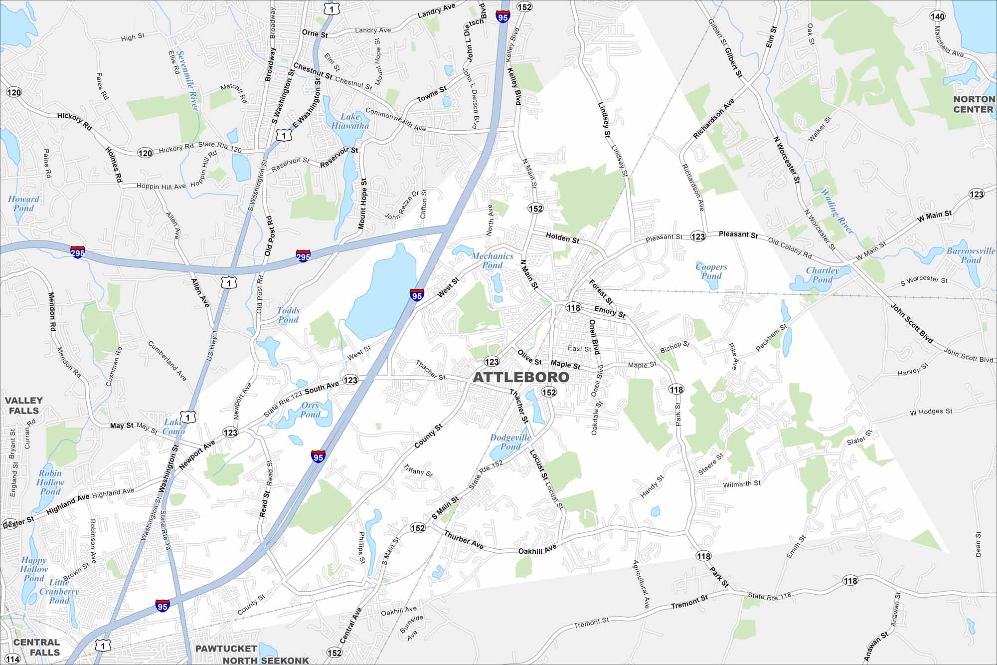
Here’s our map of Attleboro, Massachusetts with its highways, streets, and park areas. Attleboro is known as the “Jewelry Capital of the World”.
Map Information
On the Map
Interstates/Highways: I-95, I-295, US Hwy 1, State Rte 123, State Rte 152, State Rte 118, State Rte 120 Major Roads: County St, Oakhill Ave, Tiffany St, Locust St, Pike Ave, Thacher St, West St, Holden St, Pleasant St, Oakdale St, Emory St, Forest St, Bishop St, Slater St, Handy St, Tremont St, Richardson Ave, Peckham St, Smith St, Wilmarth St Lakes and Reservoirs: Lake Hiawatha, Mechanics Pond, Todds Pond, Orrs Pond, Dodgeville Pond, Coopers Pond, Chartley Pond, Barrowsville Pond, Robin Hollow Pond, Happy Hollow Pond, Cranberry Pond Major Rivers: Sevenmile River, Wading River Nearby Communities: Valley Falls, Central Falls, Pawtucket, North Seekonk, Norton CenterMassachusetts State Maps
Here’s our state maps of Massachusetts


City Maps of Massachusetts
Explore Boston and other urban areas in Massachusetts


