Map of Arlington, Texas
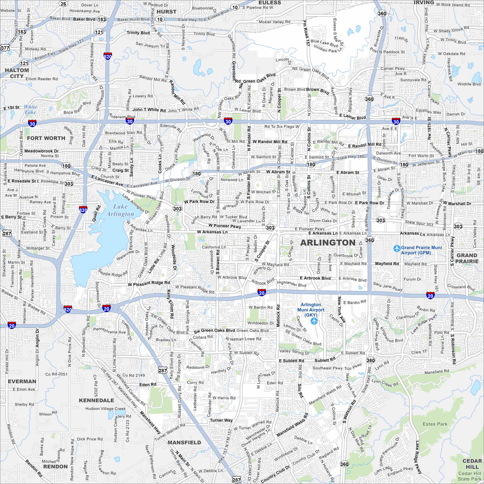
See the highways, airports, and parks of Arlington, Texas. Our map shows how this city stretches between Dallas and Fort Worth. Arlington is well-recognized for its stadiums and entertainment district.
Map Information
On the Map
Interstates/Highways: I-20, I-30, I-820, US Hwy 287, State Hwy 360, State Hwy 180, State Hwy 121, State Hwy 161, State Hwy 303 Major Roads: Division St, Abram St, Park Row Dr, Pioneer Pkwy, Arkansas Ln, Mayfield Rd, Pleasant Ridge Rd, Bardin Rd, Green Oaks Blvd, Sublett Rd, Harris Rd, Eden Rd, Poly Webb Rd, Collins St, Cooper St, Matlock Rd, Davis Dr, Bowen Rd, Fielder Rd, Center St Airports: Grand Prairie Muni Airport (GPM), Arlington Muni Airport (GKY) Lakes and Reservoirs: Lake Arlington, Viridian Lake, Blue Lake Parks and Preserves: Cedar Hill State Park, Estes Park Nearby Communities: Fort Worth, Haltom City, Hurst, Euless, Irving, Grand Prairie, Cedar Hill, Mansfield, Kennedale, Rendon, EvermanTexas State Maps
Scan our maps of the massive southern state of Texas.


City Maps of Texas
Explore our map collection of Texas cities.


