Map of Apple Valley, Minnesota
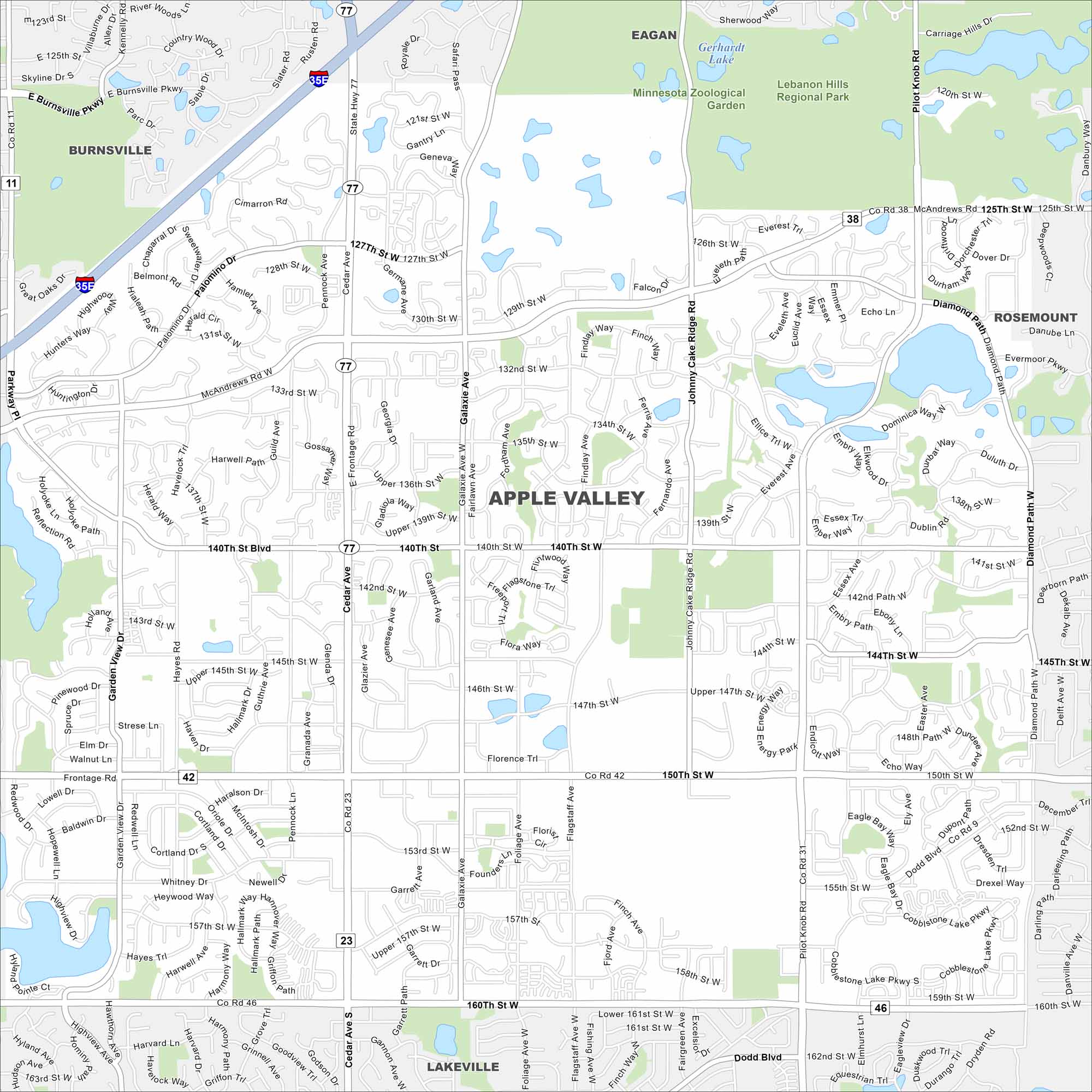
Our map of Apple Valley highlights the highways, streets, and nearby lakes. Roads link toward Minneapolis in the Twin Cities area. Apple Valley is home to the Minnesota Zoo.
Map Information
On the Map
Interstates/Highways: I-35E, State Rte 77 Major Roads: Cedar Ave, Co Rd 42, McAndrews Rd, 140th St, 150th St, Pilot Knob Rd, Johnny Cake Ridge Rd, Galaxie Ave, Diamond Path, 160th St, Flagstaff Ave, Pennock Ave, Garden View Dr, 127th St, 147th St, 153rd St, 157th St, 125th St, Upper 136th St, Palomino Dr Lakes and Reservoirs: Gerhardt Lake, Echo Lake, Farquar Lake, Alimagnet Lake, Long Lake, Cobblestone Lake, Lac Lavon Parks and Preserves: Lebanon Hills Regional Park, Minnesota Zoological Garden Nearby Communities: Burnsville, Eagan, Rosemount, LakevilleMinnesota State Maps
Explore every lake in our state maps of Minnesota


Minnesota City Maps
Browse through our city maps of Minnesota


