Map of Ankeny, Iowa
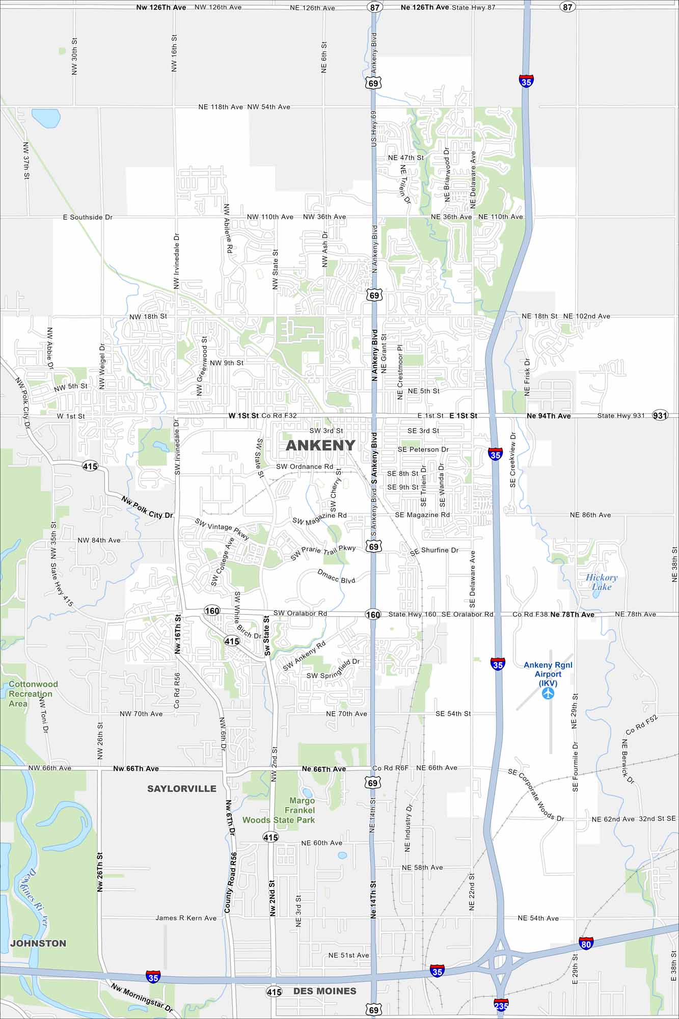
Our map of Ankeny shows the Des Moines River flowing on the west side. It includes highways like I-35 and park spaces. Ankeny, Iowa has experienced rapid growth in recent years.


Map Information
On the Map
Interstates/Highways: I-35, I-80, I-235, US Hwy 69, State Hwy 160, State Hwy 415, State Hwy 931, State Hwy 87 Major Roads: Ankeny Blvd, Delaware Ave, State St, Oralabor Rd, 1st St, Ordinance Rd, 36th Ave, 118th Ave, 126th Ave, 66th Ave, 70th Ave, 78th Ave, 110th Ave, Magazine Rd, Vintage Pkwy, DMACC Blvd, Irvinedale Dr, NW 36th St, NE 54th Ave, NE 18th St Airports: Ankeny Rgnl Airport (IKV) Lakes and Reservoirs: Hickory Lake Major Rivers: Des Moines River Parks and Preserves: Margo Frankel Woods State Park, Cottonwood Recreation Area Nearby Communities: Saylorville, Johnston, Des MoinesIowa City Maps
Browse city maps in the state of Iowa


