Map of Amarillo, Texas
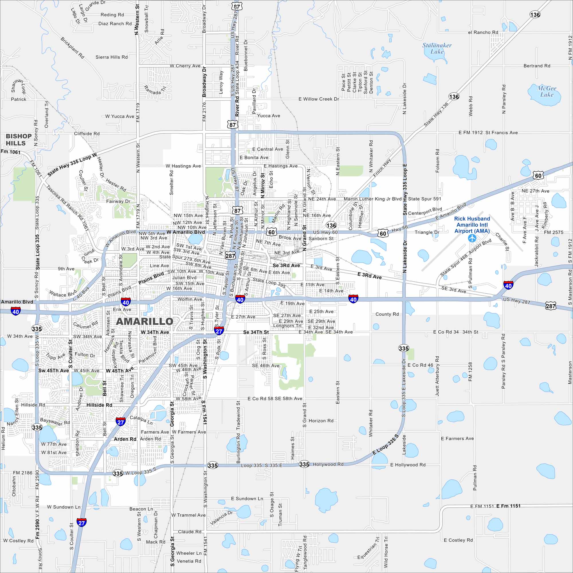
Amarillo stretches wide across the Texas Panhandle. This location is where open highways seem endless. It’s a Route 66 stop, famous for big skies and the Cadillac Ranch. Our map includes nearby lakes and highways.
Map Information
On the Map
Interstates/Highways: I-40, I-27, US Hwy 87, US Hwy 287, US Hwy 60, State Hwy 136, State Loop 335 Major Roads: Amarillo Blvd, 34th Ave, 45th Ave, 58th Ave, Western St, Georgia St, Washington St, Coulter St, Bell St, Lakeside Dr, Grand St, Eastern St, Broadway Dr, Hollywood Rd, Sundown Ln, Cherry Ave, Willow Creek Dr, Hastings Ave, Plains Blvd, Wolflin Ave Airports: Rick Husband Amarillo Intl Airport (AMA) Lakes and Reservoirs: Stalanaker Lake, McGee Lake Nearby Communities: Bishop HillsTexas State Maps
Scan our maps of the massive southern state of Texas.


City Maps of Texas
Explore our map collection of Texas cities.


