Map of Ada, Oklahoma
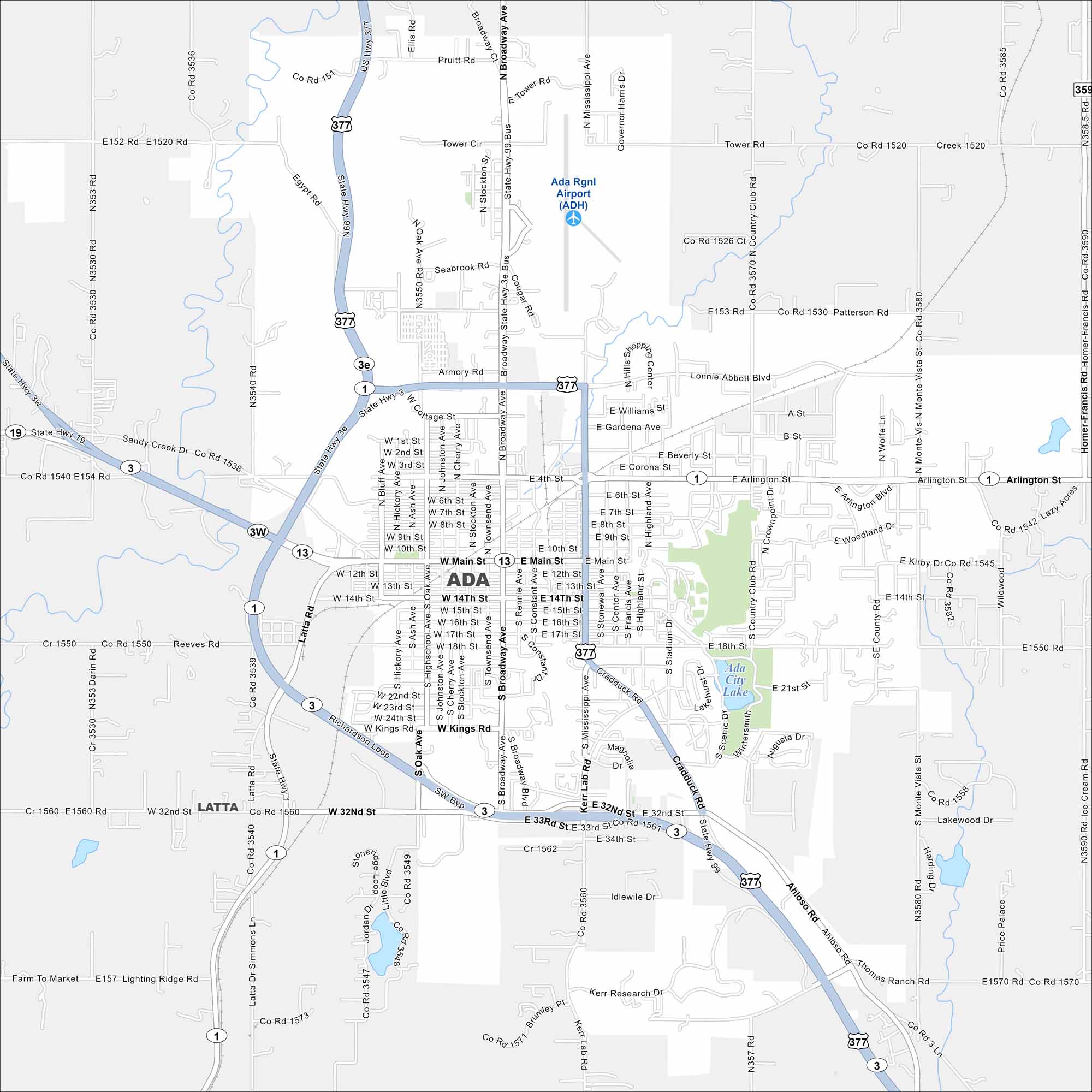
Ada is a compact city with roads crossing near the Canadian River basin. Our map shows its small-town core and Ada City Lake. But it’s also known as the home of the Chickasaw Nation.
Map Information
On the Map
Interstates/Highways: US Hwy 377, State Rte 3E, State Rte 1, State Rte 3, State Rte 3W, State Rte 19, State Rte 99 Major Roads: Main St, Broadway Ave, Mississippi Ave, Lonnie Abbott Blvd, Arlington St, Richardson Loop, Kerr Lab Rd, 32nd St, 33rd St, 14th St, 18th St, Kings Rd, Monte Vista St, Stadium Dr, Country Club Rd, Latta Rd, Oak Ave, Townsend Ave, Stockton Ave, Constant Ave Airports: Ada Rgnl Airport (ADH) Lakes and Reservoirs: Ada City Lake Nearby Communities: LattaOklahoma State Maps
Here is our map collection of the Sooner State.


City Maps of Oklahoma
Explore Oklahoma’s cities with our maps


