Map of Abilene, Texas
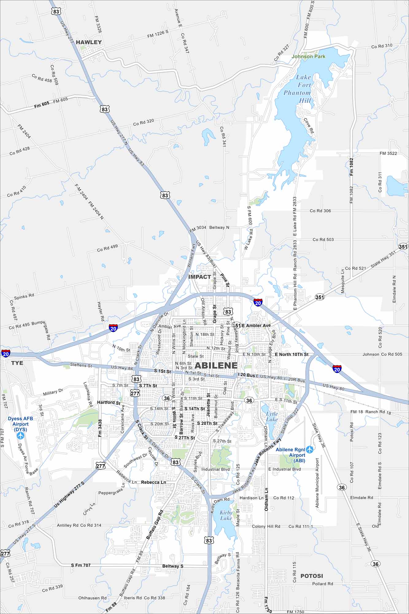
Highways spread wide in Abilene, linking neighborhoods across the open plains. Our map shows its spot in West Texas. It’s a place built on ranching, railroads, and a big sense of space.
Map Information
On the Map
Interstates/Highways: I-20, US Hwy 83, US Hwy 277, US Hwy 84, State Rte 351, State Rte 36 Major Roads: Beltway N, Beltway S, Ambler Ave, Pine St, Grape St, Treadaway Blvd, Judge Ely Blvd, 10th St, 27th St, Industrial Blvd, Rebecca Ln, Southwest Dr, Buffalo Gap Rd, Antilley Rd, Iberis Rd, Hartford St, Sayles Blvd, Barrow St, Willis St, Danville Dr Airports: Dyess AFB Airport, Abilene Rgnl Airport (ABI) Lakes and Reservoirs: Lake Fort Phantom Hill, Lytle Lake, Kirby Lake Parks and Preserves: Johnson Park Nearby Communities: Hawley, Impact, Tye, PotosiTexas State Maps
Scan our maps of the massive southern state of Texas.


City Maps of Texas
Explore our map collection of Texas cities.


