Map of Waco, Texas
Take a look at Waco, home to Baylor University and Magnolia Market. Our map helps you find your way through this central Texas hub.
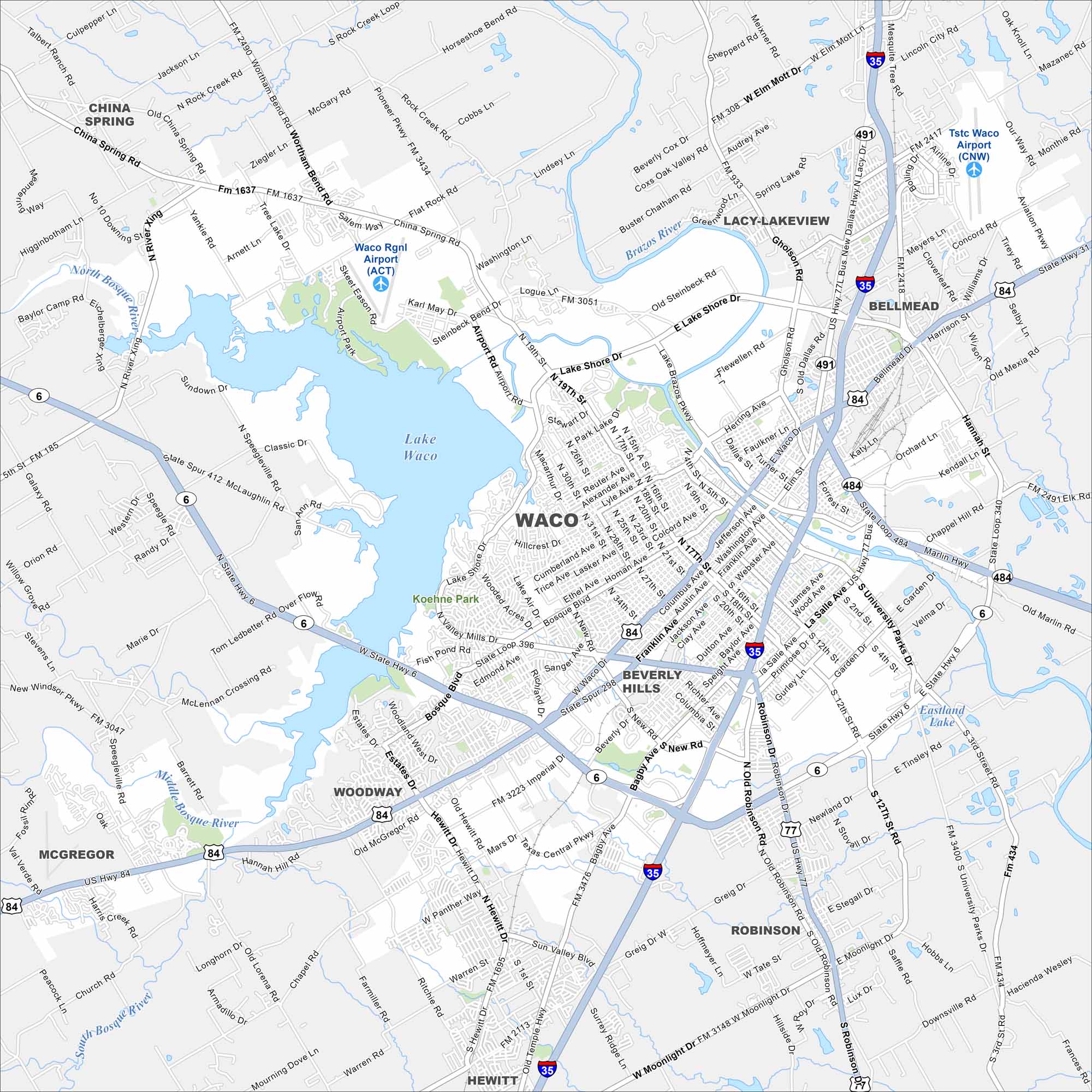
Map Information
On the Map
Interstates/Highways: I-35, US Hwy 84, US Hwy 77, State Rte 6, State Rte 31, State Rte 164 Major Roads: Valley Mills Dr, Lake Shore Dr, Franklin Ave, Waco Dr, New Rd, Bagby Ave, Bosque Blvd, Hewitt Dr, Panther Way, Gholson Rd, University Parks Dr, La Salle Ave, Sanger Ave, Austin Ave, Washington Ave, Hillcrest Dr, MacArthur Dr, Steinbeck Bend Dr, Airport Rd, Wooded Acres Dr Airports: Waco Rgnl Airport (ACT), Tstc Waco Airport (CNW) Lakes and Reservoirs: Lake Waco, Eastland Lake Major Rivers: Brazos River, North Bosque River, Middle Bosque River, South Bosque River Nearby Communities: Bellmead, Lacy Lakeview, Beverly Hills, Woodway, Robinson, Hewitt, McGregor, China SpringTexas State Maps
Scan our maps of the massive southern state of Texas.


City Maps of Texas
Explore our map collection of Texas cities.


