Map of Andover, Minnesota
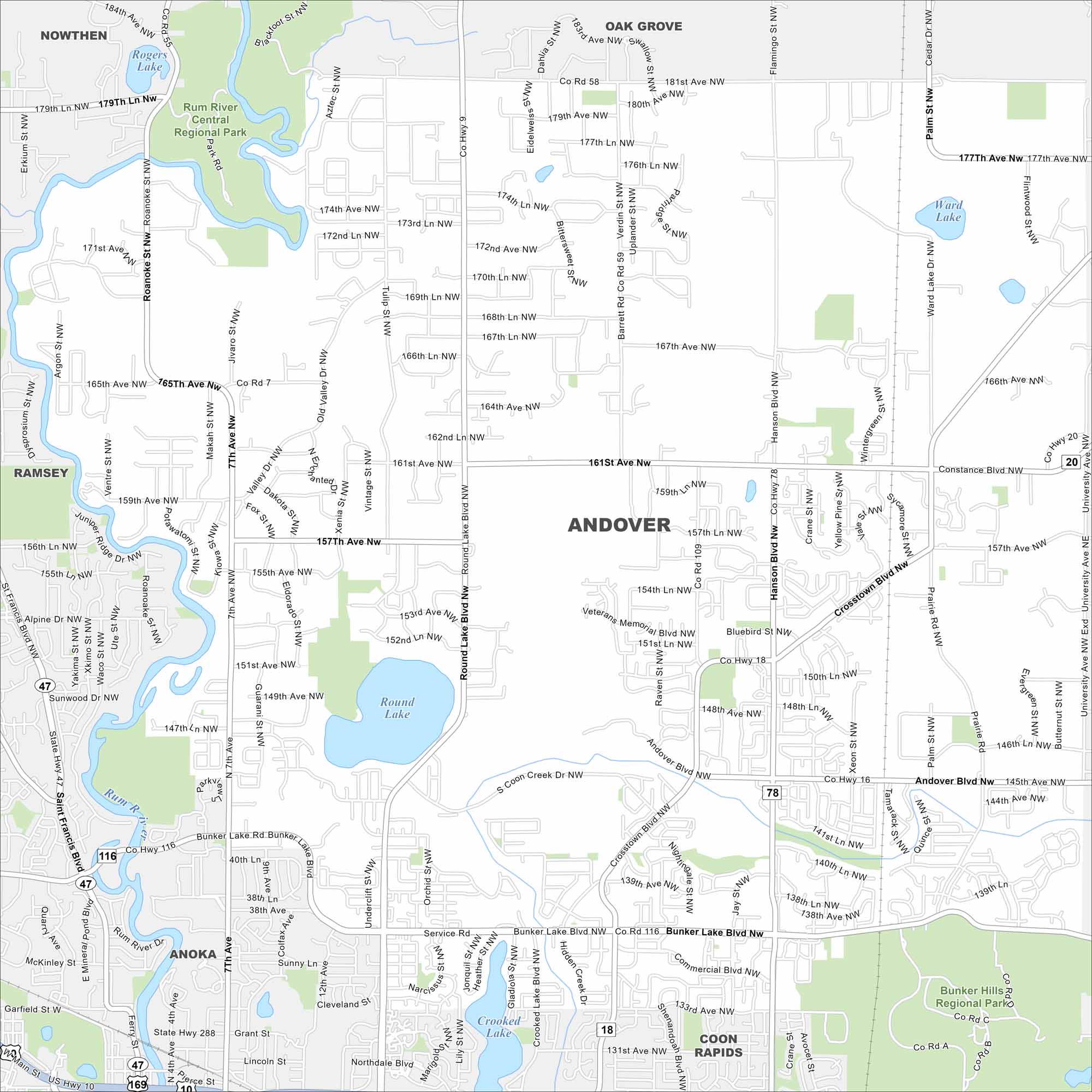
Andover is mapped with its lakes, waterways and highways. Roads connect into the Twin Cities but still maintains wide green spaces. The city is part of Anoka County.
Map Information
On the Map
Interstates/Highways: US Hwy 10, State Rte 47 Major Roads: Andover Blvd, Bunker Lake Blvd, Hanson Blvd, Round Lake Blvd, Crosstown Blvd, Constance Blvd, University Ave, 7th Ave, 161st Ave, 157th Ave, 147th Ave, Prairie Rd, Nightingale St, Shadow Ridge Dr, Coon Creek Dr, Variolite St, Quinn St, Tulip St, Sycamore St, Jay St Lakes and Reservoirs: Rogers Lake, Round Lake, Crooked Lake, Ward Lake Major Rivers: Rum River Parks and Preserves: Rum River Central Regional Park, Bunker Hills Regional Park Nearby Communities: Nowthen, Oak Grove, Ramsey, Anoka, Coon Rapids, Ham LakeMinnesota State Maps
Explore every lake in our state maps of Minnesota


Minnesota City Maps
Browse through our city maps of Minnesota


