Map of Ardmore, Oklahoma
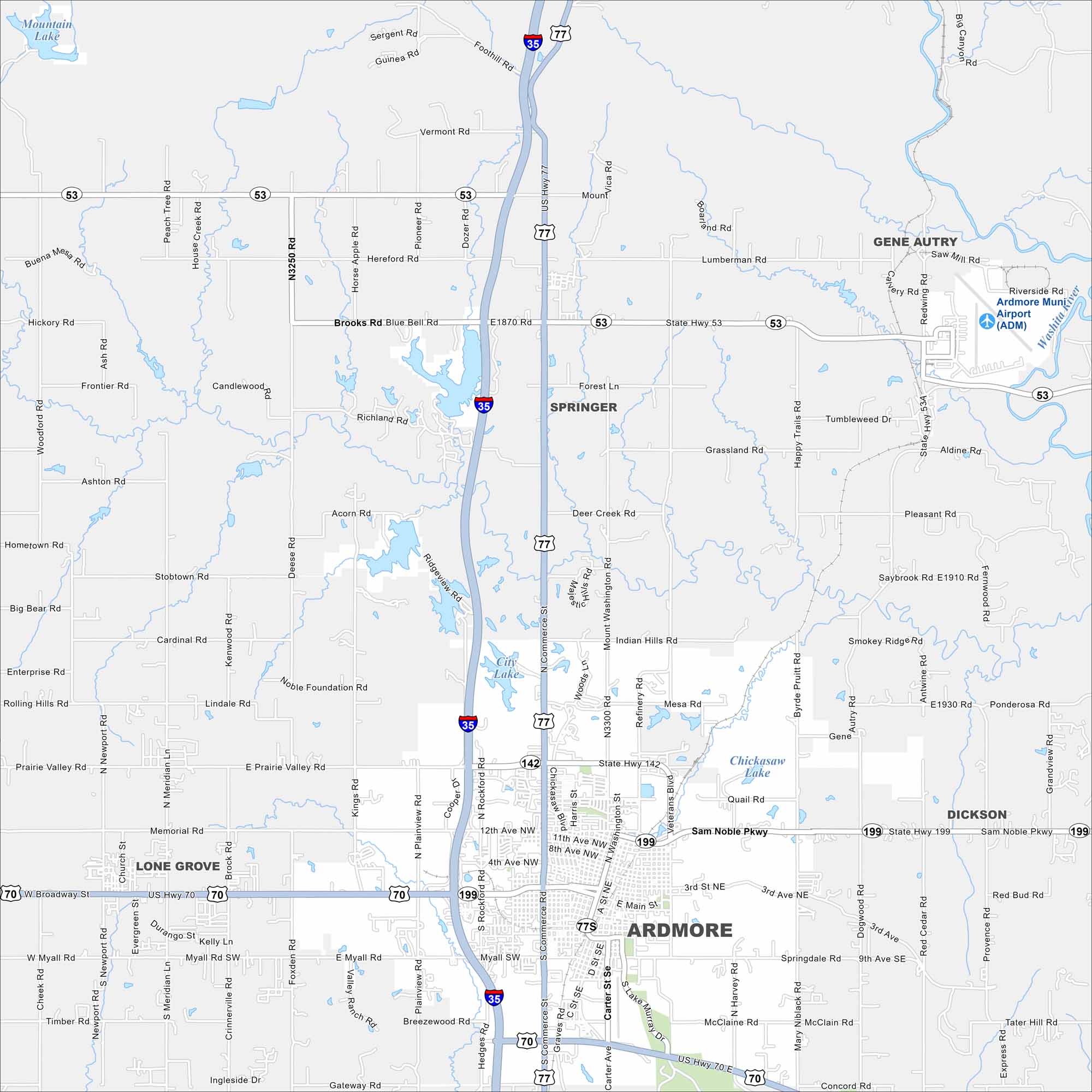
Our map of Ardmore shows its lakes, rivers, roads and parks. The city grew quite a bit as it’s positioned between Oklahoma City and Dallas.
Map Information
On the Map
Interstates/Highways: I-35, US Hwy 77, US Hwy 70, State Rte 53, State Rte 142, State Rte 199 Major Roads: Main St, Sam Noble Pkwy, Commerce St, Broadway St, Myall Rd, 12th Ave NW, Grandview Rd, Veterans Blvd, Refinery Rd, Mary Niblack Rd, Ponderosa Rd, Lake Murray Dr, Carter St, Washington St, Harris St, Rockford Rd, Plainview Rd, Kings Rd, Noble Foundation Rd, Blue Bell Rd Airports: Ardmore Muni Airport (ADM) Lakes and Reservoirs: Mountain Lake, City Lake, Chickasaw Lake Major Rivers: Washita River Nearby Communities: Ardmore, Springer, Gene Autry, Dickson, Lone GroveOklahoma State Maps
Here is our map collection of the Sooner State.


City Maps of Oklahoma
Explore Oklahoma’s cities with our maps


