Map of Arvada, Colorado
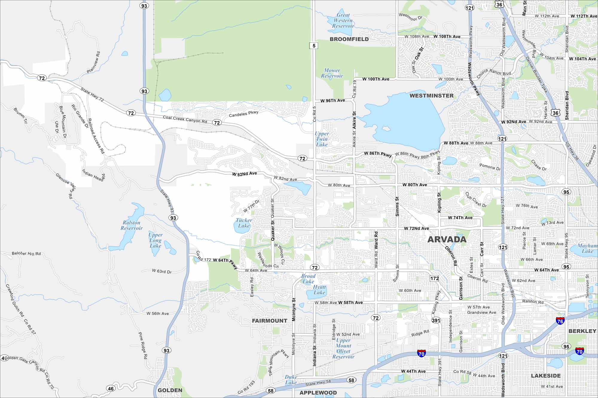
Arvada is located northwest of Denver. Our map of Arvada shows the roads, waterways, and park spaces. Streets connect to Denver.
Colorado State Maps
Browse Colorado with our detailed state maps


Map Information
On the Map
Interstates/Highways: I-70, I-76, State Rte 72, State Rte 93, State Rte 95, State Rte 121, State Rte 172, State Rte 391, US Hwy 36 Major Roads: Wadsworth Blvd, Kipling St, Sheridan Blvd, 80th Ave, 72nd Ave, 64th Ave, 100th Ave, 88th Ave, Indiana St, Ward Rd, 58th Ave, Simms St, 52nd Ave, 44th Ave, Alkire St, McIntyre St, Garrison St, Independence St, 92nd Ave, 86th Pkwy Lakes and Reservoirs: Great Western Reservoir, Mower Reservoir, Standley Lake, Upper Twin Lake, Ralston Reservoir, Upper Long Lake, Tucker Lake, Broad Lake, Hyatt Lake, Upper Mount Olivet Reservoir, Duke Lake Nearby Communities: Broomfield, Westminster, Fairmont, Applewood, Golden, Berkley, LakesideColorado City Maps
Here are maps of Colorado’s urban areas


