Map of Bastrop, Texas
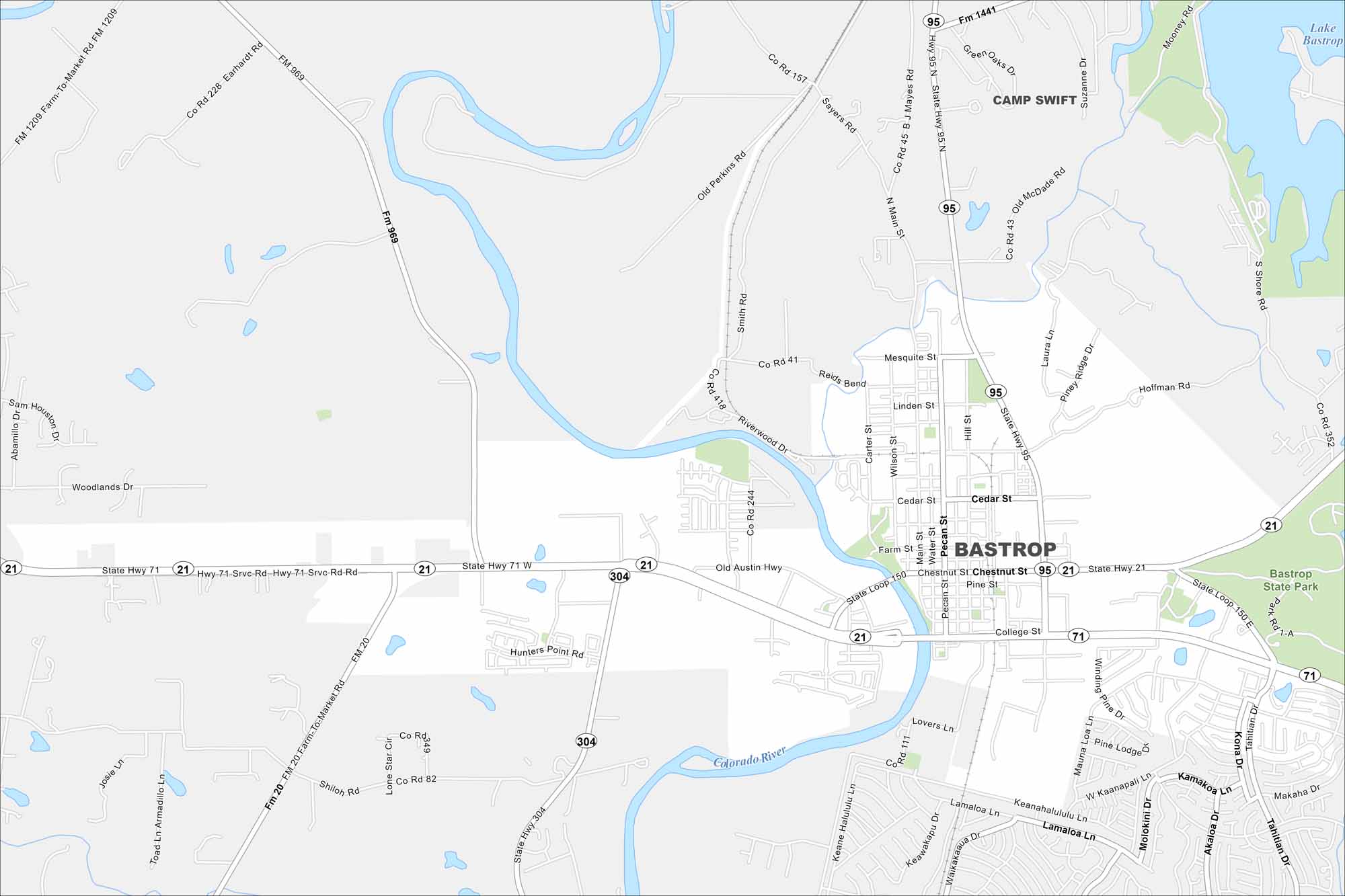
Start with this map of Bastrop, located along the Colorado River. Discover its famous Lost Pines region and city center. Our map shows river crossings, roads, and the nearby Bastrop State Park.
Map Information
On the Map
Interstates/Highways: State Hwy 71, State Hwy 21, State Hwy 95, State Hwy 304, State Loop 150 Major Roads: Main St, Chestnut St, Pine St, Cedar St, Farm St, Water St, Pecan St, Hill St, Linden St, Mesquite St, Carter St, Wilson St, College St, Lovers Ln, Old Austin Hwy, Hunters Point Rd, Shiloh Rd, Winding Way, Tahitian Dr, Lovers Ln Major Rivers: Colorado River Parks and Preserves: Bastrop State Park Nearby Communities: Camp SwiftTexas State Maps
Scan our maps of the massive southern state of Texas.


City Maps of Texas
Explore our map collection of Texas cities.


