Map of Beaumont, Texas
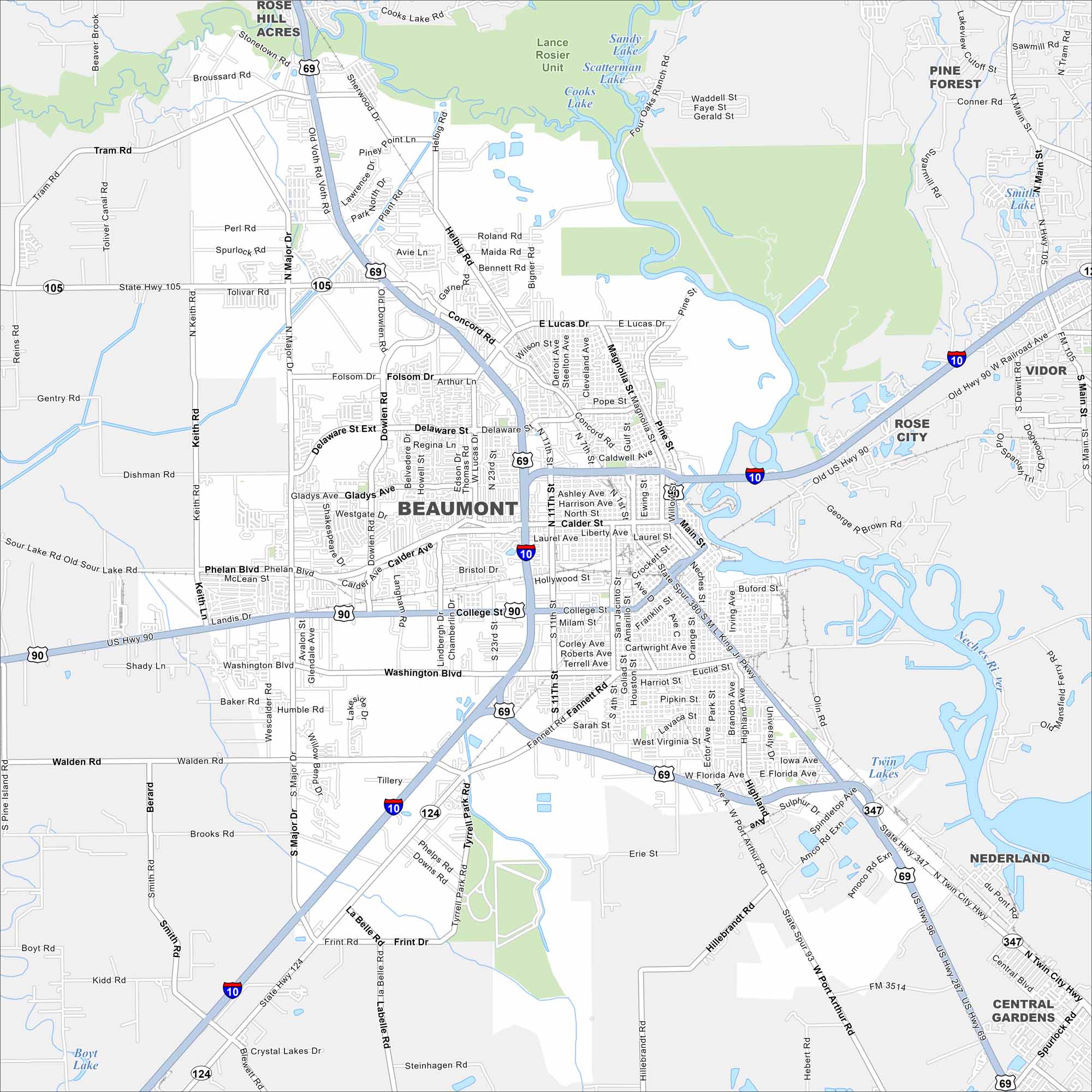
Find your bearings in Beaumont, a city with Gulf Coast wetlands and oil history. Beaumont sits in southeast Texas near the Louisiana border. Our map shows the Neches River, city streets, and surrounding bayous.
Map Information
On the Map
Interstates/Highways: I-10, US Hwy 69, US Hwy 90, US Hwy 96, US Hwy 287, State Hwy 105, State Hwy 124, State Hwy 347, State Rte 105, State Rte 124, State Rte 347 Major Roads: Phelan Blvd, College St, E Lucas Dr, Concord Rd, Major Dr, Dowlen Rd, 11th St, Washington Blvd, Calder Ave, Gladys Ave, Delaware St, Fannett Rd, Walden Rd, 23rd St, 4th St, 7th St, Main St, Magnolia St, Keith Rd, Old Dowlen Rd Lakes and Reservoirs: Cooks Lake, Sandy Lake, Scatterman Lake, Smith Lake, Lake Oz, Twin Lakes Major Rivers: Neches River Parks and Preserves: Lance Rosier Unit Nearby Communities: Rose Hill Acres, Pine Forest, Vidor, Rose City, Nederland, Central GardensTexas State Maps
Scan our maps of the massive southern state of Texas.


City Maps of Texas
Explore our map collection of Texas cities.


