Map of Bemidji, Minnesota
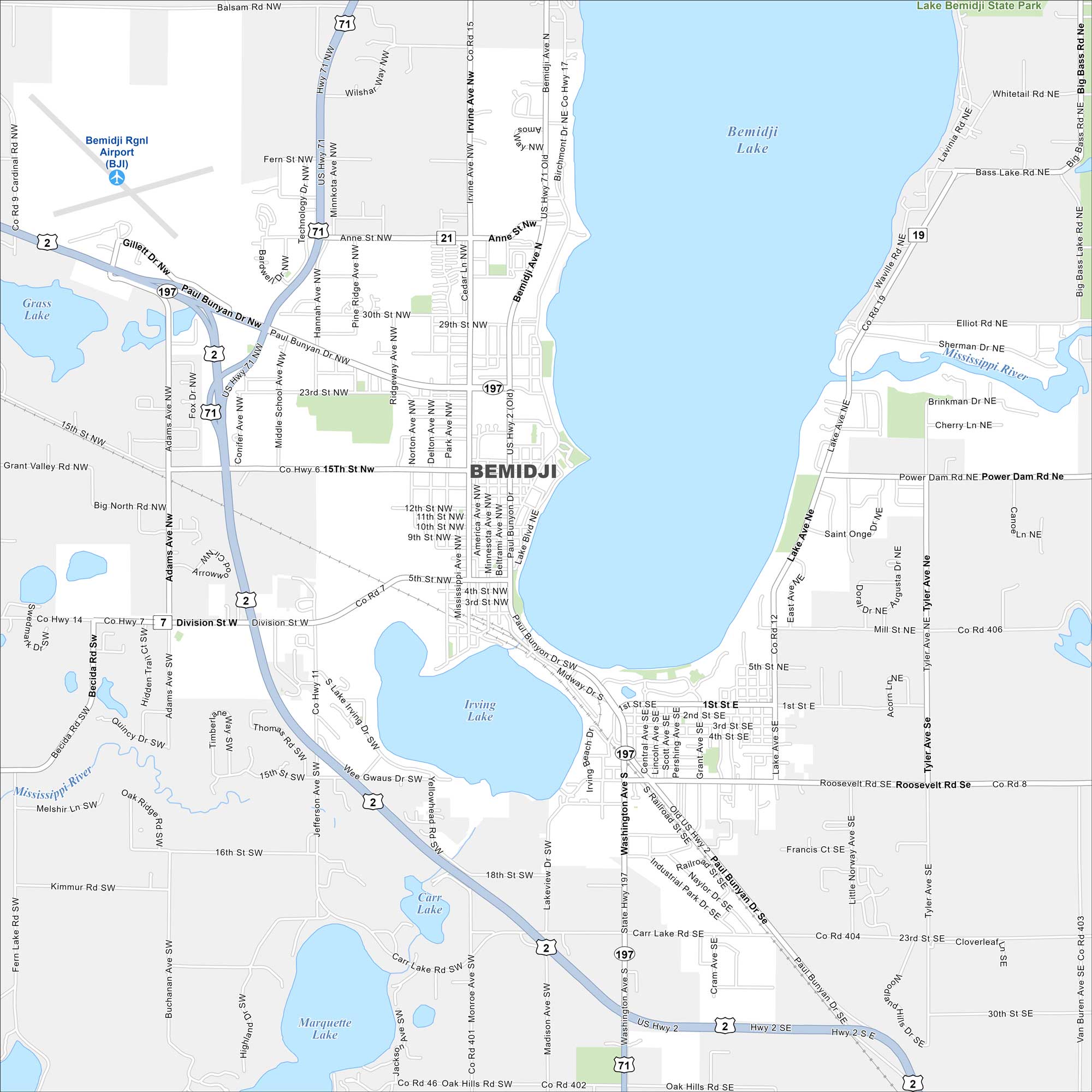
Bemidji is surrounded by lakes in northern Minnesota. Our map shows its roads, water bodies, and nearby forests. It’s called the “First City on the Mississippi” because the river flows right through it.
Map Information
On the Map
Interstates/Highways: US Hwy 2, US Hwy 71, State Rte 197 Major Roads: Paul Bunyan Dr, Division St, Washington Ave, Anne St, 15th St, Bemidji Ave, Irvine Ave, Birchmont Dr, Hannah Ave, Middle School Ave, Adams Ave, Roosevelt Rd, Carr Lake Rd, 5th St, Midway Dr, Industrial Park Rd, 23rd St, 30th St, Mill St, Grant Ave Airports: Bemidji Rgnl Airport (BJI) Lakes and Reservoirs: Bemidji Lake, Irving Lake, Carr Lake, Marquette Lake, Grass Lake Major Rivers: Mississippi River Parks and Preserves: Lake Bemidji State Park Nearby Communities: Nymore, Oak HillsMinnesota State Maps
Explore every lake in our state maps of Minnesota


Minnesota City Maps
Browse through our city maps of Minnesota


