Map of Bethany, Oklahoma
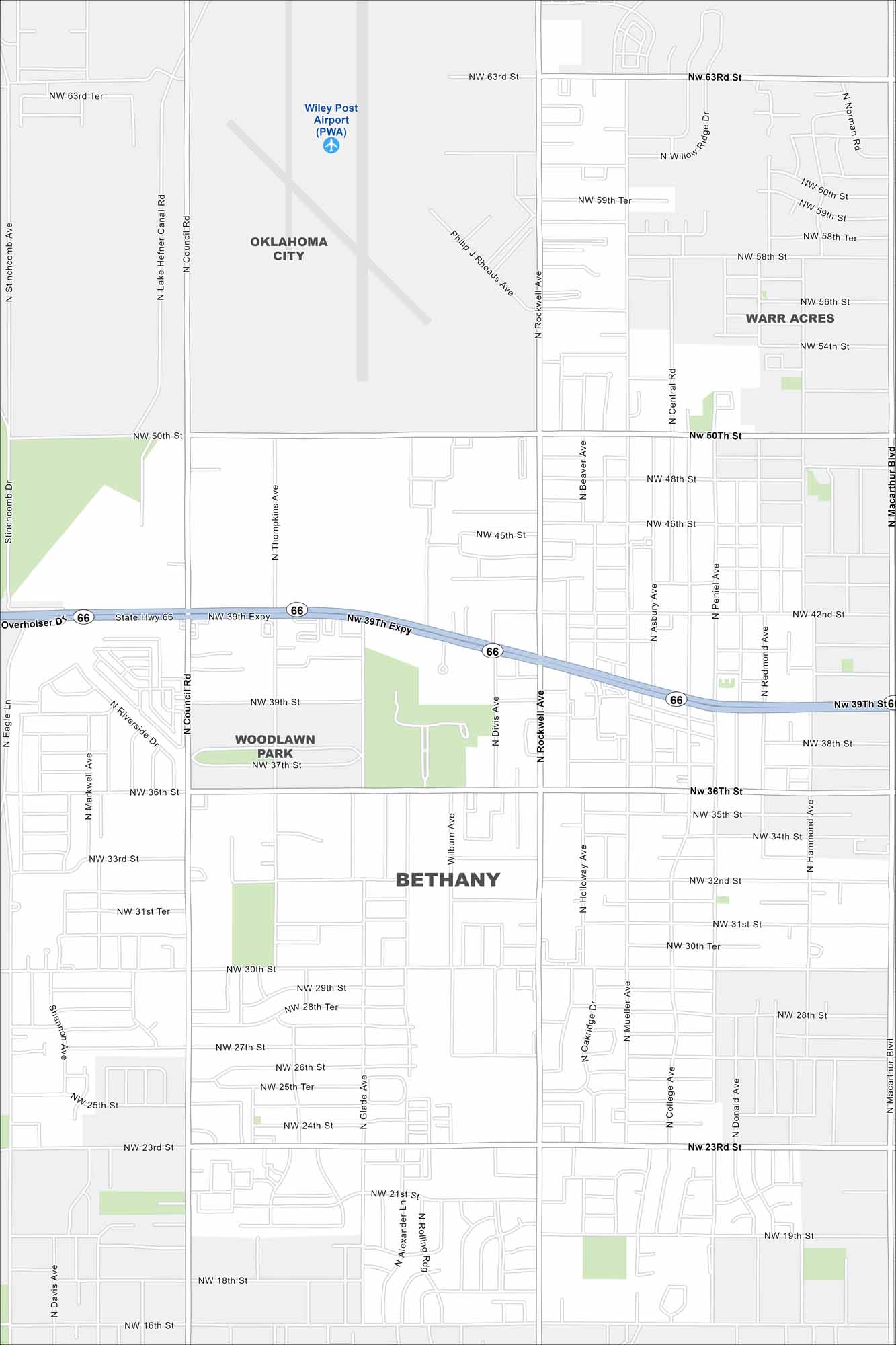
See Bethany on our map with highways and green spaces. It’s situated just west of Oklahoma City. The city is known for its Route 66 heritage.
Map Information
On the Map
Interstates/Highways: State Rte 66 Major Roads: 39th Expy, Council Rd, MacArthur Blvd, Rockwell Ave, 63rd St, 50th St, 36th St, 23rd St, 16th St, 30th St, 38th St, 42nd St, Central Rd, College Ave, Mueller Ave, Oakridge Dr, Hollow Ave, Divis Ave, Peniel Ave, Hammond Ave Airports: Wiley Post Airport (PWA) Nearby Communities: Oklahoma City, Warr Acres, Woodlawn ParkOklahoma State Maps
Here is our map collection of the Sooner State.


City Maps of Oklahoma
Explore Oklahoma’s cities with our maps


