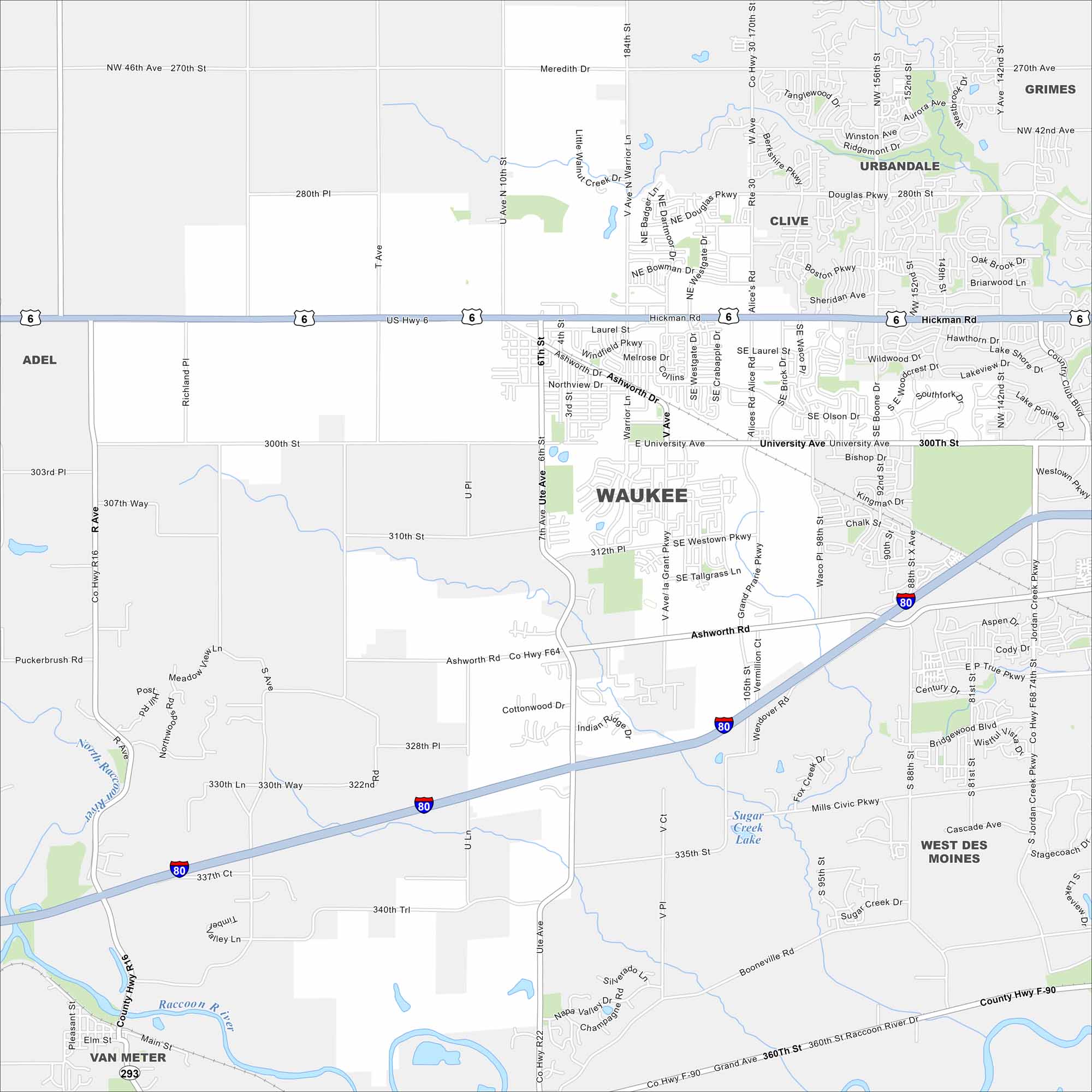
Map of Waukee, Iowa
Looking to explore Waukee, Iowa? This fast-growing Des Moines suburb features new neighborhoods, trails, and a lively town center.


Map Information
On the Map
Interstates/Highways: I-80, US Hwy 6 Major Roads: University Ave, Hickman Rd, Ashworth Rd, Alice Rd, Warrior Ln, Ute Ave, 10th St, westown Pkwy, Booneville Rd, Grand Ave, 156th St, Douglas Pkwy, Meredith Dr, Tanglewood Dr, Ridge Rd, S Jordan Creek Pkwy, Mills Civic Pkwy, Cascade Ave, 88th St, 95th St Lakes and Reservoirs: Sugar Creek Lake Major Rivers: Raccoon River, North Raccoon River Nearby Communities: Grimes, Urbandale, Clive, West Des Moines, Van Meter, AdelIowa City Maps
Browse city maps in the state of Iowa


