Map of Beverly, Massachusetts
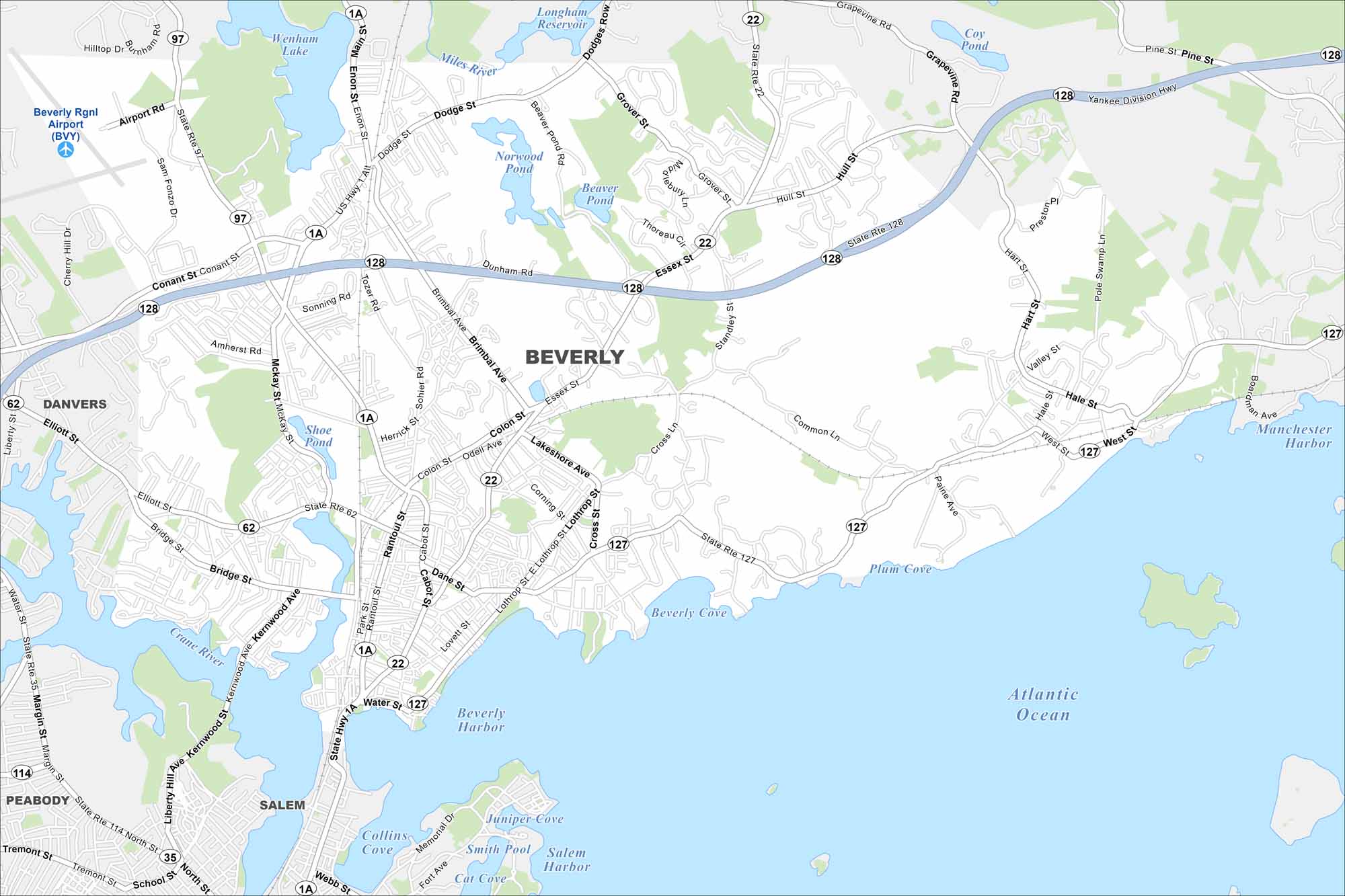
Beverly is a coastal city north of Boston. Our map highlights harbors, parks, and neighborhood streets. It’s often called the “Birthplace of the U.S. Navy” because of its early shipbuilding role.
Map Information
On the Map
Interstates/Highways: State Rte 128, State Rte 1A, State Rte 22, State Rte 127, State Rte 62, State Rte 97, State Rte 114, State Rte 35 Major Roads: Cabot St, Rantoul St, Essex St, Brimbal Ave, Colon St, Herrick St, Dodge St, Enon St, Hale St, Common Ln, Grover St, Hull St, Hart St, Valley St, Woodbury St, Corning St, Dane St, Park St, Water St, McKay St Airports: Beverly Rgnl Airport (BVY) Lakes and Reservoirs: Atlantic Ocean, Beverly Harbor, Salem Harbor, Beverly Cove, Plum Cove, Manchester Harbor, Collins Cove, Smith Pool, Cat Cove, Wenham Lake, Longham Reservoir, Norwood Pond, Beaver Pond, Coy Pond, Shoe Pond Major Rivers: Miles River, Crane River, North River Nearby Communities: Danvers, Salem, PeabodyMassachusetts State Maps
Here’s our state maps of Massachusetts


City Maps of Massachusetts
Explore Boston and other urban areas in Massachusetts


