Map of Bloomington, Minnesota
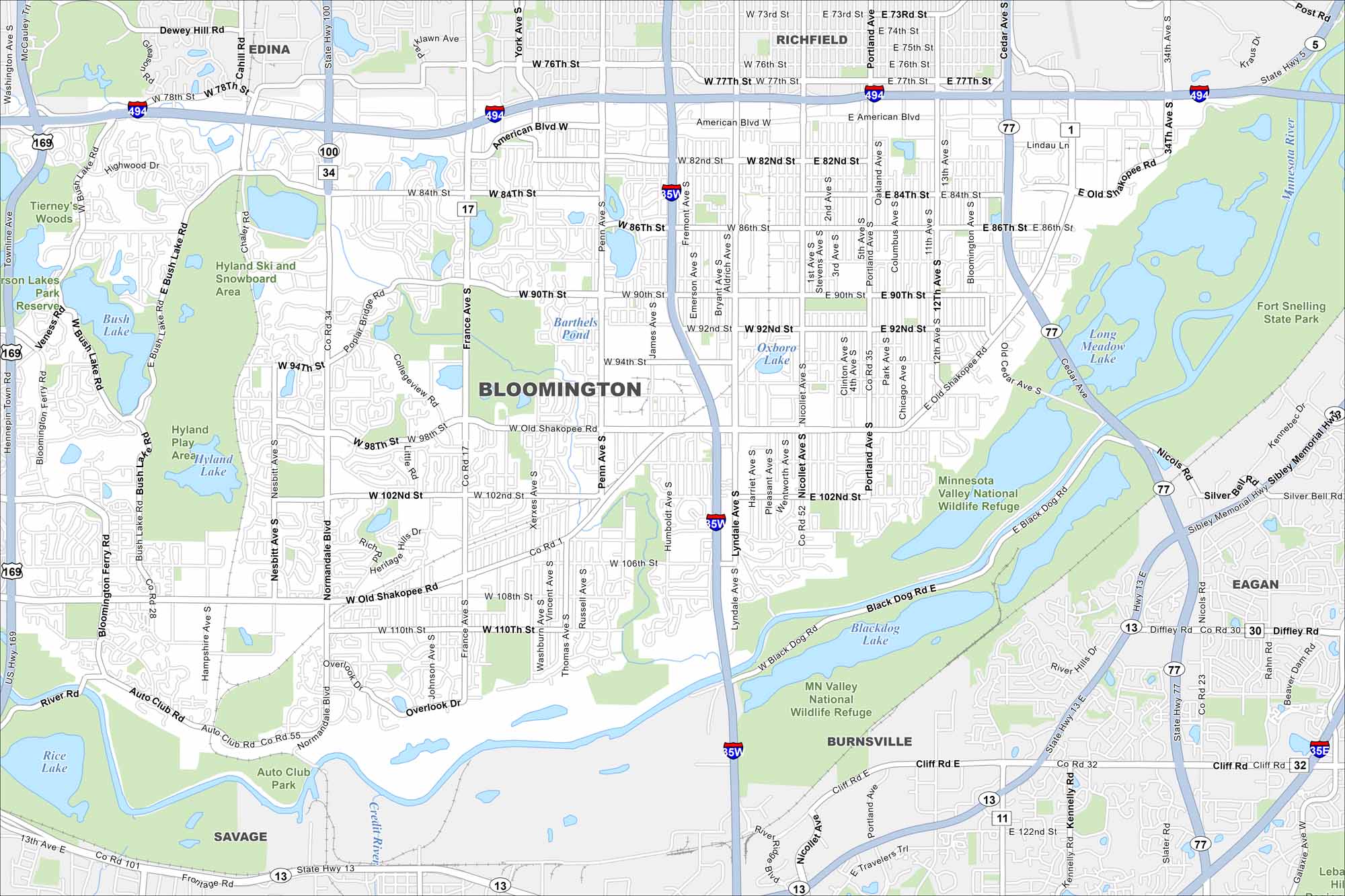
Get a snapshot of Bloomington, Minnesota. This is the home of the Mall of America. Lakes and parks spread through the community. It has become popular because of its city access and green space.
Map Information
On the Map
Interstates/Highways: I-494, I-35W, US Hwy 169, State Rte 77, State Rte 100, Sibley Memorial Hwy Major Roads: American Blvd, Old Shakopee Rd, 98th St, 86th St, 90th St, 102nd St, 106th St, 110th St, France Ave, Normandale Blvd, Bush Lake Rd, Lyndale Ave, Portland Ave, Cedar Ave, Nicollet Ave, Penn Ave, Xerxes Ave, Humboldt Ave, Auto Club Rd Lakes and Reservoirs: Bush Lake, Hyland Lake, Blackdog Lake, Long Meadow Lake, Oxboro Lake, Barthels Pond, Rice Lake Major Rivers: Minnesota River Parks and Preserves: Hyland Ski and Snowboard Area, Hyland Play Area, Tierney’s Woods, MN Valley National Wildlife Refuge, Fort Snelling State Park Nearby Communities: Edina, Richfield, Eagan, Burnsville, SavageMinnesota State Maps
Explore every lake in our state maps of Minnesota


Minnesota City Maps
Browse through our city maps of Minnesota


