Map of Boulder, Colorado
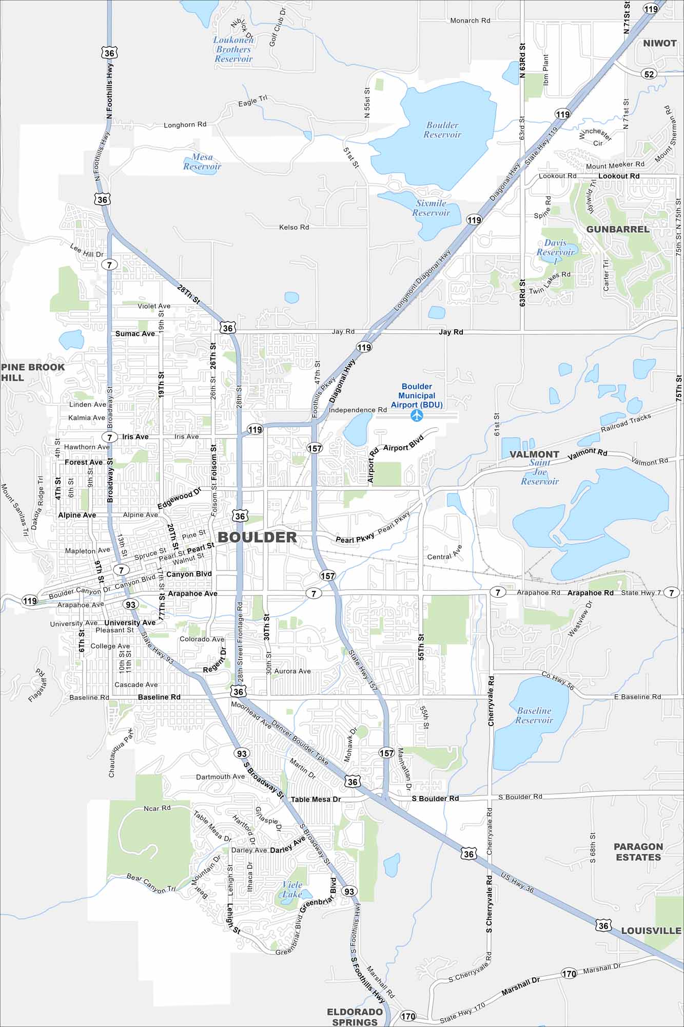
Boulder sits at the foot of the Rocky Mountains. Our map shows open space, trails, and streets. It’s known for outdoor living and a strong university presence.
Colorado State Maps
Browse Colorado with our detailed state maps


Map Information
On the Map
Interstates/Highways: US Hwy 36, State Rte 7, State Rte 52, State Rte 93, State Rte 119, State Rte 157, State Rte 170 Major Roads: Broadway, 28th St, Arapahoe Ave, Baseline Rd, Iris Ave, Foothills Pkwy, Canyon Blvd, Pearl St, Valmont Rd, Jay Rd, Table Mesa Dr, 63rd St, 75th St, 55th St, 30th St, Folsom St, 9th St, South Boulder Rd, Cherryvale Rd, Lookout Rd Airports: Boulder Municipal Airport (BDU) Lakes and Reservoirs: Boulder Reservoir, Sixmile Reservoir, Loukonen Brothers Reservoir, Mesa Reservoir, Davis Reservoir, Valmont Saint Joe Reservoir, Baseline Reservoir, Viele Lake Nearby Communities: Niwot, Gunbarrel, Pine Brook Hill, Paragon Estates, Louisville, Eldorado SpringsColorado City Maps
Here are maps of Colorado’s urban areas


