Map of Broomfield, Colorado
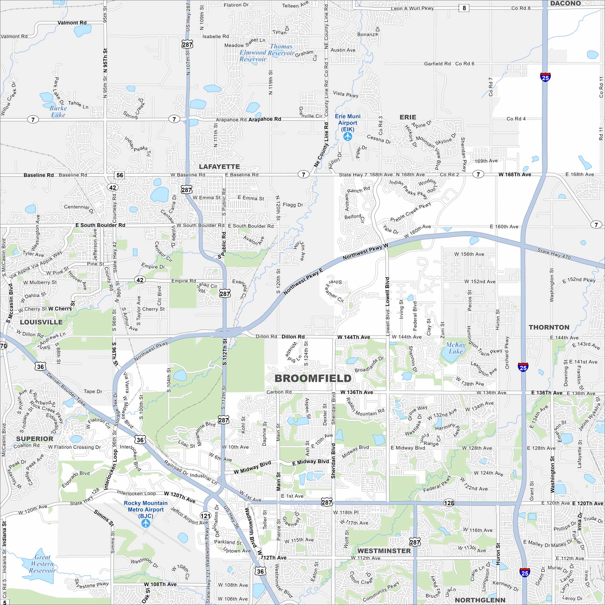
See Broomfield on our map, spread between Denver and Boulder. Highways pass through, but open space and trails are easy to spot. Its location makes it a natural connector in the Front Range.
Colorado State Maps
Browse Colorado with our detailed state maps


Map Information
On the Map
Interstates/Highways: I-25, State Rte 7, State Rte 42, State Rte 121, State Rte 128, US Hwy 36, US Hwy 287 Major Roads: 120th Ave, 144th Ave, 136th Ave, Wadsworth Blvd, Main St, Sheridan Blvd, Lowell Blvd, Federal Pkwy, 112th Ave, 160th Ave, 168th Ave, Baseline Rd, Arapahoe Rd, South Boulder Rd, Northwest Pkwy, Dillon Rd, Midway Blvd, Zuni St, Pecos St, Huron St Airports: Rocky Mountain Metro Airport (BJC), Erie Muni Airport (EIK) Lakes and Reservoirs: Thomas Elmwood Reservoir, Great Western Reservoir, McKay Lake Nearby Communities: Lafayette, Erie, Louisville, Superior, Westminster, Northglenn, Thornton, DaconoColorado City Maps
Here are maps of Colorado’s urban areas


