Map of Bryan, Texas
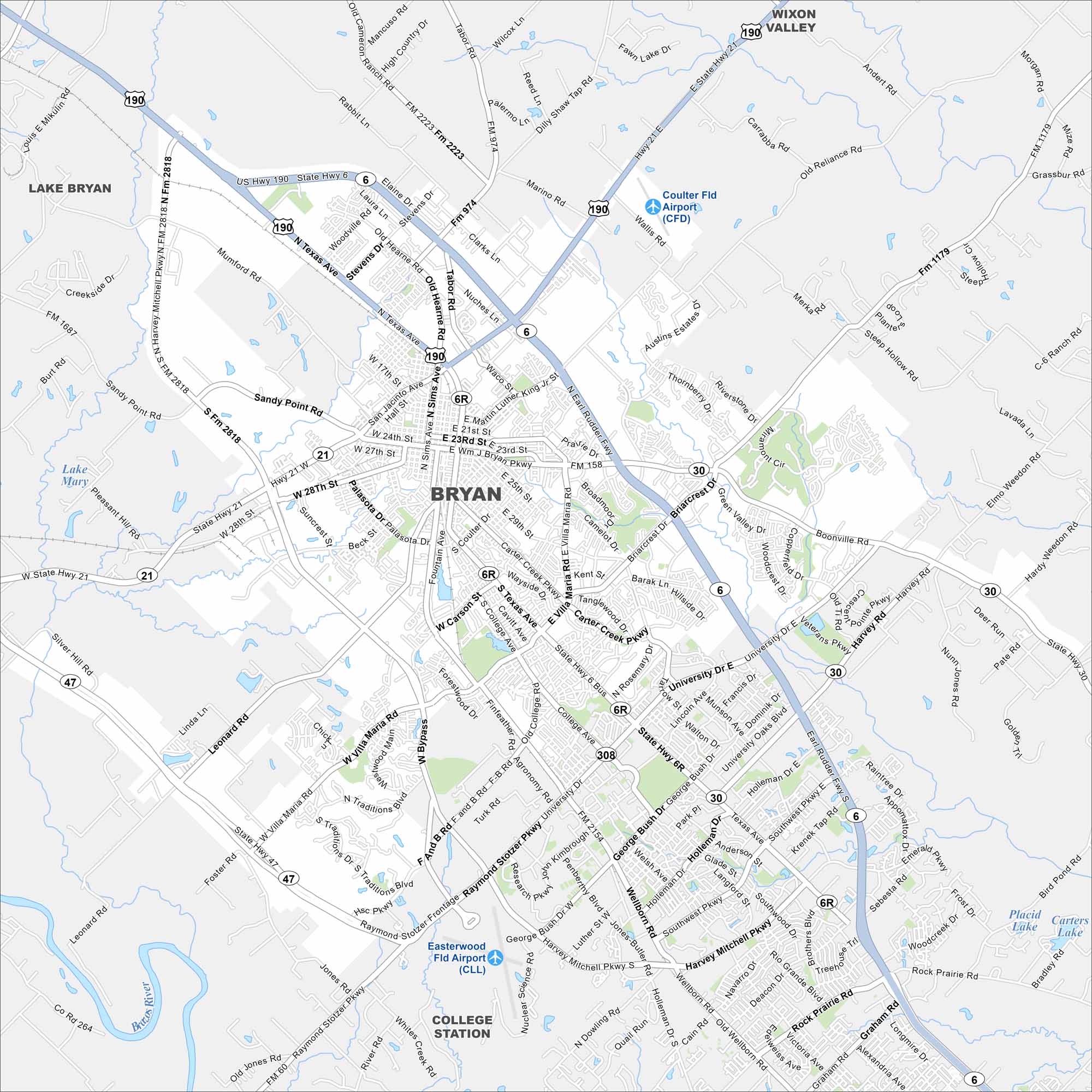
Check out Bryan on our map, paired with nearby College Station. Roads stretch across the Brazos Valley. The city is often tied to Texas A&M.
Map Information
On the Map
Interstates/Highways: US Hwy 190, State Hwy 6, State Hwy 21, State Hwy 47, State Hwy 30, State Hwy 308 Major Roads: Texas Ave, William J Bryan Pkwy, Villa Maria Rd, College Ave, Briarcrest Dr, Boonville Rd, Harvey Mitchell Pkwy, Raymond Stotzer Pkwy, University Dr, Finfeather Rd, Coulter Dr, Palasota Dr, Sims Ave, Martin Luther King Jr St, Earl Rudder Fwy, Barron Rd, Wellborn Rd, Graham Rd, Rock Prairie Rd, Southwest Pkwy Airports: Coulter Fld Airport (CFD), Easterwood Fld Airport (CLL) Lakes and Reservoirs: Lake Bryan, Lake Mary, Placid Lake, Carters Lake Major Rivers: Brazos River Nearby Communities: Wixon Valley, College StationTexas State Maps
Scan our maps of the massive southern state of Texas.


City Maps of Texas
Explore our map collection of Texas cities.


