Map of Waxahachie, Texas
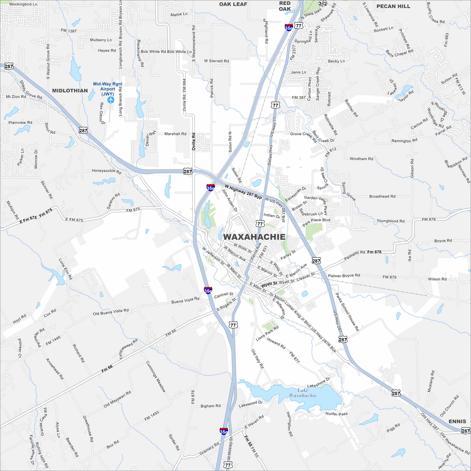
Want to explore Waxahachie? Known for Victorian architecture and the Scarborough Renaissance Festival, it’s a Texas city with deep roots. Lake Waxahachie sits in the south, great for boating and fishing.
Map Information
On the Map
Interstates/Highways: I-35, US Hwy 287, US Hwy 77, State Rte 34 Major Roads: Main St, Jefferson St, Marvin Ave, Ferris Ave, Broadhead Rd, Brown St, Garden Valley Pkwy, Ovilla Rd, Marshall Rd, Solon Rd, Butcher Rd, Howard Rd, Boyce Rd, Wilson Rd, Lake Shore Dr, Bigham Rd, Old Maypearl Rd Airports: Mid-Way Rgnl Airport (JWY) Lakes and Reservoirs: Lake Waxahachie Nearby Communities: Midlothian, Oak Leaf, Red Oak, Pecan Hill, EnnisTexas State Maps
Scan our maps of the massive southern state of Texas.


City Maps of Texas
Explore our map collection of Texas cities.


