Map of Burleson, Texas
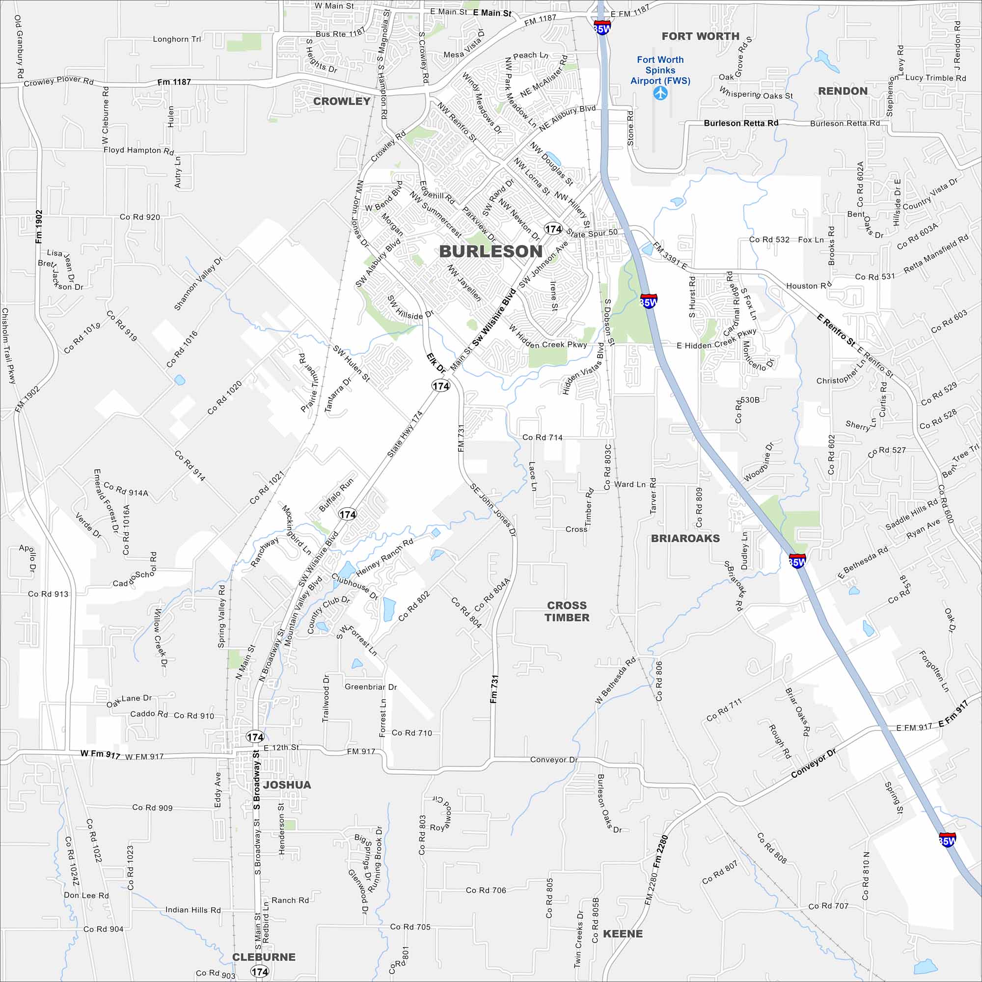
Check out our map of Burleson, just south of Fort Worth. It’s marked by suburban growth, wide streets, and open spaces. The city has expanded quickly because of its location along I-35.
Map Information
On the Map
Interstates/Highways: I-35W, State Hwy 174, State Hwy 917, State Rte 174, State Rte 917 Major Roads: Wilshire Blvd, Renfro St, Alsbury Blvd, John Jones Dr, Hidden Creek Pkwy, Broadway St, Main St, Newton Dr, Summercrest Blvd, Hillside Dr, Dobson St, Hurst Rd, Bethesda Rd, McAlister Rd, Gregory St, Tarver Rd, Conveyor Dr, Hulen St, Shannon Valley Dr, Highpoint Rd Airports: Fort Worth Spinks Airport (FWS) Nearby Communities: Fort Worth, Rendon, Crowley, Briaroaks, Cross Timber, Joshua, Keene, CleburneTexas State Maps
Scan our maps of the massive southern state of Texas.


City Maps of Texas
Explore our map collection of Texas cities.


