Map of Cedar Falls, Iowa
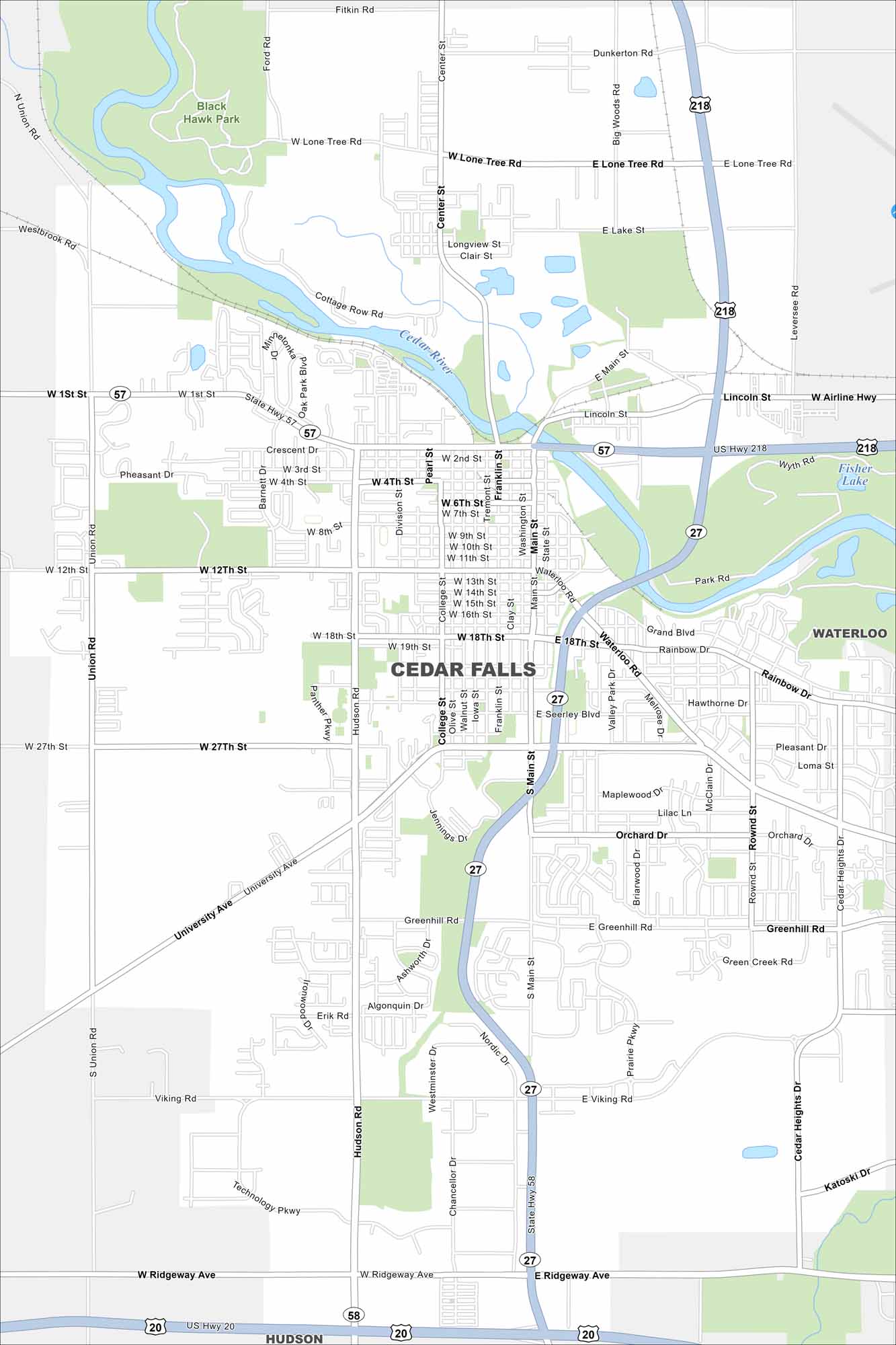
Take a look at Cedar Falls on our map. This is where the Cedar River flows through the city. Neighborhoods and parks line the riverbanks. It feels like a small city but is closely tied to the University of Northern Iowa. The river is its true centerpiece.


Map Information
On the Map
Interstates/Highways: US Hwy 218, US Hwy 20, State Hwy 58, State Hwy 57, State Hwy 27 Major Roads: University Ave, Main St, Hudson Rd, 1st St, 12th St, 18th St, 27th St, Ridgeway Ave, Viking Rd, Center St, Greenhill Rd, Union Rd, Cedar Heights Dr, Main St, College St, Franklin St, Waterloo Rd, Grand Blvd, Rainbow Dr, Orchard Dr Lakes and Reservoirs: Fisher Lake Major Rivers: Cedar River Parks and Preserves: Black Hawk Park Nearby Communities: Waterloo, HudsonIowa City Maps
Browse city maps in the state of Iowa


