Map of Chicopee, Massachusetts
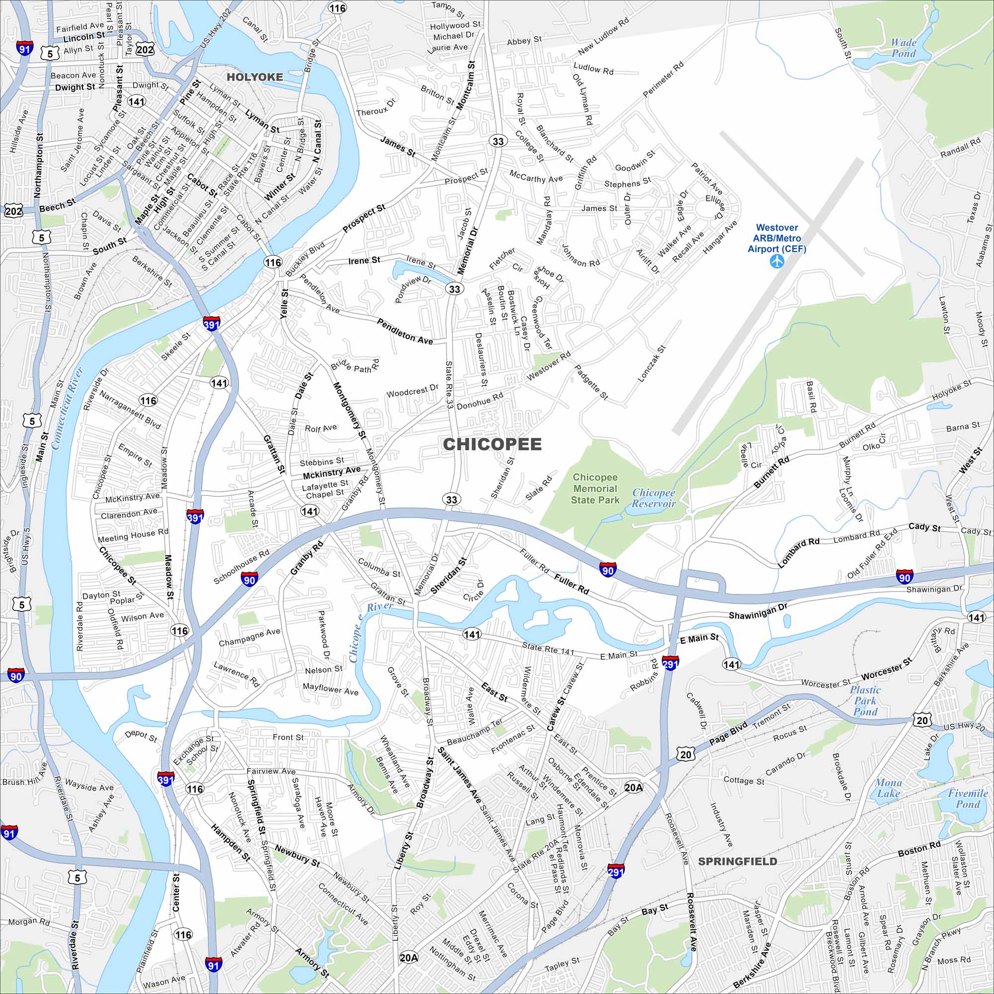
Look at Chicopee with its mapped highways and riverfront. Located on the Connecticut River, it also includes the Chicopee River. Its history is tied to mills and industry.
Map Information
On the Map
Interstates/Highways: I-91, I-391, I-90, I-291, US Hwy 20, US Hwy 5, State Rte 116, State Rte 33, State Rte 141, State Rte 202, State Rte 20A Major Roads: Memorial Dr, Springfield St, Montgomery St, Westover Rd, Fuller Rd, Shawinigan Dr, Page Blvd, Grattan St, Chicopee St, Meadow St, Broadway, Prospect St, Front St, New Ludlow Rd, Saint James Ave, Liberty St, Worcester St, Boston Rd, Berkshire Ave, Bay St Airports: Westover ARB/Metro Airport (CEF) Lakes and Reservoirs: Chicopee Reservoir, Plastic Park Pond, Mona Lake, Fivemile Pond, Wade Pond Major Rivers: Connecticut River, Chicopee River Parks and Preserves: Chicopee Memorial State Park Nearby Communities: Springfield, HolyokeMassachusetts State Maps
Here’s our state maps of Massachusetts


City Maps of Massachusetts
Explore Boston and other urban areas in Massachusetts


